From MMT Chief Meteorologist Steve Hamilton:
My Mountain Town Weather: UPDATE
Snow to ring in the new year!
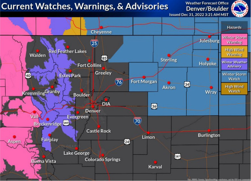
Various watches and warnings are posted by the National Weather Service in Boulder. A Winter Weather Advisory is up for some of the Foothills. Generally, we should see 2 to 4 inches for all of the foothills, and 1 to 3 inches for the Denver metro. The Eastern Plains are under a Winter Storm Watch.
A Few Snow Showers... Next Storm Sunday Night and Monday...
Breezy to gusty wind over the next few days across the Foothills, but we'll see some sunshine as well. A fairly dry high pressure system will be set up over Central Colorado through the weekend. However, we have some moist air available. With the gusty wind, we could see some terrain-caused snow or rain showers both Saturday and New Years Day. Temperatures will be near average, or slightly above through the weekend. Otherwise, we can expect some sun and occasional clouds. We are watching the next storm system, which should arrive over the Foothills, the mountains and eastern Colorado late Sunday night and Monday.
mymountaintown.com/expert-local-weather
URGENT - WINTER WEATHER MESSAGE
National Weather Service Denver CO
215 AM MST Sat Dec 31 2022
COZ034-311900-
/O.EXB.KBOU.WW.Y.0040.000000T0000Z-221231T1900Z/
South and Southeast Grand/West Central and Southwest Boulder/Gilpin/
Clear Creek/Summit/North and West Park Counties Above 9000 Feet-
Including the cities of Indian Peaks, Mount Evans, Williams Fork Mountains, Breckenridge, Berthoud Pass, East Slopes Mosquito Range, East Slopes Southern Gore Range, Kenosha Mountains, Eisenhower Tunnel, and Winter Park
215 AM MST Sat Dec 31 2022
...
WINTER WEATHER ADVISORY IN EFFECT UNTIL NOON MST TODAY...
* WHAT...Snow ongoing.
Snow accumulations of 2 to 6 inches. Winds gusting as high as 55 mph. Additional impactful snowfall expected Sunday night through Tuesday.
* WHERE...The Mountains of Summit County, the Mosquito Range, and the Indian Peaks. This includes the I-70 mountain corridor.
* WHEN...Until Noon MST today.
* IMPACTS...Travel could be very difficult due to snow and blowing snow on the roadways.
PRECAUTIONARY/PREPAREDNESS ACTIONS...
Slow down and use caution while traveling. The latest road conditions for Colorado can be obtained by calling 5 1 1 or by going to
www.cotrip.org
.