My Mountain Town Weather

From Meteorologist Steve Hamilton
Morrison | Conifer | Evergreen |  Pine | Bailey | Fairplay | Jefferson-Como | Alma | Lake George & Guffey | Hartsel
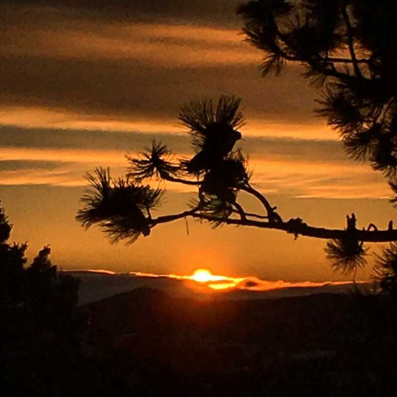
 

Some Weekend Rain, Then Dry And Warmer Next Week...

It looks like we'll have a decent chance of rainfall in the Foothills Friday afternoon and again Saturday. Following that, we'll be back in dry and very
warm conditions on Sunday and through much of next week. Fire weather conditions are expected over the mountains and some of the Foothills as
things turn dry and breezy. At this point, most of next week looks dry and very warm, with low rain chances. Meanwhile, a low pressure trough is
due in on Friday and Saturday. There will be plenty of moist air coming in, with good rain chances through Saturday afternoon. A few thunderstorms
might have brief heavy rainfall. As we get into next week, be prepared for very warm and dry weather, with occasionally gusty wind. Mostly 80s for
the Foothills, but the Denver area could hit about 100°. The next opportunity for rain may be next Thursday.


Morrison

Friday: Partly sunny. Scattered afternoon showers and thunderstorms. High: Upper 80s. Breezy.

Friday Night: A few showers before midnight, then clearing. Lower 60s.

Saturday: Sunny in the morning. Scattered afternoon thunderstorms. High: Upper 80s.

Saturday Night: Slight chance of an evening shower. Breezy. Lower 60s.

Sunday: Sunny and hot. Lower 60s.

Conifer

Friday: Showers and thunderstorms are likely in the afternoon. Breezy. Mid to upper 70s.

Friday Night: Cloudy. Showers or thunderstorms possible before midnight. Upper 40s.

Saturday: Showers and thunderstorms are likely in the afternoon. Breezy. High: Upper 70s.

Saturday Night: A few showers before midnight. Upper 40s.

Sunday: Mostly sunny. Slight chance of an afternoon thunderstorm. High: 80.

Evergreen

Friday: Afternoon showers and thunderstorms. High: 80. Breezy.

Friday Night: Scattered evening showers or thunderstorms. Clearing after midnight. Lower 50s.

Saturday: Showers and thunderstorms in the afternoon. Partly cloudy. Lower 80s.

Saturday Night: Partly cloudy. A few evening showers. Low: 50.

Sunday: Sunny. High: Mid 80s.

Pine

Friday: Afternoon showers and thunderstorms are likely. Lower 80s.

Friday Night: Showers or thunderstorms in the evening. Clearing after midnight. Lower 50s.

Saturday: Showers and thunderstorms are likely in the afternoon. Lower 80s.

Saturday Night: Partly cloudy with a few evening showers possible. Lower 50s.

Sunday: Sunny. Mid 80s.

Bailey

Friday: Showers and thunderstorms are likely in the afternoon. Breezy. Upper 70s.

Friday Night: Scattered evening showers. Lower 50s.

Saturday: Showers and thunderstorms in the afternoon. Upper 70s to lower 80s.

Saturday Night: A few showers before midnight. Lower 50s.

Sunday: Sunny. Slight chance of an afternoon shower. Lower 80s.

Fairplay

Friday: Afternoon showers and thunderstorms are likely. Lower 70s. Breezy.

Friday Night: Showers and thunderstorms in the evening. Clearing after midnight. Mid 40s.

Saturday: Showers and thunderstorms in the afternoon. Lower 70s. Windy.

Saturday Night: A few showers in the evening. Lower 40s.

Sunday: Sunny, with a high near 71. Breezy.

Como And Jefferson

Friday: Showers and thunderstorms are likely in the afternoon. Breezy. Upper 60s.

Friday Night: Showers and thunderstorms in the evening. Clearing overnight. Mid 40s.

Saturday: Afternoon thunderstorms or showers likely. Lower 70s.

Saturday Night: Partly cloudy. A few evening showers. Lower 40s.

Sunday: Sunny and breezy. Lower 70s.

Alma

Friday: Afternoon showers and thunderstorms. Breezy. Mid 60s.

Friday Night: Cloudy. Showers and thunderstorms in the evening. Mid 40s.

Saturday: Mix of sun and clouds. Scattered afternoon showers, and breezy. Upper 60s.

Saturday Night: A few evening thunderstorms possible. Lower 40s.

Sunday: Sunny and breezy. Upper 60s.

Lake George And Guffey

Friday: Afternoon showers and thunderstorms likely. Breezy. Lower 80s.

Friday Night: Scattered showers in the evening. Lower 40s.

Saturday: Showers and thunderstorms are likely in the afternoon. Breezy. Lower 80s.

Saturday Night: Mostly clear.

Sunday: Sunny and breezy. Mid 80s.

Hartsel

Friday: Showers and thunderstorms in the afternoon. Breezy. Mid 70s.

Friday Night: Showers possible before midnight. Mid 40s.

Saturday: Afternoon showers and thunderstorms. Gusty wind. Mid 70s.

Saturday Night: Mostly clear.

Sunday: Sunny, with a high near 76. Breezy.

FB 3 28 2017Steve Hamilton is a meteorologist based in Denver. He is certified by the American Meteorological Society and the National Weather Association. Steve embraced meteorology at age nine, when Hurricane Agnes roared across his home town in New Jersey. He moved to Denver, Colorado with his family in 1979, graduating from Columbine High School in Littleton in 1980. Steve has a BS in Mass Media from Colorado State University. In 2009 he obtained a Certificate of Meteorology from Mississippi State University, and a certification from the American Meteorological Society. He is continuing his education remotely through Penn State University. He is a lead meteorologist for The Storm Report, Inc., delivering daily weather forecasts via radio, and digital media.


MyMountainTown's Avatar
MyMountainTown replied the topic: #1 01 Jan 2020 20:18
Thank you for asking Petersenbj, after some planning with Chief Meteorologist Steve Hamilton, we're thrilled to announce that we are now covering Hartsel, Lake George, and Guffey in our daily mountain weather forecasts! Pass the word along to your friends, family, and neighbors! mymountaintown.com/expert-local-weather

Lake George And Guffey Jan 2-4
Thursday: Fair and breezy. High: Lower 30s.
Thursday Night: Mostly clear and chilly. Low: Single digits.
Friday: Sunny and breezy. High: Mid 30s. Wind gusting to 20 mph.
Saturday: Mostly sunny and warmer. High: Mid 40s.
Sunday: Fair. High: Upper 30s.

Hartsel Jan 2-4
Thursday: Fair and breezy. High: Lower 20s. Wind gusting to 20 mph.
Thursday Night: Mostly clear. Low: Single digits.
Friday: Sunny and breezy. High: Mid 20s.
Saturday: Sunny with a few clouds and warmer. High: Mid to upper 30s.
Sunday: Fair. High: Lower 30s.
Petersenbj's Avatar
Petersenbj replied the topic: #2 21 Nov 2019 19:12
Would it be possible to get forecast info for the Hartsel area. Seems there is always a big difference with what is forecast for Fair play. Understand if not really possible but wanted to check.

Thanks for the great work you do.
ScienceChic's Avatar
ScienceChic replied the topic: #3 06 Nov 2017 20:58
Be careful commuting tomorrow everyone!

Snow Hangs Around Tuesday...
A steady upslope flow will keep snow or snow showers going in the foothills until late Tuesday night. Not much accumulation is expected, with totals staying under 5 inches by Tuesday night. By late evening, snow will be ending with skies going partly cloudy. Temperatures will be cold Tuesday night with lows in the teens for many locations. High pressure moves in on Wednesday, with sunny and warmer weather.

ScienceChic's Avatar
ScienceChic replied the topic: #4 07 Aug 2017 07:32
Ummm, he said the "U" word and the "S" word! :ohmy: This is so not okay. It's August 7th.
#SoNotReady #StillSummer :sunshine: :unsure:

From Chief Meteorologist Steve Hamilton: Can You Say "Upslope"?
"A large area of high pressure to the east, combined with low pressure over Texas will bring upslope conditions to the foothills through Tuesday. High pressure will direct the wind into the mountains, while the low to the southeast pulls in moist air. Temperatures will be much cooler than normal, with rain likely along with afternoon thunderstorms. A good chance of rain continues into Tuesday, with rain slowly tapering off by Tuesday afternoon. We'll have showers, off-and-on, into the middle of the week. A little snow may be mixed with the rain in the higher elevations during the evening and overnight hours."

Details on our Local Weather Page: mymountaintown.com/expert-local-weather
ScienceChic's Avatar
ScienceChic replied the topic: #5 22 Feb 2017 08:40
We need some serious snow dancing to be going on! Aside from the high fire danger that we need to fix, the 285 Winterfest is this Saturday! :) :snowflake: :superluge: :sunnysnow:

From our Chief Meteorologist Steve Hamilton:

Gusty And Warm Through Wednesday - Maybe Snow By Thursday...
Breezy and unusually warm again on Wednesday with high pressure still over Colorado and the central Rockies. Downslope wind will cause compressional warming, and that means another mild, windy day for the foothills. Changes are coming by Thursday with a cold front and low pressure passing through. As the low moves to our east, we should have a chance of snow most of Thursday and into Friday. Accumulations will not be heavy, but we need all we can get right now.

mymountaintown.com/expert-local-weather
HappyCamper's Avatar
HappyCamper replied the topic: #6 16 May 2016 08:42
Guess I will be pulling the plants in and covering the ones in the greenhouse thanks
Chief Meteorologist's Avatar
Chief Meteorologist replied the topic: #7 16 May 2016 03:42
Looks like 3 to 4 inches in the Bailey area. This will happen mainly tonight into Tuesday morning with snow letting up by Tuesday afternoon.
HappyCamper's Avatar
HappyCamper replied the topic: #8 15 May 2016 17:16
So what is going to happen the next couple of days here in Bailey? I got plants in the green house and people talking snow please let me know.

Thanks
ScienceChic's Avatar
ScienceChic replied the topic: #9 20 Apr 2016 08:04

What a glorious morning! Bill Nilsson captured this beautiful sunrise in Bailey and shared it with us on Facebook.

We have a chance for a few showers popping up here and there today before sunny warm weather returns through the weekend. We're not out of the winter woods yet though - Chief Meteorologist Steve Hamilton says things may change next week so stay tuned for more. Details on our Weather page mymountaintown.com/weather-traffic/super-local-weather
MountainTownAlerts's Avatar
MountainTownAlerts replied the topic: #10 24 Mar 2016 13:17
Preliminary Snowfall Map (3/23/16) for NE Colorado. For the latest Local Storm Reports - Go to forecast.weather.gov/product.php?site=bo...uct=LSR&issuedby=BOU


Idledale 26"
Conifer 22"
Evergreen 20.5"
Denver 19.5" & 18"
Bergen Park 18.5"
Littleton 13.5"
HappyCamper's Avatar
HappyCamper replied the topic: #11 01 Feb 2016 11:53
Thanks was wondering when things change.

Snowing hard in Evergreen now we have gotten 2 inches since I came in this morning.
Chief Meteorologist's Avatar
Chief Meteorologist replied the topic: #12 01 Feb 2016 11:47
Well, first of all, "They" is The Weather Channel. Winter storms are not named by any government agency like NOAA or the National Hurricane Center. Those are the people who name hurricanes. NOAA does not name winter storms.

So, what you're seeing here is an effort by TWC to get attention by taking the initiative and naming winter storms on their own. There is nothing official about what they're doing, but then again, there isn't anything illegal about it. NOAA, The National Weather Service, does not recognize the names TWC issues. It's purely a marketing campaign by TWC. I think they think it's popular, but I've also heard a lot of negative responses from people about the names they've come up with being "silly".

To summarize, the only "officially named" storms are hurricanes, typhoons and tropical cyclones. A storm gets a name when it reaches Tropical Storm status, as judged by the National Hurricane Center. That is, a tropical cyclone (originating in the Tropics) with sustained wind speeds of 39 mph. Then it gets a name from NHC.

TWC is doing their own thing with naming winter storms. I will also tell you that TWC uses the same data from NOAA and the National Weather Service that the rest of us meteorologists use in determining the forecasts. What TWC has done is make weather more "personal" and "understandable", because government agencies use official "weather speak" in their description of storms. That's why we have humans on Radio and TV to explain things.

I hope that helps answer the question! -Steve
HappyCamper's Avatar
HappyCamper replied the topic: #13 01 Feb 2016 11:17
Why are they naming winter storms now?
Chief Meteorologist's Avatar
Chief Meteorologist replied the topic: #14 27 Jan 2016 11:05
I am "model watching" today, and no not THAT kind of model watching LOL. There are still some things up in the air with this one, no pun intended. If the TV guys are hyping it, it's because they've been told to by their bosses. This system has yet to come together with consistency in the myriad forecast models. Once the analysis is complete, I'll be posting plenty of information on our Super Local Forecasts page for sure. :-)
HappyCamper's Avatar
HappyCamper replied the topic: #15 27 Jan 2016 06:24
So what do you say about the storm coming in Monday/Tuesday?

News Stations are already trying to hype it up as a big one.
Chief Meteorologist's Avatar
Chief Meteorologist replied the topic: #16 20 Dec 2015 12:10
I'm not expecting much snow on Christmas. The current GFS model run is showing another one of those east-central Colorado lows, just like the previous few.

We will likely get "some" snow, but the configuration of this storm is too far north to bring us anything significant.

So yes, Santa will have good flying weather. And I hear Rudolph's nose-bulb has been replaced by one of those high-efficiency LED light sets. Shouldn't be a problem. :) :caribouxmas
ScienceChic's Avatar
ScienceChic replied the topic: #17 20 Dec 2015 11:00
As long as the airport doesn't shut down Christmas day, I'll be a happy camper. ;)
HappyCamper's Avatar
HappyCamper replied the topic: #18 19 Dec 2015 18:18
Looks like Santa will have decent flying weather at least here in Colorado!!

I will say I was hoping for some of the white stuff

:snowindow: :happysnow: :snomanpipe: :xmaslights: :candle:
Chief Meteorologist's Avatar
Chief Meteorologist replied the topic: #19 12 Dec 2015 11:00
Well, it's going to be slippery... that's for sure. So, take it easy and follow all the appropriate rules of the road. Be safe!
ScienceChic's Avatar
ScienceChic replied the topic: #20 12 Dec 2015 10:51
Cool, that's not bad at all. I'm looking forward to heading to the wine club night at Aspen Peak Cellars tonight! Thanks Steve!

Here's how it looks now:

Chief Meteorologist's Avatar
Chief Meteorologist replied the topic: #21 12 Dec 2015 10:24
As I mention in the Bailey forecast on the site, we are looking at something around - or less than - 5 inches of snow. If that changes, we will update, of course.

Stay tuned, and thanks for the comment!
HappyCamper's Avatar
HappyCamper replied the topic: #22 11 Dec 2015 20:07
So what's the scoop how much snow is Bailey going to get?
ScienceChic's Avatar
ScienceChic replied the topic: #23 29 Nov 2015 21:31
From Chief Meteorologist Steve Hamilton:
Prepare for strong wind, gusting to 55 mph in some foothills locations Monday and Monday Night.
High pressure will be moving over the central Rockies on Monday. This will clear out the snow, but it will also bring very windy conditions to the foothills. We are expecting some wind advisories to be issued sometime Monday, and we will keep you up to date. Wind gusts to 55 mph may happen late Monday afternoon into the evening.

Details here: mymountaintown.com/weather-traffic/super-local-weather
ScienceChic's Avatar
ScienceChic replied the topic: #24 25 Nov 2015 19:09
From Chief Meteorologist Steve Hamilton on our Super Local Weather Page : A Winter Weather Advisory is in effect from 6 p.m. Wednesday evening until 8 a.m. Friday morning. We are expecting light snow and freezing drizzle to begin this evening, changing to all snow by tonight. Some light ice accumulation will occur, making roads slick and travel slow.

2 to 6 inches of snow is expected, with the highest totals in the foothill areas.

Temperatures will drop to the 20s overnight, and will remain there during Thanksgiving Day. Snow will taper off by early Friday, but temperatures will be in the teens during the day.

Posted earlier today on our Facebook Page:

From Meteorologist Steve Hamilton: If you've got travel plans for Thanksgiving, here's your weather update. The National Weather Service has issued a Winter Weather Advisory that covers most of our Mountain Towns and the Denver Metro. Be prepared for several inches of snow, cold temperatures, slick roads and poor visibility. Check in with our main weather page for continuous coverage: mymountaintown.com/weather-traffic/super-local-weather

Sounds like a great day to stay inside, watch football, and enjoy good food and spirits! If you have to travel, or friends/family are coming to you, please be safe and make sure your cars are winter-ready.

Happy Thanksgiving everyone!
:happytgivin
Chief Meteorologist's Avatar
Chief Meteorologist replied the topic: #25 15 Nov 2015 18:49
What you've got there is a whole bunch of "weather speak" right from the National Weather Service website. The finer points are as follows...

This storm is much like the last one. It's a fast-mover, and not on an optimum track for a monumental snow event. The reason this storm has been so difficult to nail-down is, in part, due to a dynamic weather pattern related to the position and intensity of the Jet Stream. (Maybe El Nino is having an impact, but I won't pin it on that, officially.)

We're under a Winter Storm Watch for most of the Mountain Towns except for Morrison and Fairplay. Morrison isn't included because of the lack of full-blown upslope. Fairplay is not included because it will be protected from most of the upslope flow late Monday/Tuesday. The rest of the areas will receive up to 12 inches of snow along with gusty wind and colder temperatures. The higher mountains are under a Winter Storm Warning with higher accumulations expected.

For our coverage area, we can expect snow to begin tomorrow afternoon, lasting though Tuesday morning. This means a messy commute early Tuesday.

You should be prepared for up to 12 inches of snowfall, with slightly higher amounts in higher elevations. There will likely be widely-varying amounts per location. The "snow window" is Monday evening through Tuesday mid-morning. Snow will rapidly taper-off through the day Tuesday, followed by breezy and cold conditions.

Most of the snow will fall late Monday night and early Tuesday morning. We will most likely be changing some snow totals as we get closer to storm initiation, and if you have the capability of sending snow reports to us through our Facebook page, that would be awesome.

Stay tuned for more, tomorrow morning! -Meteorologist Steve Hamilton
© My Mountain Town (new)
Google+