Calendar

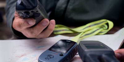
This class will be a review of UTMs and Lat/Long. We will discuss what GPS and GLONASS are, how “GPS” works and its limitations, functions on your GPS units, Datums, Positions Formats and working through the screen options.
We will cover, hands-on, setting waypoints, learning about tracks, trackback, compass and altimeter calibration, route planning, using route-planner, and blue-tooth transfer of waypoints. This discussion will be based on the Garmin GPSMAP 64st unit. Other GPS units will have the same main functions, so the discussion is “transferable”.
Time pending, we can go outside and find a few points nearby so have hiking shoes and clothes appropriate for the weather, this is optional. This class is designed as a follow up to our Basic Map & Compass class, but it is not a prerequisite.
Please bring your own GPS unit. Sorry, we do not have any units to loan out.
FYI - Garmin In-Reach (a two-way communication tool with 100K maps) is not a true GPS unit with advanced mapping and navigational tools. However, it can be used as such in an emergency. We will not be discussing the In-reach type unit’s features, so bring your user manual. For daily hiking use as a true GPS, the In-Reach is a bit clunky when trying to make it do what a real GPS navigation tool does. (If you have the money, get both – a two-way communication tool and a GPS unit).
GPS units to consider: I like the Garmin GPSMAP 64 SC and the new Garmin GPSMAP 66 series because it is easy to use and you can use it with gloves on in cold weather. If you have questions as to our recommendations or want to discuss before buying one, feel free to contact us.
Skills for the Hills is Alpine Rescue Team's public wilderness and backcountry education program. Our classes are free, however, we appreciate donations at the door. We never charge you, your family or the local authorities for search and rescue.
Support Alpine Rescue Team and all Colorado SAR teams by purchasing a Colorado Outdoor Recreation Search and Rescue (CORSAR) Card. Buy a five-year ($12) or one-year ($3) card online.
"Skills for the Hills" is used with permission of Mountain Aid, Scotland.
Are there ID or minimum age requirements to enter the event?
Teenager and above.
What are my transportation/parking options for getting to and from the event?
Parking is available in the RTD Parkn'Ride lot across the road, and in the dirt lot below our building. Do not park on the apon in front of Alpine Rescue Team HQ or on the fire department apron to the north.
How can I contact the organizer with any questions?
Email your message to This email address is being protected from spambots. You need JavaScript enabled to view it.