From our Chief Meteorologist Steve Hamilton:
Update: My Mountain Town Weather
Winter Storm Watch
Sunday Evening Through Monday Morning.
The US National Weather Service Denver/Boulder Colorado has issued a Winter Storm Watch (green highlighted area) affecting some of our communities.
Heavy snow is possible.
Accumulation 4 to 10 inches possible.
Wind gusts up to 35 mph.
Travel will likely be difficult with hazardous road conditions from Sunday night until about noon Monday.
Graphics from the National Weather Service-Denver/Boulder:
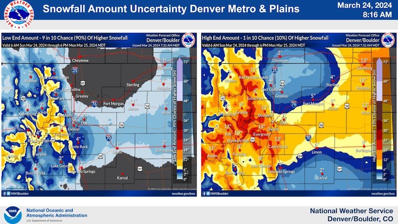
Some uncertainties remain on total snowfall accumulations overnight tonight. Here are the high and low end scenarios for storm total accumulations across the forecast area. Expect increasing travel impacts this evening which will continue into Monday AM. #COwx
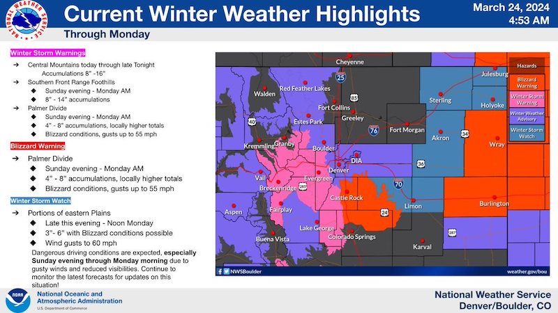
A storm system will produce blizzard conditions over the Palmer Divide and possibly to portions of the eastern plains tonight through Monday morning. Winds gusts up to 60 mph may occur with very poor visibility. #cowx
Proudly serving mountain Jeffco, Clear Creek & Park County!
You can also find & connect with us on: Facebook
• X
• Instagram
• YouTube
• LinkedIn