- Posts: 103
- Thank you received: 4
- Forum
- Life Up the Hill
- Outdoor & Colorado Life
- Photo Blog
- Landscape Photography: Denver and the CO Rockies, as you've never seen them
Landscape Photography: Denver and the CO Rockies, as you've never seen them
- 285Tourism
-
 Topic Author
- Mountain Folk
-

Less
More
03 Jan 2016 18:10 #1
by 285Tourism
Landscape Photography: Denver and the CO Rockies, as you've never seen them was created by 285Tourism
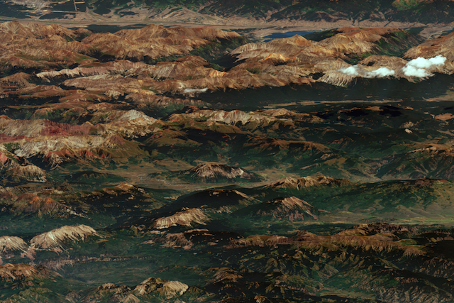
On that late summer day, though, WorldView-3 followed an unusual path. In the late morning, as it passed over the Pacific, it turned back and looked at the continent to the east. Gazing over Los Angeles; the Mojave desert; the Grand Canyon; and the southern tip of Utah, it captured an image of Colorado.
Here is that image, which has never previously been released to the public.
Since most satellite images are taken looking directly down, few satellite images give this sense of the landscape.
View it full-size here and interactive:
A New Kind of Landscape Photography : Denver and the Colorado Rockies, as you’ve never seen them before
Please Log in or Create an account to join the conversation.
- Forum
- Life Up the Hill
- Outdoor & Colorado Life
- Photo Blog
- Landscape Photography: Denver and the CO Rockies, as you've never seen them
Time to create page: 0.138 seconds


