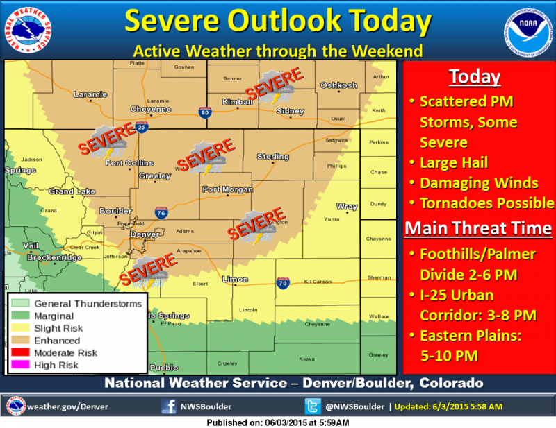
Severe thunderstorms will be possible this afternoon and evening, with potential for very large hail, damaging winds, and even tornadoes. Some low clouds will delay the stronger surface heating across the plains, but the airmass in and near the foothills and Palmer Divide is expected to destabilize considerably by mid afternoon with enough sunshine there. Severe thunderstorms will be possible across the foothills and Palmer Divide area mainly between 2 and 6 PM, the Front Range I-25 Urban Corridor 3 PM to 8 PM, and across the eastern plains of Colorado 5 PM to 10 PM. Spotter activation will likely be required during those time periods.
From Denver Channel 7's Storm Shield: Severe Weather Update In Effect until Jun 4, 2015, 1:35a.m.
Conditions are favorable for severe thunderstorms across the I-25 Corridor and the northeast plains this afternoon and evening. Large hail, damaging winds, & isolated tornadoes will be possible from around 3p.m. until 10p.m. The storms will first impact areas along I-25 & then move toward the northeast.