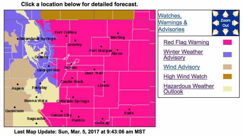
Red Flag Warning
URGENT - FIRE WEATHER MESSAGE
National Weather Service Denver/Boulder CO
402 AM MST Sun Mar 5 2017
...
VERY HIGH FIRE DANGER THROUGH MONDAY...
.Dangerous wildland fire behavior including rapid fire spread
are likely should fires start in the Front Range foothills and
on the plains of northeast Colorado today and Monday. Strong and
gusty southwest winds, low relative humidity, above average
temperatures and dry fuels will contribute to this hazardous fire
behavior. On Sunday...very strong northwest winds and low
relative humidity behind a cold front may produce extreme fire
behavior even with cooler temperatures.
Open burning is prohibited on Red Flag Warning days. Residents
across all of northeast Colorado should prepare for these critical
fire weather conditions.
COZ238>241-245>247-249-051915-
/O.UPG.KBOU.FW.A.0007.170306T1800Z-170307T0100Z/
/O.NEW.KBOU.FW.W.0009.170306T1800Z-170307T0100Z/
/O.CON.KBOU.FW.W.0008.170305T1700Z-170306T0200Z/
Larimer County Below 6000 Feet/Northwest Weld County-
Boulder And Jefferson Counties Below 6000 Feet/West Broomfield
County-
North Douglas County Below 6000 Feet/Denver/West Adams and
Arapahoe Counties/East Broomfield County-
Elbert/Central and East Douglas Counties Above 6000 Feet-
Central and East Adams and Arapahoe Counties-
North and Northeast Elbert County Below 6000 Feet/North Lincoln
County-
Southeast Elbert County Below 6000 Feet/South Lincoln County-
Washington County-
402 AM MST Sun Mar 5 2017
...RED FLAG WARNING REMAINS IN EFFECT FROM 10 AM THIS MORNING TO
7 PM MST THIS EVENING FOR WIND AND LOW RELATIVE HUMIDITY FOR THE FRONT
RANGE FOOTHILLS AND MOST OF NORTHEAST COLORADO INCLUDING THE
DENVER METRO AREA AND PALMER DIVIDE...
...RED FLAG WARNING IN EFFECT FROM 11 AM TO 6 PM MST MONDAY FOR
STRONG WINDS AND LOW RELATIVE HUMIDITY FOR ALL OF NORTHEAST AND
EAST CENTRAL COLORADO...
The National Weather Service in Denver has issued a Red Flag
Warning FOR WIND AND LOW RELATIVE HUMIDITY...which is in effect
from 11 AM to 6 PM MST Monday.
* Affected Area...Fire Weather Zones 238...239...240...241...245...
246...247 and 249.
* Timing...Critical fire weather conditions will develop by this
afternoon. Conditions should improve with nightfall. Even stronger
winds are expected on Monday.
* Winds...Southwest 20 to 30 mph today, and northwest winds 20 to
35 mph with gusts to around 55 mph on Monday.
* Relative Humidity...as low as 7 percent.
* Impacts...Dry vegetation will be prone to fire, and the low
humidity and strong winds will produce dangerous fire
behavior...including rapid fire spread...should fires start.
PRECAUTIONARY/PREPAREDNESS ACTIONS...
A Red Flag Warning means that critical fire weather conditions
are either occurring now....or will shortly. A combination of
strong winds...low relative humidity...and warm temperatures can
contribute to extreme fire behavior.