Per Elk Creek Fire Department: Fire danger is currently at or higher than during the Lower North Fork Fire.
Red Flag Warning
URGENT - FIRE WEATHER MESSAGE
National Weather Service Denver/Boulder CO
1256 PM MST Sat Mar 11 2017
...ANOTHER DAY WITH VERY HIGH FIRE DANGER ON SUNDAY...
.Strong winds will develop on Sunday along with warmer
temperatures and lower humidities. This will produce very high
fire danger on Sunday afternoon. Conditions will be worst from the
southern Front Range foothills across the Denver metro area and
onto the plains along and south of Interstate 70. Further north it
will be very windy but the humidities will be higher.
COZ216-239>241-245>247-120700-
/O.UPG.KBOU.FW.A.0011.170312T1800Z-170313T0000Z/
/O.NEW.KBOU.FW.W.0013.170312T1800Z-170313T0000Z/
Jefferson and West Douglas Counties Above 6000 Feet/Gilpin/Clear
Creek/Northeast Park Counties Below 9000 Feet-
Boulder And Jefferson Counties Below 6000 Feet/West Broomfield
County-
North Douglas County Below 6000 Feet/Denver/West Adams and
Arapahoe Counties/East Broomfield County-
Elbert/Central and East Douglas Counties Above 6000 Feet-
Central and East Adams and Arapahoe Counties-
North and Northeast Elbert County Below 6000 Feet/North Lincoln
County-
Southeast Elbert County Below 6000 Feet/South Lincoln County-
1256 PM MST Sat Mar 11 2017
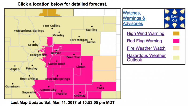
...RED FLAG WARNING IN EFFECT FROM NOON TO 6 PM MDT SUNDAY FOR
WIND AND LOW RELATIVE HUMIDITY FOR FIRE WEATHER ZONES 216...239...
240...241...245...246...AND 247...
The National Weather Service in Denver has issued a Red Flag
Warning FOR WIND AND LOW RELATIVE HUMIDITY...which is in effect
from noon to 6 PM MDT Sunday. The Fire Weather Watch is no longer
in effect.
* Affected Area...The southern Front Range foothills, Denver metro
area, and the plains east and southeast of Denver...fire weather
zones 216...239...240...241...245...246 and 247.
* Timing...Winds will increase in the morning and continue through
the afternoon. Relative humidity levels will reach their lowest
levels by mid-afternoon.
* Winds...Northwest 25 to 35 mph with gusts up to 45 mph.
* Relative Humidity...as low as 14 percent.
* Impacts...
Very high fire danger through the afternoon hours.
Conditions will be favorable for the ignition and rapid growth
of wildfires.
PRECAUTIONARY/PREPAREDNESS ACTIONS...
A Red Flag Warning means that critical fire weather conditions
are either occurring now....or will shortly. A combination of
strong winds...low relative humidity...and warm temperatures can
contribute to extreme fire behavior.