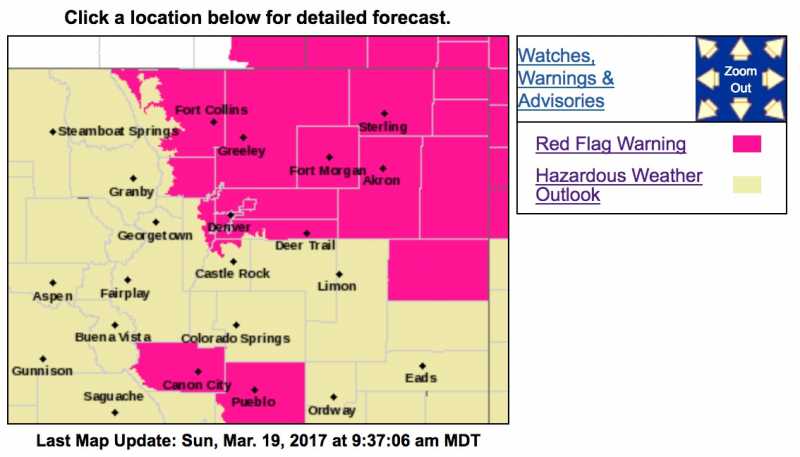
Red Flag Warning
URGENT - FIRE WEATHER MESSAGE
National Weather Service Denver/Boulder CO
320 AM MDT Sun Mar 19 2017
...Very High Fire Danger Across Northeast Colorado Today...
.
A Red Flag Warning is in effect from noon today through early
this evening for very warm, very dry and windy conditions over
the northern foothills and plains.
COZ239-240-243>245-249-191730-
/O.UPG.KBOU.FW.A.0014.170319T1800Z-170320T0100Z/
/O.EXA.KBOU.FW.W.0016.170319T1800Z-170320T0100Z/
Boulder And Jefferson Counties Below 6000 Feet/West Broomfield
County-
North Douglas County Below 6000 Feet/Denver/West Adams and
Arapahoe Counties/East Broomfield County-
Central and South Weld County-Morgan County-
Central and East Adams and Arapahoe Counties-Washington County-
320 AM MDT Sun Mar 19 2017
...
RED FLAG WARNING IN EFFECT FROM NOON TODAY TO 7 PM MDT THIS
EVENING FOR WIND AND LOW RELATIVE HUMIDITY ACROOS THE NORTHEAST
PLAINS...
The National Weather Service in Denver has issued a Red Flag
Warning FOR WIND AND LOW RELATIVE HUMIDITY...which is in effect
from noon today to 7 PM MDT this evening. The Fire Weather Watch
is no longer in effect.
* Affected Area...Fire Weather Zones 239...240...243...244...
245 and 249.
* Timing...Conditions will become elevated starting around noon
today and then decrease by 7 pm this evening.
* Winds...Northwest 10 to 15 mph with gusts up to 25 mph.
* Relative Humidity...as low as 9 percent.
* Impacts...conditions will be favorable for rapid ignition of
dry vegetation, fire growth and spread.
PRECAUTIONARY/PREPAREDNESS ACTIONS...
A Red Flag Warning means that critical fire weather conditions
are either occurring now....or will shortly. A combination of
strong winds...low relative humidity...and warm temperatures can
contribute to extreme fire behavior.