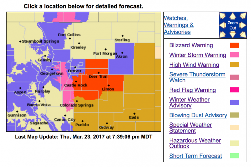
Winter Storm Warning
URGENT - WINTER WEATHER MESSAGE
National Weather Service Denver/Boulder CO
330 PM MDT Thu Mar 23 2017
...Strong storm to bring blizzard conditions to parts of
northeastern Colorado...
A spring storm will bring much needed precipitation to northeast
and north central Colorado. Precipitation is expected to develop
across the forecast area tonight and then intensify late tonight
through Friday morning as the storm system strengthens over
southeast Colorado.
Moderate to heavy snowfall can be expected
over the mountains, foothills, Palmer Ridge and some adjacent
plains tonight into Friday morning, heaviest along and south of
of the I-70 corridor. Very strong northerly winds will develop
late tonight and continue through midday Friday across the
plains. Blizzard conditions will be possible from the Palmer
Divide east towards Limon and north across central and eastern
Adams and Arapahoe Counties with zero visiblities at times.
COZ036-240530-
/O.CON.KBOU.WS.W.0006.170324T0600Z-170324T1800Z/
Jefferson and West Douglas Counties Above 6000 Feet/Gilpin/Clear
Creek/Northeast Park Counties Below 9000 Feet-
Including the cities of Bailey, Central City, Evergreen,
Georgetown, Idaho Springs, and Westcreek
330 PM MDT Thu Mar 23 2017
...
WINTER STORM WARNING REMAINS IN EFFECT FROM MIDNIGHT TONIGHT
TO NOON MDT FRIDAY...
* TIMING...Snow will increase in intensity over the mountains
and southern foothills after midnight and continue through
Friday morning. The heaviest snowfall is likely from late
tonight through Friday morning.
*
SNOW ACCUMULATIONS...6 to 12 inches over the high mountains
and southern foothills. Snowfall rates up to two inches per
hour will be possible in the mountains and southern foothills
early Friday morning.
* WIND/VISIBILITY...Northerly winds from 15 to 25 mph with gusts
to 35 mph are expected over the southern Foothills late
tonight through Friday morning. Speeds will be much lighter in
the mountains with gusts up to 20 mph at times. Visibilities
could be under one quarter of a mile in the windiest areas.
* IMPACTS...Heavy snow, strong winds and poor visibilities will
create hazardous winter driving conditions. Roads will be icy
and snow packed.
PRECAUTIONARY/PREPAREDNESS ACTIONS...
A Winter Storm Warning for heavy snow means severe winter weather
conditions are expected or occurring. Significant amounts of
snow are forecast that will make travel dangerous. Only travel in
an emergency. If you must travel...keep an extra flashlight...
food...and water in your vehicle in case of an emergency.