- Posts: 9766
- Thank you received: 221
- Forum
- Life Up the Hill
- Scanner & Emergency Info, Weather Forecasts
- Winter Storm Warning Friday PM thru Saturday Afternoon
Winter Storm Warning Friday PM thru Saturday Afternoon
- MountainTownAlerts
-
 Topic Author
- Mountain Legend
-

Less
More
27 Apr 2017 18:05 - 28 Apr 2017 09:38 #1
by MountainTownAlerts
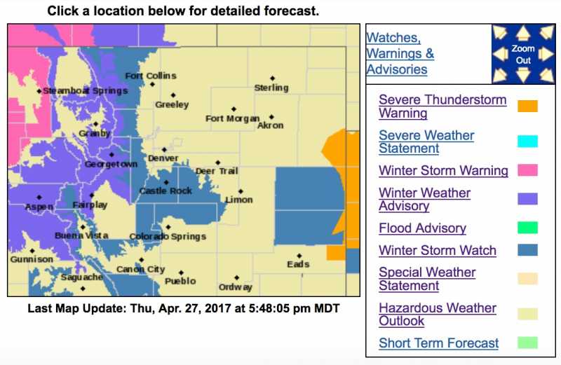
Check Chief Meteorologist Steve Hamilton's updated town forecasts for more details and keep tabs as the storm moves into the area with our interactive radar map:
mymountaintown.com/expert-local-weather
Winter Storm Watch
URGENT - WINTER WEATHER MESSAGE
National Weather Service Denver/Boulder CO
1228 PM MDT Thu Apr 27 2017
...MORE SNOW HEADED TO COLORADO...
.The first storm to affect the Colorado high country will wind
down by 6 PM today. Between now and 6 PM brief moderate to heavy
snow showers are possible along the I-70 corridor and northern
mountains. Travelers across the high mountains passes should
continue to be prepared for reduced visibility and slow,
hazardous winter travel conditions associated with the snow
showers this afternoon into this evening.
Another storm system will bring colder temperatures and more
widespread snowfall all the way down onto the plains Friday night
and Saturday. This storm will have potential to bring significant
snow accumulations up to a foot over the foothills of Boulder and
Jefferson counties, and across the Palmer Divide. This may impact
travel across those areas as temperatures drop into the 20s. A
few inches of snow will be possible in lower elevations including
the Denver metro area. Snow accumulation on trees that have
already leafed out may result in broken tree limbs and scattered
power outages. Stay tuned to the National Weather Service or your
local news media for the latest updates on this spring storm.
COZ035-036-041-280600-
/O.CON.KBOU.WS.A.0011.170429T0000Z-170430T0000Z/
Larimer and Boulder Counties Between 6000 and 9000 Feet-
Jefferson and West Douglas Counties Above 6000 Feet/Gilpin/Clear
Creek/Northeast Park Counties Below 9000 Feet-
Elbert/Central and East Douglas Counties Above 6000 Feet-
Including the cities of Estes Park, Glendevey, Nederland,
Red Feather Lakes, Bailey, Central City, Evergreen, Georgetown,
Idaho Springs, Westcreek, Castle Rock, Elbert, Fondis, Kiowa,
and Larkspur
1228 PM MDT Thu Apr 27 2017
...WINTER STORM WATCH REMAINS IN EFFECT FROM FRIDAY EVENING
THROUGH SATURDAY AFTERNOON...
* TIMING...Snow will develop by Friday evening and may be heavy
at times Friday night into Saturday morning. Snow will
decrease Saturday afternoon.
* SNOW ACCUMULATIONS...Up to 1 foot possible.
* WIND/VISIBILITY...Northeast winds 15 to 30 mph, with the
strongest winds on the plains. Visibility may be reduced to a
quarter mile in heavy snow.
* IMPACTS...Roads will likely become snow and slush covered with
the onset of heavier snow Friday evening. Hazardous travel
conditions are expected to last into Saturday. Wet snow may
also accumulate on already leafed out trees, resulting in
broken tree limbs and scattered power outages.
PRECAUTIONARY/PREPAREDNESS ACTIONS...
A Winter Storm Watch means there is a potential for significant
snow accumulations that may impact travel. Continue to monitor
the latest forecasts.
Last edit: 28 Apr 2017 09:38 by MountainTownAlerts. Reason: update from Watch to Warning
Please Log in or Create an account to join the conversation.
- HappyCamper
-

- Mountain Legend
-
Less
More
- Posts: 1810
- Thank you received: 98
27 Apr 2017 19:58 #2
by HappyCamper
Replied by HappyCamper on topic Winter Storm Warning Friday PM thru Saturday Afternoon
So how much snow are they saying Bailey will get?
Please Log in or Create an account to join the conversation.
- Chief Meteorologist
-

- Happy Camper
-

Less
More
- Posts: 46
- Thank you received: 14
28 Apr 2017 07:06 #3
by Chief Meteorologist
Replied by Chief Meteorologist on topic Winter Storm Warning Friday PM thru Saturday Afternoon
The Watch is now a Warning and has been changed on the website. For the Bailey question, to be specific, 1" possible this afternoon, 3 - 7" possible overnight and another 1 - 2" on Saturday-day. So, potentially as much as 10" total, or as little as 5" for the Bailey area. That is the latest from our model data, QPF and atmospheric soundings. -Steve
Please Log in or Create an account to join the conversation.
- MountainTownAlerts
-
Topic Author
- Mountain Legend
-
Less
More
- Posts: 9766
- Thank you received: 221
28 Apr 2017 10:05 - 28 Apr 2017 10:06 #4
by MountainTownAlerts
Replied by MountainTownAlerts on topic Winter Storm Warning Friday PM thru Saturday Afternoon
Chief Meteorologist Steve Hamilton has updated our town forecasts with more details such as how many inches we can expect to receive tonight. Keep tabs as the storm moves into the area with our interactive radar map:
mymountaintown.com/expert-local-weather
and exclusive webcams!
Hwy 285 Morrison to Grant: mymountaintown.com/weather-traffic
Hwy 285 Kenosha to South Park: mymountaintown.com/weather-traffic/285-w...ferson-to-south-park
I-70/Hwy 73/Hwy 74: Golden to Evergreen: mymountaintown.com/weather-traffic/i-70-...-golden-to-evergreen
I-70 Evergreen to Eisenhower Tunnel: mymountaintown.com/weather-traffic/i-70-...-and-traffic-cameras

Winter Storm Warning
URGENT - WINTER WEATHER MESSAGE
National Weather Service Denver/Boulder CO
449 AM MDT Fri Apr 28 2017
...MORE SNOW HEADED TO COLORADO...
.A Spring storm system will bring cold temperatures and snow to much of the area tonight through Saturday. Significant snow accumulations are expected across the Front Range Foothills and Palmer Divide. Accumulating snow can be expected across most of the plains as well, with a few inches expected from the Denver Metro area southeast along the I-70 corridor through Limon. The wintry conditions may impact travel. Wet snow accumulating on trees that have already leafed out may also result in broken tree limbs and scattered power outages. Stay tuned to the National Weather Service or your local news media for the latest updates on this winter-like storm.
COZ035-036-041-281900-/O.UPG.KBOU.WS.A.0011.170429T0000Z-170430T0000Z/ /O.NEW.KBOU.WS.W.0010.170428T2200Z-170430T0000Z/
Larimer and Boulder Counties Between 6000 and 9000 Feet-
Jefferson and West Douglas Counties Above 6000 Feet/Gilpin/Clear
Creek/Northeast Park Counties Below 9000 Feet-
Elbert/Central and East Douglas Counties Above 6000 Feet-
449 AM MDT Fri Apr 28 2017
...WINTER STORM WARNING IN EFFECT FROM 4 PM THIS AFTERNOON TO 6 PM MDT SATURDAY...
The National Weather Service in Denver has issued a Winter Storm Warning for heavy snow, which is in effect from 4 PM this afternoon to 6 PM MDT Saturday. The Winter Storm Watch is no longer in effect.
* TIMING...Snow is expected develop in the Front Range Foothills this afternoon and will become heavy at times late this afternoon and evening. Snow will continue through tonight, and then gradually taper off from north to south on Saturday.
* SNOW ACCUMULATIONS...8 to 15 inches, heaviest in the southern Front Range Foothills.
* WIND/VISIBILITY...Northeast winds 15 to 30 mph, with the strongest winds on the plains. Visibility may be reduced to a quarter mile in heavy snow.
* IMPACTS...Roads will become snow and slush covered with the heavier snowfall late this afternoon and evening. Hazardous travel conditions will linger into Saturday. Wet snow may also accumulate on already leafed out trees, resulting in broken tree limbs and scattered power outages.
PRECAUTIONARY/PREPAREDNESS ACTIONS...
A Winter Storm Warning for heavy snow means severe winter weather conditions are expected or occurring. Significant amounts of snow are forecast that will make travel dangerous. If you must travel...keep an extra flashlight...food...and water in your vehicle in case of an emergency.
Winter Weather Advisory
URGENT - WINTER WEATHER MESSAGE
National Weather Service Denver/Boulder CO
449 AM MDT Fri Apr 28 2017
...MORE SNOW HEADED TO COLORADO...
COZ033-034-037-281900-
/O.NEW.KBOU.WW.Y.0021.170428T2200Z-170430T0000Z/
South and East Jackson/Larimer/North and Northeast Grand/
Northwest Boulder Counties Above 9000 Feet-
South and Southeast Grand/West Central and Southwest Boulder/
Gilpin/Clear Creek/Summit/North and West Park Counties Above
9000 Feet-Central and Southeast Park County-
449 AM MDT Fri Apr 28 2017
...WINTER WEATHER ADVISORY IN EFFECT FROM 4 PM THIS AFTERNOON TO 6 PM MDT SATURDAY...
The National Weather Service in Denver has issued a Winter Weather Advisory for snow, which is in effect from 4 PM this afternoon to 6 PM MDT Saturday.
* TIMING...Snow is expected develop across the Mountains and Park County this afternoon and may become heavy at times on the eastern slope of the Front Range late this afternoon and evening. Snow will continue through tonight, and then gradually decrease Saturday.
* SNOW ACCUMULATIONS...6-12 inches on the eastern slope of the Front Range, and 2-6 inches elsewhere.
* WIND/VISIBILITY...Northeast winds 15 to 25 mph. Visibility may be reduced to a quarter mile in heavy snow.
* IMPACTS...Roads will become snow and slush covered with the heavier snowfall late this afternoon and evening. Hazardous travel conditions will linger into Saturday.
PRECAUTIONARY/PREPAREDNESS ACTIONS...
A Winter Weather Advisory means that periods of snow will cause travel difficulties. Be prepared for slippery roads and limited visibilities...and use caution while driving.
URGENT - WINTER WEATHER MESSAGE
National Weather Service Denver/Boulder CO
449 AM MDT Fri Apr 28 2017
...MORE SNOW HEADED TO COLORADO...
COZ039-040-045>047-281900-
/O.NEW.KBOU.WW.Y.0021.170429T0000Z-170430T0000Z/
Boulder And Jefferson Counties Below 6000 Feet/West Broomfield County-
North Douglas County Below 6000 Feet/Denver/West Adams and
Arapahoe Counties/East Broomfield County-
Central and East Adams and Arapahoe Counties-
North and Northeast Elbert County Below 6000 Feet/North Lincoln County-
Southeast Elbert County Below 6000 Feet/South Lincoln County-
449 AM MDT Fri Apr 28 2017
...WINTER WEATHER ADVISORY IN EFFECT FROM 6 PM THIS EVENING TO 6 PM MDT SATURDAY...
The National Weather Service in Denver has issued a Winter Weather Advisory for snow, which is in effect from 6 PM this evening to 6 PM MDT Saturday.
* TIMING...Rain showers will develop across the plains and I-25 Corridor this afternoon, and then mix with and change to snow late this afternoon into early evening. The snow may be briefly heavy early this evening, but then taper to light snow and continue through much of Saturday before ending.
* SNOW ACCUMULATIONS...3 to 6 inches. Locally heavier amounts possible right next to the foothills.
* WIND/VISIBILITY...Northeast winds 10 to 20 mph. Visibility may be reduced to a half mile or less in the heavier snow showers this evening.
* IMPACTS...Wet snow may accumulate on already leafed out trees, resulting in broken tree limbs and scattered power outages. Some roads will become snow and slush covered this evening with the heavier snow showers. Hazardous travel conditions may linger into Saturday morning with temperatures dropping below freezing tonight.
PRECAUTIONARY/PREPAREDNESS ACTIONS...
A Winter Weather Advisory means that periods of snow may cause travel difficulties, and other impacts such as broken tree limbs. Be prepared for slippery roads and limited visibilities...and use caution while driving. If possible, safely knock accumulated snow off vulnerable trees.
Hwy 285 Morrison to Grant: mymountaintown.com/weather-traffic
Hwy 285 Kenosha to South Park: mymountaintown.com/weather-traffic/285-w...ferson-to-south-park
I-70/Hwy 73/Hwy 74: Golden to Evergreen: mymountaintown.com/weather-traffic/i-70-...-golden-to-evergreen
I-70 Evergreen to Eisenhower Tunnel: mymountaintown.com/weather-traffic/i-70-...-and-traffic-cameras
Winter Storm Warning
URGENT - WINTER WEATHER MESSAGE
National Weather Service Denver/Boulder CO
449 AM MDT Fri Apr 28 2017
...MORE SNOW HEADED TO COLORADO...
.A Spring storm system will bring cold temperatures and snow to much of the area tonight through Saturday. Significant snow accumulations are expected across the Front Range Foothills and Palmer Divide. Accumulating snow can be expected across most of the plains as well, with a few inches expected from the Denver Metro area southeast along the I-70 corridor through Limon. The wintry conditions may impact travel. Wet snow accumulating on trees that have already leafed out may also result in broken tree limbs and scattered power outages. Stay tuned to the National Weather Service or your local news media for the latest updates on this winter-like storm.
COZ035-036-041-281900-/O.UPG.KBOU.WS.A.0011.170429T0000Z-170430T0000Z/ /O.NEW.KBOU.WS.W.0010.170428T2200Z-170430T0000Z/
Larimer and Boulder Counties Between 6000 and 9000 Feet-
Jefferson and West Douglas Counties Above 6000 Feet/Gilpin/Clear
Creek/Northeast Park Counties Below 9000 Feet-
Elbert/Central and East Douglas Counties Above 6000 Feet-
449 AM MDT Fri Apr 28 2017
...WINTER STORM WARNING IN EFFECT FROM 4 PM THIS AFTERNOON TO 6 PM MDT SATURDAY...
The National Weather Service in Denver has issued a Winter Storm Warning for heavy snow, which is in effect from 4 PM this afternoon to 6 PM MDT Saturday. The Winter Storm Watch is no longer in effect.
* TIMING...Snow is expected develop in the Front Range Foothills this afternoon and will become heavy at times late this afternoon and evening. Snow will continue through tonight, and then gradually taper off from north to south on Saturday.
* SNOW ACCUMULATIONS...8 to 15 inches, heaviest in the southern Front Range Foothills.
* WIND/VISIBILITY...Northeast winds 15 to 30 mph, with the strongest winds on the plains. Visibility may be reduced to a quarter mile in heavy snow.
* IMPACTS...Roads will become snow and slush covered with the heavier snowfall late this afternoon and evening. Hazardous travel conditions will linger into Saturday. Wet snow may also accumulate on already leafed out trees, resulting in broken tree limbs and scattered power outages.
PRECAUTIONARY/PREPAREDNESS ACTIONS...
A Winter Storm Warning for heavy snow means severe winter weather conditions are expected or occurring. Significant amounts of snow are forecast that will make travel dangerous. If you must travel...keep an extra flashlight...food...and water in your vehicle in case of an emergency.
Winter Weather Advisory
URGENT - WINTER WEATHER MESSAGE
National Weather Service Denver/Boulder CO
449 AM MDT Fri Apr 28 2017
...MORE SNOW HEADED TO COLORADO...
COZ033-034-037-281900-
/O.NEW.KBOU.WW.Y.0021.170428T2200Z-170430T0000Z/
South and East Jackson/Larimer/North and Northeast Grand/
Northwest Boulder Counties Above 9000 Feet-
South and Southeast Grand/West Central and Southwest Boulder/
Gilpin/Clear Creek/Summit/North and West Park Counties Above
9000 Feet-Central and Southeast Park County-
449 AM MDT Fri Apr 28 2017
...WINTER WEATHER ADVISORY IN EFFECT FROM 4 PM THIS AFTERNOON TO 6 PM MDT SATURDAY...
The National Weather Service in Denver has issued a Winter Weather Advisory for snow, which is in effect from 4 PM this afternoon to 6 PM MDT Saturday.
* TIMING...Snow is expected develop across the Mountains and Park County this afternoon and may become heavy at times on the eastern slope of the Front Range late this afternoon and evening. Snow will continue through tonight, and then gradually decrease Saturday.
* SNOW ACCUMULATIONS...6-12 inches on the eastern slope of the Front Range, and 2-6 inches elsewhere.
* WIND/VISIBILITY...Northeast winds 15 to 25 mph. Visibility may be reduced to a quarter mile in heavy snow.
* IMPACTS...Roads will become snow and slush covered with the heavier snowfall late this afternoon and evening. Hazardous travel conditions will linger into Saturday.
PRECAUTIONARY/PREPAREDNESS ACTIONS...
A Winter Weather Advisory means that periods of snow will cause travel difficulties. Be prepared for slippery roads and limited visibilities...and use caution while driving.
URGENT - WINTER WEATHER MESSAGE
National Weather Service Denver/Boulder CO
449 AM MDT Fri Apr 28 2017
...MORE SNOW HEADED TO COLORADO...
COZ039-040-045>047-281900-
/O.NEW.KBOU.WW.Y.0021.170429T0000Z-170430T0000Z/
Boulder And Jefferson Counties Below 6000 Feet/West Broomfield County-
North Douglas County Below 6000 Feet/Denver/West Adams and
Arapahoe Counties/East Broomfield County-
Central and East Adams and Arapahoe Counties-
North and Northeast Elbert County Below 6000 Feet/North Lincoln County-
Southeast Elbert County Below 6000 Feet/South Lincoln County-
449 AM MDT Fri Apr 28 2017
...WINTER WEATHER ADVISORY IN EFFECT FROM 6 PM THIS EVENING TO 6 PM MDT SATURDAY...
The National Weather Service in Denver has issued a Winter Weather Advisory for snow, which is in effect from 6 PM this evening to 6 PM MDT Saturday.
* TIMING...Rain showers will develop across the plains and I-25 Corridor this afternoon, and then mix with and change to snow late this afternoon into early evening. The snow may be briefly heavy early this evening, but then taper to light snow and continue through much of Saturday before ending.
* SNOW ACCUMULATIONS...3 to 6 inches. Locally heavier amounts possible right next to the foothills.
* WIND/VISIBILITY...Northeast winds 10 to 20 mph. Visibility may be reduced to a half mile or less in the heavier snow showers this evening.
* IMPACTS...Wet snow may accumulate on already leafed out trees, resulting in broken tree limbs and scattered power outages. Some roads will become snow and slush covered this evening with the heavier snow showers. Hazardous travel conditions may linger into Saturday morning with temperatures dropping below freezing tonight.
PRECAUTIONARY/PREPAREDNESS ACTIONS...
A Winter Weather Advisory means that periods of snow may cause travel difficulties, and other impacts such as broken tree limbs. Be prepared for slippery roads and limited visibilities...and use caution while driving. If possible, safely knock accumulated snow off vulnerable trees.
Last edit: 28 Apr 2017 10:06 by MountainTownAlerts.
Please Log in or Create an account to join the conversation.
- Forum
- Life Up the Hill
- Scanner & Emergency Info, Weather Forecasts
- Winter Storm Warning Friday PM thru Saturday Afternoon
Time to create page: 0.175 seconds
sponsors