Winter Storm Warning
URGENT - WINTER WEATHER MESSAGE
National Weather Service Denver CO
432 AM MST Thu Nov 16 2017
...SNOW RETURNS TO THE MOUNTAINS...
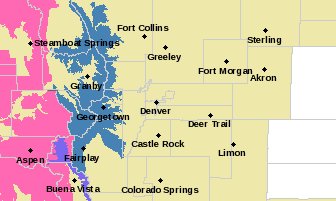
.A Pacific jet stream and moisture plume will combine to produce accumulating snowfall over the northern Colorado mountains later tonight through Friday night. Snow will begin to develop towards midnight, and become more widespread during the day on Friday. Snow intensity is expected to increase sharply from north to south Friday afternoon, reaching the I-70 Mountain Corridor by early Friday evening as a strong cold front arrives.
Travel conditions are expected to deteriorate rapidly during this time, with snow levels quickly dropping to valley floors. Blowing snow may produce poor visibilities, especially over the high mountain passes. The heavy snow will decrease from northwest to southeast late Friday night, with drier conditions expected by Saturday.
On the plains, scattered rain and snow showers will likely develop behind the strong cold front late Friday afternoon and evening, but any snow accumulation on the plains is expected to be light.
COZ031-161945-
/O.UPG.KBOU.WS.A.0017.171117T0600Z-171118T1200Z/
/O.NEW.KBOU.WS.W.0015.171117T0700Z-171118T1200Z/
Rabbit Ears Pass-
Including the cities of
East Slopes Park and Northern Gore Ranges, Gore Pass, and Rabbit Ears Pass
432 AM MST Thu Nov 16 2017
...
WINTER STORM WARNING IN EFFECT FROM MIDNIGHT TONIGHT TO 5 AM MST SATURDAY...
* WHAT...Heavy snow expected. Plan on difficult travel conditions by later tonight and Friday.
Total snow accumulations of 1 to 2 feet of snow is expected.
* WHERE...Rabbit Ears Pass.
* WHEN...From midnight tonight to 5 AM MST Saturday.
* ADDITIONAL DETAILS...Winds gusting as high as 45 mph will cause patchy blowing and drifting snow.
PRECAUTIONARY/PREPAREDNESS ACTIONS...
A Winter Storm Warning for snow means severe winter weather conditions are expected. If you must travel, keep an extra flashlight, food and water in your vehicle in case of an emergency. The latest road conditions for the state you are calling from can be obtained by calling 5 1 1.
Winter Storm Watch
URGENT - WINTER WEATHER MESSAGE
National Weather Service Denver CO
432 AM MST Thu Nov 16 2017
...SNOW RETURNS TO THE MOUNTAINS...
.A Pacific jet stream and moisture plume will combine to produce accumulating snowfall over the northern Colorado mountains later tonight through Friday night. Snow will begin to develop towards midnight, and become more widespread during the day on Friday.
Snow intensity is expected to increase sharply from north to south Friday afternoon, reaching the I-70 Mountain Corridor by early Friday evening as a strong cold front arrives.
Travel conditions are expected to deteriorate rapidly during this time, with snow levels quickly dropping to valley floors. Blowing snow may produce poor visibilities, especially over the high mountain passes. The heavy snow will decrease from northwest to southeast late Friday night, with drier conditions expected by Saturday.
On the plains, scattered rain and snow showers will likely develop behind the strong cold front late Friday afternoon and evening, but any snow accumulation on the plains is expected to be light.
COZ033-034-161945-
/O.EXT.KBOU.WS.A.0017.171117T0700Z-171118T1200Z/
Rocky Mountain National Park and the Medicine Bow Range-The Mountains of Summit County, the Mosquito Range, and the Indian Peaks-
Including the cities of Cameron Pass, Laramie and Medicine Bow Mountains, Rabbit Ears Range, Rocky Mountain National Park, Willow Creek Pass,
Berthoud Pass, Breckenridge, East Slopes Mosquito Range, East Slopes Southern Gore Range, Eisenhower Tunnel, Indian Peaks, Kenosha Mountains, Mount Evans, Williams Fork Mountains, and Winter Park
432 AM MST Thu Nov 16 2017
...
WINTER STORM WATCH NOW IN EFFECT FROM LATE TONIGHT THROUGH LATE FRIDAY NIGHT...
* WHAT...
Heavy snow possible. Plan on difficult travel conditions, especially the evening commute on Friday. Total snow accumulations of 7 to 18 inches, are possible. Highest amounts near Rocky Mountain National Park.
* WHERE...Rocky Mountain National Park and the Medicine Bow Range and The Mountains of Summit County, the Mosquito Range, and the Indian Peaks.
* WHEN...From late tonight through late Friday night.
* ADDITIONAL DETAILS...Winds gusting as high as 55 mph will cause areas of blowing and drifting snow.
PRECAUTIONARY/PREPAREDNESS ACTIONS...
A Winter Storm Watch means there is potential for significant snow, sleet or ice accumulations that may impact travel. Continue to monitor the latest forecasts.