MMT Weather URGENT: High Wind Warning - All CO Foothills through Sunday morning. Sustained wind 45 to 55 mph possible. Gusts of 65 to 85 mph possible. I-70, US-40, Hwy 285 all affected. Secure outdoor items now. #cowx #MMTwx
mymountaintown.com/expert-local-weather
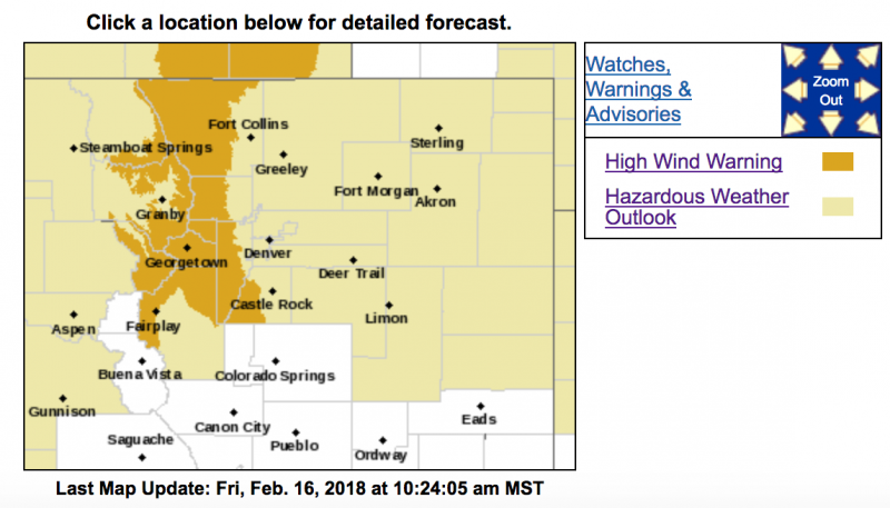
High Wind Warning
URGENT - WEATHER MESSAGE
National Weather Service Denver/Boulder CO
913 AM MST Fri Feb 16 2018
...
Strong winds for the East Slopes of the Front Range Mountains and Foothills tonight through Sunday mid-morning...
.Two systems will bring strong winds tonight and Saturday night to the high country down into the foothills. There will be a slight decrease in speeds Saturday during the day, but winds will increase again Saturday evening.
COZ033>036-170100-
/O.UPG.KBOU.HW.A.0001.180217T0700Z-180218T1500Z/
/O.NEW.KBOU.HW.W.0002.180217T0700Z-180218T1500Z/
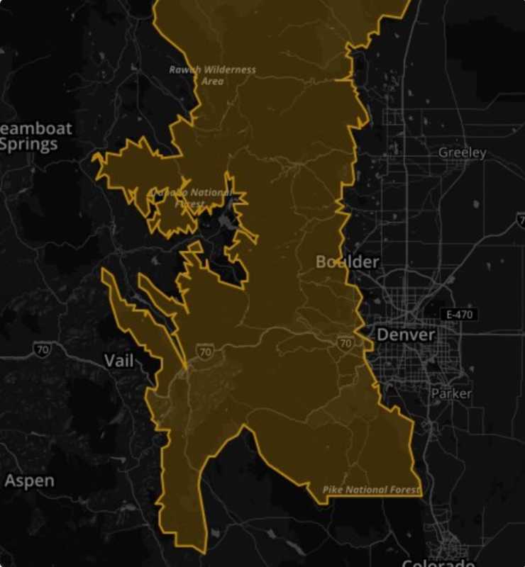
South and East Jackson/Larimer/North and Northeast Grand/Northwest Boulder Counties Above 9000 Feet-
South and Southeast Grand/West Central and Southwest Boulder/Gilpin/
Clear Creek/Summit/North and West Park Counties Above 9000 Feet-
Larimer and Boulder Counties Between 6000 and 9000 Feet-
Jefferson and West Douglas Counties Above 6000 Feet/
Gilpin/Clear Creek/Northeast Park Counties Below 9000 Feet-
Including the cities of Cameron Pass, Laramie and Medicine Bow Mountains, Rabbit Ears Range, Rocky Mountain National Park, Willow Creek Pass,
Berthoud Pass, Breckenridge, East Slopes Mosquito Range, East Slopes Southern Gore Range, Eisenhower Tunnel, Indian Peaks, Kenosha Mountains, Mount Evans, Williams Fork Mountains, Winter Park, Estes Park, Glendevey, Nederland, Red Feather Lakes,
Bailey, Central City, Evergreen, Georgetown, Idaho Springs, and Westcreek
913 AM MST Fri Feb 16 2018
...
HIGH WIND WARNING IN EFFECT FROM MIDNIGHT TONIGHT TO 8 AM MST SUNDAY...
The National Weather Service in Denver has issued a High Wind Warning, which is in effect from midnight tonight to 8 AM MST Sunday. The High Wind Watch is no longer in effect.
* TIMING...Midnight tonight through mid-morning Sunday. Winds will subside slightly between Saturday mid morning to Saturday late afternoon before increasing again Saturday evening.
* WINDS...
Westerly at 45 to 55 mph sustained with gusts 70 to 85 mph.
* IMPACTS...
Travel will be hazardous, especially for lightweight and high profile vehicles over high mountain passes, Highway 285 through Park County and over the Peak To Peak Highway due to crosswinds.
PRECAUTIONARY/PREPAREDNESS ACTIONS...
A High Wind Warning means a hazardous high wind event is expected or occurring. Sustained wind speeds of at least 50 mph or gusts of 75 mph or more can lead to property damage. Loose outdoor items should be brought inside or secured properly.