Red Flag Warning
URGENT - FIRE WEATHER MESSAGE
National Weather Service Denver/Boulder CO
655 PM MDT Sun Apr 29 2018
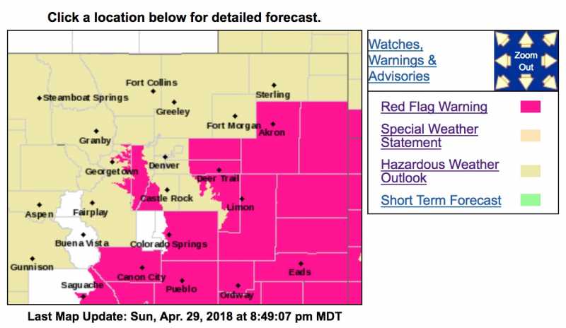
...HIGH FIRE DANGER REMAINS IN PLACE ACROSS PORTIONS OF EASTERN COLORADO THROUGH MONDAY...
.Unseasonably warm temperatures, very low relative humidity and gusty southwest winds will create high fire danger across east central Colorado. Fire danger will continue to decrease this evening as winds subside, but then increase again Monday as winds become gusty late in the morning through the afternoon.
COZ216-245-249-301200-
/O.CON.KBOU.FW.W.0021.180430T1600Z-180501T0100Z/
Jefferson and West Douglas Counties Above 6000 Feet/Gilpin/Clear Creek/Northeast Park Counties Below 9000 Feet-
Central and East Adams and Arapahoe Counties-Washington County-
655 PM MDT Sun Apr 29 2018
...
RED FLAG WARNING REMAINS IN EFFECT FROM 10 AM TO 7 PM MDT MONDAY FOR WIND AND LOW RELATIVE HUMIDITY FOR THE SOUTHERN FRONT RANGE FOOTHILLS...AND PLAINS THROUGH EASTERN ADAMS...ARAPAHOE...AND WASHINGTON COUNTIES...FIRE WEATHER ZONES 216...245...AND 246...
* Affected Area...Fire Weather Zones 216...245 and 249.
* Timing...Late Monday morning through early Monday evening.
* Winds...Southwest 15 to 20 mph with gusts up to 35 mph.
* Relative Humidity...As low as 11 percent.
* Impacts...Fires may start and spread rapidly with the very warm, dry and gusty weather conditions.
PRECAUTIONARY/PREPAREDNESS ACTIONS...
A Red Flag Warning means that critical fire weather conditions are either occurring now....or will shortly. A combination of strong winds...low relative humidity...and warm temperatures can contribute to extreme fire behavior.