Red Flag Warning for Park County until 7pm on May 10, 2018

09 May 2018 14:35 - 09 May 2018 16:27 #1 by MountainTownAlerts

URGENT - FIRE WEATHER MESSAGE
National Weather Service Denver/Boulder CO
350 AM MDT Wed May 9 2018

...HIGH FIRE DANGER THURSDAY...

.Unseasonably warm temperatures, very low relative humidity and gusty southwest winds will create high fire danger across central and southeast Park, southeast Elbert and southern Lincoln counties.

COZ214-247-091800-
/O.UPG.KBOU.FW.A.0011.180510T1700Z-180511T0100Z/
/O.NEW.KBOU.FW.W.0022.180510T1700Z-180511T0100Z/
Central and Southeast Park County-
Southeast Elbert County Below 6000 Feet/South Lincoln County-
350 AM MDT Wed May 9 2018

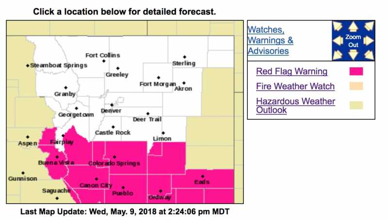
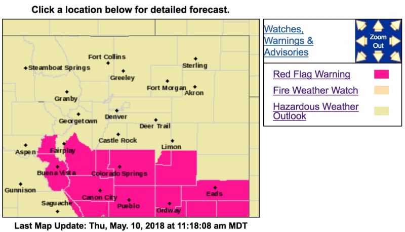
...RED FLAG WARNING IN EFFECT FROM 11 AM TO 7 PM MDT THURSDAY FOR WIND AND LOW RELATIVE HUMIDITY FOR SOUTH PARK, SOUTHEAST ELBERT AND SOUTHERN LINCOLN COUNTIES...

The National Weather Service in Denver has issued a Red Flag Warning FOR WIND AND LOW RELATIVE HUMIDITY, which is in effect from 11 AM to 7 PM MDT Thursday. The Fire Weather Watch is no longer in effect.

* Affected Area...Fire Weather Zones 214 and 247.

* Timing...late Thursday morning through early Thursday evening.

* Winds...Southwest 15 to 20 mph with gusts up to 30 mph.

* Relative Humidity...As low as 9 percent.

* Impacts...Fires may start and spread rapidly with the very warm, dry and gusty weather conditions.

PRECAUTIONARY/PREPAREDNESS ACTIONS...

A Red Flag Warning means that critical fire weather conditions are either occurring now....or will shortly. A combination of strong winds...low relative humidity...and warm temperatures can contribute to extreme fire behavior.
Attachments:

Please Log in or Create an account to join the conversation.

10 May 2018 11:31 #2 by MountainTownAlerts

URGENT - FIRE WEATHER MESSAGE
National Weather Service Denver/Boulder CO
233 AM MDT Thu May 10 2018

COZ214-247-101800-
/O.CON.KBOU.FW.W.0022.180510T1700Z-180511T0100Z/
/O.CON.KBOU.FW.A.0012.180511T1800Z-180512T0100Z/
Central and Southeast Park County-
Southeast Elbert County Below 6000 Feet/South Lincoln County-
233 AM MDT Thu May 10 2018

...RED FLAG WARNING REMAINS IN EFFECT FROM 11 AM THIS MORNING TO 7 PM MDT THIS EVENING FOR WIND AND LOW RELATIVE HUMIDITY FOR SOUTH PARK, SOUTHEAST ELBERT AND SOUTHERN LINCOLN COUNTIES...

...FIRE WEATHER WATCH REMAINS IN EFFECT FROM FRIDAY AFTERNOON THROUGH FRIDAY EVENING FOR WIND AND LOW RELATIVE HUMIDITY FOR SOUTH PARK, SOUTHEAST ELBERT AND SOUTHERN LINCOLN COUNTIES...

* Affected Area...Fire Weather Zones 214 and 247.

* Timing...Red Flag conditions expected late this morning through early this evening. Another round of Red Flag conditions are possible Friday, depending on location of a cold front.

* Winds...Southwest 10 to 20 mph with gusts up to 35 mph.

* Relative Humidity...As low as 9 percent.

* Impacts...Fires may start and spread rapidly with the very warm, dry and gusty weather conditions.

PRECAUTIONARY/PREPAREDNESS ACTIONS...

A Red Flag Warning means that critical fire weather conditions are either occurring now....or will shortly. A combination of strong winds...low relative humidity...and warm temperatures can contribute to extreme fire behavior.

A Fire Weather Watch means that critical fire weather conditions are forecast to occur. Listen for later forecasts and possible Red Flag Warnings.
Attachments:

Please Log in or Create an account to join the conversation.

Time to create page: 0.161 seconds
Powered by Kunena Forum
sponsors
© My Mountain Town (new)
Google+