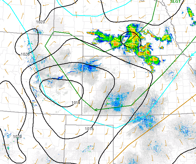
The Storm Prediction Center has parts of eastern Colorado in a "Slight" risk for severe thunderstorms, mainly this afternoon and evening. The slight risk area is represented inside the green line on the image. A "slight" risk means that we have a chance of some severe thunderstorms, with the main impacts being damaging straight-line wind and large hail. We could also see a brief isolated tornado, although the chances are low.
Most of the foothills are excluded from the slight risk area, but part of the Denver metro is included. For the foothills, specifically, we have upslope conditions around low pressure to our south, and a cold front coming in from the northwest. Thunderstorms are expected to form in the foothills this afternoon before advancing eastward and getting stronger as they go. This is a typical pattern for this type of situation.
Having said that, a few strong storms will be possible for the foothills as things progress into the afternoon. Some storms could have damaging hail and wind, but should move quickly along with the cold front. Damage risk is low today for the foothills communities, but not nonexistent. - Meteorologist Steve Hamilton