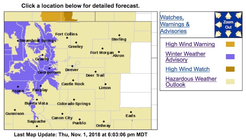
Winter Weather Advisory
URGENT - WINTER WEATHER MESSAGE
National Weather Service Denver CO
302 PM MDT Thu Nov 1 2018
...BOUTS OF SNOW AND BLOWING SNOW HEADED FOR THE MOUNTAINS OVER THE NEXT FEW DAYS...
.A powerful and moist Pacific jet stream will bring several waves of snow and blowing snow to the mountains. Light snow will occur tonight, but
a stronger storm will arrive by Friday evening. That storm will last through much of Saturday before decreasing late in the day. Strong winds and blowing snow will accompany this storm, creating hazardous travel conditions in the Colorado high country, including the I-70 Corridor from Georgetown through Vail Pass.
Travel conditions may improve for later Saturday night into Sunday morning, before
the next storm arrives Sunday afternoon and continues through Monday with more snow and blowing snow expected.
COZ031-033-034-020515-
/O.NEW.KBOU.WW.Y.0031.181103T0000Z-181104T0000Z/
Rabbit Ears Pass-
Rocky Mountain National Park and the Medicine Bow Range-
The Mountains of Summit County, the Mosquito Range, and the Indian Peaks-
Including the cities of East Slopes Park and Northern Gore Ranges, Gore Pass, Rabbit Ears Pass, Cameron Pass, Laramie and Medicine Bow Mountains, Rabbit Ears Range, Rocky Mountain National Park, Willow Creek Pass,
Berthoud Pass, Breckenridge, East Slopes Mosquito Range, East Slopes Southern Gore Range, Eisenhower Tunnel, Indian Peaks, Kenosha Mountains, Mount Evans, Williams Fork Mountains, and Winter Park
302 PM MDT Thu Nov 1 2018
...
WINTER WEATHER ADVISORY IN EFFECT FROM 6 PM FRIDAY TO 6 PM MDT SATURDAY...
* WHAT...Snow expected, with the heaviest snow Friday evening.
Total snow accumulations of 6 to 12 inches expected. Winds gusting to 50 to 60 mph over the higher passes.
* WHERE...Rabbit Ears Pass, Rocky Mountain National Park and the Medicine Bow Range and The Mountains of Summit County, the Mosquito Range, and the Indian Peaks.
* WHEN...From 6 PM Friday to 6 PM MDT Saturday.
* ADDITIONAL DETAILS...Travel could be very difficult. Areas of blowing snow could significantly reduce visibility.
PRECAUTIONARY/PREPAREDNESS ACTIONS...
A Winter Weather Advisory for snow means periods of snow will cause primarily travel difficulties. Expect snow covered roads and limited visibilities, and use caution while driving. Chain and adequate snow tire laws will likely be in effect. Plan accordingly.
The latest road conditions for the state you are calling from can be obtained by calling 5 1 1.