Per Chief Meteorologist Steve Hamilton:
Snow For Veterans Day...
High pressure will drop south from the Canadian Rockies, through the northern Rockies, and into our area late Saturday and Sunday. This system will bring cold temperatures. As the high enters our region, return flow will tap in to limited moisture over the southern plains, from low pressure moving to our south. The result will be a period of snow, lasting from late Saturday through late Sunday. Most of the heavier snow will fall in the southern Rockies, but we'll get some as well. Most areas should see about 2 to 4 inches, with some locally higher amounts, by Sunday night. Bring in a big heap of firewood because things will stay cold through Monday.
Morrison
Veterans Day: Snow. 1 to 3 inches possible. High: Upper 20s.
Sunday Night: Snow showers and cold. Low: Lower teens.
Monday: A few early snow showers, then some clearing in the afternoon. High: Upper 20s.
Conifer
Veterans Day: Snow. 2 to 4 inches possible. High: Mid 20s.
Sunday Night: Snow, tapering off to snow showers. Cold. Low: Single digits.
Monday: Lingering snow showers, then partly sunny. High: Lower 20s.
Evergreen
Veterans Day: Snow. 2 to 4 inches possible. High: Lower 20s.
Sunday Night: Snow, tapering off to snow showers. Low: 10.
Monday: Early snow showers, then partly sunny and cold. High: Mid 20s.
Pine
Veterans Day: Snow. 1 to 3 inches possible. High: Mid 20s.
Sunday Night: Evening snow showers. Low: Single digits.
Monday: Lingering snow showers, then some clearing. Cold. High: 20.
Bailey
Veterans Day: Snow. 2 to 4 inches possible. High: Upper 20s.
Sunday Night: Snow showers and cold. Low: Near 10.
Monday: A few snow showers with clearing in the afternoon. High: 20.
Fairplay
Veterans Day: Snow. 2 to 4 inches possible. High: Upper teens.
Sunday Night: Snow, tapering off to snow showers. Low: Near 0.
Monday: Turning partly sunny. High: Mid to upper teens.
Jefferson-Como
Veterans Day: Snow and cold. 1 to 3 inches possible. High: Near 20.. Cloudy, with a high near 19.
Sunday Night: Snow, tapering off late. Low: Near 0.
Monday: Lingering snow showers and cold. High: Mid to upper teens.
Alma
Veterans Day: Snow or snow showers. 2 to 4 inches possible. Cold. High: Upper teens.
Sunday Night: Snow likely. Low: Near 0.
Monday: Lingering snow showers. Partly cloudy and cold. High: Mid teens.
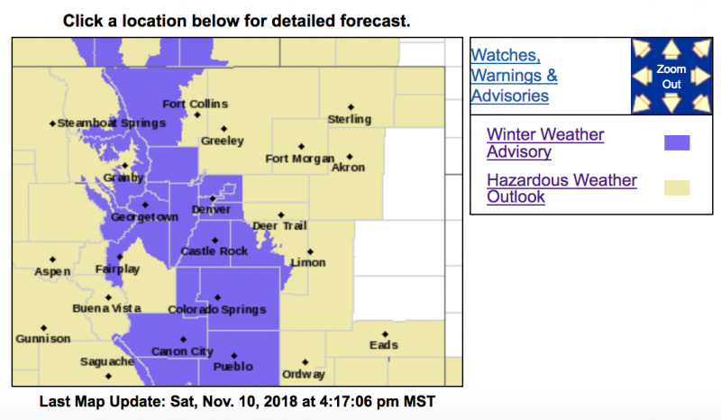
URGENT - WINTER WEATHER MESSAGE
National Weather Service Denver CO
123 PM MST Sat Nov 10 2018
...SNOW MOVING INTO COLORADO LATE TONIGHT AND SUNDAY...
.Snow will spread across the northern mountains and southward along the Front Range in the late evening and overnight hours. Some snow accumulation is likely by morning. The snow will continue on Sunday, with some decrease in the afternoon. The heaviest snow will be on the east slopes of the Front Range, where amounts of 4 to 10 inches are possible. Snow amounts will decrease eastward away from the mountains, with lighter accumulations east of Interstate 25.
Travelers should expect snow covered or icy roads in the
mountains on Sunday, with some travel impacts likely in areas just
east of the mountains.
COZ033>036-110600-
/O.CON.KBOU.WW.Y.0034.181111T0700Z-181111T2300Z/
Rocky Mountain National Park and the Medicine Bow Range-
The Mountains of Summit County, the Mosquito Range, and the Indian Peaks-
The Northern Front Range Foothills-
The Southern Front Range Foothills-
Including the cities of Cameron Pass, Laramie and Medicine Bow Mountains, Rabbit Ears Range, Rocky Mountain National Park, Willow Creek Pass, Berthoud Pass,
Breckenridge, East Slopes Mosquito Range, East Slopes Southern Gore Range, Eisenhower Tunnel, Indian Peaks, Kenosha Mountains, Mount Evans, Williams Fork Mountains, Winter Park, Estes Park, Glendevey, Nederland, Red Feather Lakes,
Bailey, Central City, Evergreen, Georgetown, Idaho Springs, and Westcreek
123 PM MST Sat Nov 10 2018
...
WINTER WEATHER ADVISORY REMAINS IN EFFECT FROM MIDNIGHT TONIGHT TO 4 PM MST SUNDAY...
* WHAT...Snow expected.
Snow accumulations of 4 to 10 inches expected by late Sunday afternoon.
* WHERE...The Northern Front Range Foothills, The Southern Front Range Foothills, The Mountains of Summit County, the Mosquito Range, and the Indian Peaks and Rocky Mountain National Park and the Medicine Bow Range.
* WHEN...Snow will spread across the mountains from north to south this evening. The main period of accumulating snow will be late tonight through midday Sunday on the east slopes of the Front Range. Lighter snow will likely continue into Sunday evening.
* ADDITIONAL DETAILS...Plan on slippery road conditions. Delays and road closures due to accidents are possible.
PRECAUTIONARY/PREPAREDNESS ACTIONS...
A Winter Weather Advisory for snow means periods of snow will cause primarily travel difficulties. Expect snow covered roads and limited visibilities, and use caution while driving.
The latest road conditions for the state you are calling from can be obtained by calling 5 1 1.