MMT Weather Update: NWS has issued a Winter Weather Advisory from 5 p.m. tonight to 5 a.m. Thursday for the Front Range Foothills and adjacent plains, including the Denver Metro area. Most of the foothills can expect 2 to 5 inches, with 1 to 3 inches in and around the Denver area. Additionally, temperatures will be cold with gusty wind, causing wind chills of -20 to -30. Slick roads will affect the commute Wednesday morning and afternoon.
Keep in mind, this storm system is evolving, and we may have to make changes to the accumulations as we get into it.
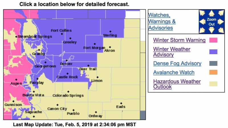
Check back on our local weather forecast page for updates from Chief Meteorologist Steve Hamilton:
mymountaintown.com/expert-local-weather
Winter Weather Advisory
URGENT - WINTER WEATHER MESSAGE
National Weather Service Denver CO
1223 PM MST Tue Feb 5 2019
...A PACIFIC SYSTEM TO BRING SNOW TO NORTH-CENTRAL AND NORTHEASTERN COLORADO WEDNESDAY THROUGH THURSDAY MORNING...
.Snow will increase in intensity and coverage across the northern mountains tonight and will continue through Thursday morning. A strong cold front will move through the urban corridor and eastern plains around midday Wednesday. Behind this front, light to moderate snowfall will fall through the afternoon and into early Thursday morning. The Wednesday evening commute will see hazardous travel conditions.
COZ035-036-038>045-048-060330-
/O.EXB.KBOU.WW.Y.0010.190206T1900Z-190207T1200Z/
The Northern Front Range Foothills-
The Southern Front Range Foothills-Fort Collins-
Boulder and the western suburbs of Denver-Denver-Castle Rock-
Briggsdale-Greeley-Fort Morgan-Byers-Sterling-
Including the cities of Estes Park, Glendevey, Nederland, Red Feather Lakes,
Bailey, Central City, Evergreen, Georgetown, Idaho Springs, Westcreek, Fort Collins, Hereford, Loveland, Nunn,
Arvada, Boulder, Golden, Lakewood, Longmont, Aurora, Brighton, City of Denver, Denver International Airport, Highlands Ranch, Littleton, Parker, Castle Rock, Elbert, Fondis, Kiowa, Larkspur, Briggsdale, Grover, Pawnee Buttes, Raymer, Stoneham, Eaton, Fort Lupton, Greeley, Roggen, Brush, Fort Morgan, Goodrich, Wiggins, Bennett, Byers, Deer Trail, Leader, Crook, Merino, Sterling, and Peetz
1223 PM MST Tue Feb 5 2019
...
WINTER WEATHER ADVISORY IN EFFECT FROM NOON WEDNESDAY TO 5 AM MST THURSDAY...
* WHAT...Snow expected.
Total snow accumulations of 2 to 5 inches expected.
* WHERE...Portions of central, north central and northeast Colorado. This includes the cities of Denver, Boulder and Fort Collins.
* WHEN...From noon Wednesday to 5 AM MST Thursday.
* ADDITIONAL DETAILS...Plan on slippery road conditions. The hazardous conditions will impact the evening commute. The cold wind chills as low as 25 below zero could cause frostbite on exposed skin in as little as 30 minutes.
PRECAUTIONARY/PREPAREDNESS ACTIONS...
A Winter Weather Advisory for snow means periods of snow will cause primarily travel difficulties. Expect snow covered roads and limited visibilities, and use caution while driving.
The latest road conditions for the state you are calling from can be obtained by calling 5 1 1.