MMT Weather from Chief Meteorologist Steve Hamilton:
High pressure will move into western Colorado on Wednesday, with a steep change in air pressure. This will cause gusty wind throughout the foothills. A High Wind Warning is in effect due to occasional gusts over 60 mph, especially for wind-prone areas. Also, some snow showers may blow over the mountains on a strong westerly air flow. Only minor accumulation is expected, and not all areas will receive snow. The best chance for accumulation will be around Fairplay, Alma and Jefferson/Como. Other than that, snow chances remain slim.
mymountaintown.com/expert-local-weather
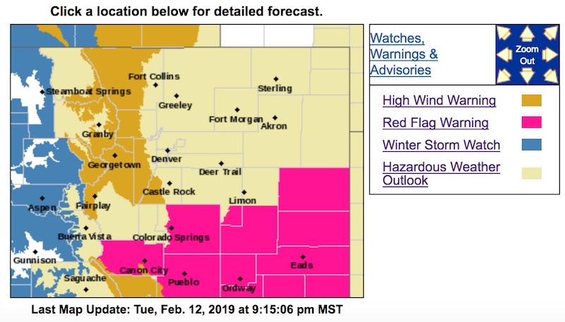
High Wind Warning
URGENT - WEATHER MESSAGE
National Weather Service Denver/Boulder CO
833 PM MST Tue Feb 12 2019
...HIGH WINDS EXPECTED IN THE NORTHERN MOUNTAINS AND FOOTHILLS LATE TONIGHT THROUGH WEDNESDAY EVENING...
.Westerly winds will increase over the northern Colorado mountains tonight and continue through Wednesday. Through Wednesday morning, the strongest winds are expected to remain over the high mountain passes.
The most likely time for damaging winds will be Wednesday afternoon through the evening hours when there is a better chance of the strong winds pushing into the lower foothills. There is a chance of a few hours of strong winds late Wednesday afternoon and early evening in wind prone places near the foothills like Boulder, Broomfield, and Golden, Carter Lake, and along the Wyoming border south of Cheyenne.
COZ033>036-131300-
/O.EXT.KBOU.HW.W.0004.190213T0700Z-190214T0700Z/
South and East Jackson/Larimer/North and Northeast Grand/
Northwest Boulder Counties Above 9000 Feet-
South and Southeast Grand/West Central and Southwest Boulder/ Gilpin/
Clear Creek/Summit/North and West Park Counties Above 9000 Feet-
Larimer and Boulder Counties Between 6000 and 9000 Feet-
Jefferson and West Douglas Counties Above 6000 Feet/Gilpin/Clear Creek/Northeast Park Counties Below 9000 Feet-
Including the cities of Cameron Pass, Laramie and Medicine Bow Mountains, Rabbit Ears Range, Rocky Mountain National Park, Willow Creek Pass, Berthoud Pass,
Breckenridge, East Slopes Mosquito Range, East Slopes Southern Gore Range, Eisenhower Tunnel, Indian Peaks, Kenosha Mountains, Mount Evans, Williams Fork Mountains, Winter Park, Estes Park, Glendevey, Nederland, Red Feather Lakes,
Bailey, Central City, Evergreen, Georgetown, Idaho Springs, and Westcreek
833 PM MST Tue Feb 12 2019
...
HIGH WIND WARNING NOW IN EFFECT FROM MIDNIGHT TONIGHT TO MIDNIGHT MST WEDNESDAY NIGHT...
* WINDS...
West 30 to 40 mph with gusts up to 80 mph.
* TIMING...Winds will increase after midnight over the high mountain passes and then increase over the foothills during the day. The strongest winds are expected Wednesday afternoon and evening.
* IMPACTS...Strong winds may blow down limbs, trees, and power lines. Scattered power outages are possible. Travel will be difficult, especially for high profile vehicles.
PRECAUTIONARY/PREPAREDNESS ACTIONS...
A High Wind Warning means a hazardous high wind event is expected or occurring. Strong winds may lead to property damage. Hazardous driving conditions due to powerful cross winds will pose a serious risk for drivers, especially for light weight and high profile vehicles. Loose outdoor items should be brought inside or secured properly. Be prepared for possible power outages.