From Chief Meteorologist Steve Hamilton:
Winter Weather Advisory Until 8 AM: Fairplay / Jefferson / Como / Alma...
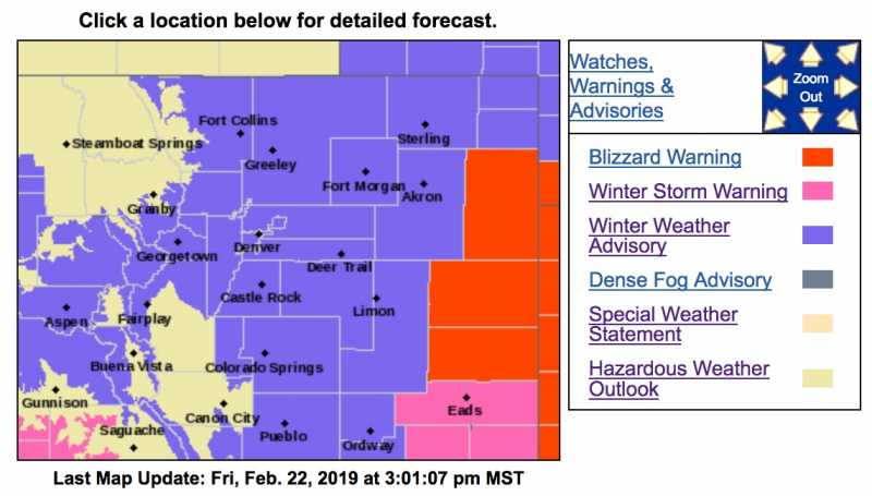
Well folks, once again we will not be getting the brunt of the latest winter storm that will pass through Colorado on Friday and Saturday. The configuration and track of this system will favor heavier snow to our east, with accumulations of less than 6 inches for the foothills. Areas that have the best chance for the most snow are Conifer and Evergreen, where we may top 6 inches. Expect 4 or 5 inches for Fairplay, Jefferson, Como and Alma, where wind will be quite gusty. The rest of the foothills should stay under 3 inches. Clearing on Saturday but windy for all locations. Wind could gust up to or over 45 mph for many areas, causing blowing and drifting snow.
Winter Weather Advisory
URGENT - WINTER WEATHER MESSAGE
National Weather Service Denver CO
1020 AM MST Fri Feb 22 2019
... SNOW INCREASING OVER THE MOUNTAINS AND PLAINS LATER THIS AFTERNOON THROUGH TONIGHT...
.The next winter storm will make its way across the state this afternoon into Saturday. Mainly light snow is expected over the mountains this morning, but it is expected to increase in coverage and intensity this afternoon and evening. The heaviest snowfall amounts in the mountains are expected to be along and south of I-70 corridor. Moderate to heavy snow showers will develop over the urban corridor late this afternoon into this evening. The evening rush hour could have hazardous traveling conditions. Farther east, snow will begin this evening lasting through Saturday morning.
COZ035-036-038>045-230130-
/O.EXB.KBOU.WW.Y.0014.190222T2300Z-190223T1500Z/
The Northern Front Range Foothills-
The Southern Front Range Foothills-
Fort Collins-
Boulder and the western suburbs of Denver-Denver-Castle Rock-
Briggsdale-Greeley-Fort Morgan-Byers-
Including the cities of Estes Park, Glendevey, Nederland, Red Feather Lakes,
Bailey, Central City, Evergreen, Georgetown, Idaho Springs, Westcreek, Fort Collins, Hereford, Loveland, Nunn,
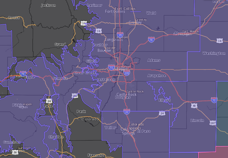
Arvada, Boulder, Golden, Lakewood, Longmont, Aurora, Brighton, City of Denver, Denver International Airport, Highlands Ranch, Littleton, Parker, Castle Rock, Elbert, Fondis, Kiowa, Larkspur, Briggsdale, Grover, Pawnee Buttes, Raymer, Stoneham, Eaton, Fort Lupton, Greeley, Roggen, Brush, Fort Morgan, Goodrich, Wiggins, Bennett, Byers, Deer Trail, and Leader
1020 AM MST Fri Feb 22 2019
...
WINTER WEATHER ADVISORY IN EFFECT FROM 4 PM THIS AFTERNOON TO 8 AM MST SATURDAY...
* WHAT...Snow expected.
Total snow accumulations of 2 to 6 inches expected. Winds gusting as high as 30 mph.
* WHERE...Portions of central, north central and northeast Colorado.
* WHEN...From 4 PM this afternoon to 8 AM MST Saturday.
* ADDITIONAL DETAILS...Plan on slippery road conditions. The hazardous conditions could impact the evening commute.
PRECAUTIONARY/PREPAREDNESS ACTIONS...
A Winter Weather Advisory for snow means periods of snow will cause primarily travel difficulties. Expect snow covered roads and limited visibilities, and use caution while driving.
The latest road conditions for the state you are calling from can be obtained by calling 5 1 1.