From Chief Meteorologist Steve Hamilton:
How We Kick Off Summer In Colorado...
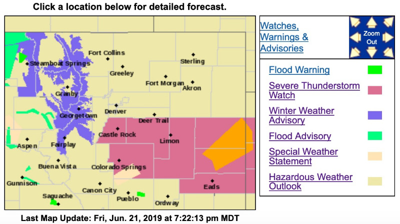
...With a Winter Weather Advisory! The Advisory only covers Fairplay, Jefferson, Como and Alma. We may see a few flakes around Conifer as well. Moist air is moving into northeast Colorado and the foothills following a cold front that passed through Friday morning. Low pressure to our southeast will continue to bring moisture from the Southern Plains into our area through much of the weekend. Scattered showers and thunderstorms are expected, with best rain chances lasting from tonight through Saturday night. As for the snow, we're looking at the possibility of a rain/snow mix for Conifer, with little or no accumulation. However, around Alma, Fairplay, Jefferson and Como, we could see a half inch or more. Most of the snow would fall in the morning hours Saturday, with another possibility of snow Saturday night into Sunday. Rain will start to taper off by Sunday afternoon, followed by a period of fair and warmer weather.
Specific town forecasts at
mymountaintown.com/expert-local-weather
Winter Weather Advisory
URGENT - WINTER WEATHER MESSAGE
National Weather Service Denver CO
346 PM MDT Fri Jun 21 2019
...MOUNTAIN SNOW THROUGH SATURDAY NIGHT ...
.A prolonged cold storm system will slowly move across the Northern and Central Rockies tonight through early Sunday. The heaviest snow is expected to fall over elevations above 9000 feet of the north ranges and above 10,000 feet along the I-70 Corridor including Summit County. Snow, mixed with rain at times, will be possible for the lower elevations on the mountain valley floors.
Cold conditions with snow showers are expected for the mountains through Sunday afternoon. Plan accordingly if you are going to be spending time in the Colorado high country.
COZ034-220600-
/O.CON.KBOU.WW.Y.0028.190622T0000Z-190623T1200Z/
The Mountains of Summit County, the Mosquito Range, and the Indian Peaks-
Including the cities of Berthoud Pass, Breckenridge, East Slopes Mosquito Range, East Slopes Southern Gore Range, Eisenhower Tunnel, Indian Peaks, Kenosha Mountains, Mount Evans, Williams Fork Mountains, and Winter Park
346 PM MDT Fri Jun 21 2019
...WINTER WEATHER ADVISORY REMAINS IN EFFECT UNTIL 6 AM MDT SUNDAY...
* WHAT...Snow expected.
Total snow accumulations of 3 to 10 inches expected, with the heaviest amounts above 10,000 feet. Winds gusting as high as 35 mph.
* WHERE...The Mountains of Summit County, the Mosquito Range, and the Indian Peaks.
* WHEN...
From 6 PM this evening to 6 AM MDT Sunday.
* ADDITIONAL DETAILS...Plan on slippery road conditions. If venturing into the mountains this weekend be prepared for cold temperatures and periods of snow.
PRECAUTIONARY/PREPAREDNESS ACTIONS...
A Winter Weather Advisory for snow means periods of snow will cause primarily travel difficulties. Expect slush and snow covered roads and limited visibilities, and use caution while driving.
The latest road conditions for the state you are calling from can be obtained by calling 5 1 1.
www.weather.gov/bou/