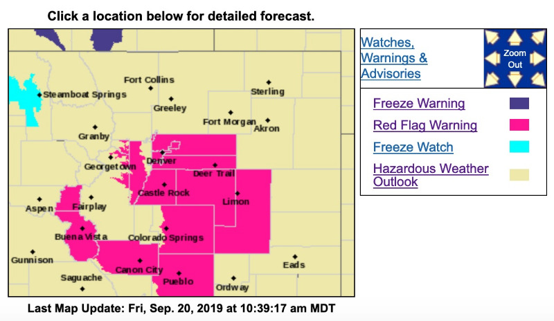
Red Flag Warning
URGENT - FIRE WEATHER MESSAGE
National Weather Service Denver/Boulder CO
1002 AM MDT Fri Sep 20 2019
COZ216-240-241-245>247-210015-
/O.NEW.KBOU.FW.W.0007.190920T1800Z-190921T0200Z/
Jefferson and West Douglas Counties Above 6000 Feet/Gilpin/Clear Creek/Northeast Park Counties Below 9000 Feet-
North Douglas County Below 6000 Feet/Denver/West Adams and Arapahoe Counties/East Broomfield County-
Elbert/Central and East Douglas Counties Above 6000 Feet-
Central and East Adams and Arapahoe Counties-
North and Northeast Elbert County Below 6000 Feet/North Lincoln County-
Southeast Elbert County Below 6000 Feet/South Lincoln County-
1002 AM MDT Fri Sep 20 2019
...
RED FLAG WARNING IN EFFECT UNTIL 8 PM MDT THIS EVENING FOR WIND AND LOW RELATIVE HUMIDITY FOR SOUTHERN FOOTHILLS...PALMER DIVIDE...AND PLAINS MAINLY ALONG AND SOUTH OF I-70...OR FIRE ZONES 216...240...241...245...246 and 247...
The National Weather Service in Denver has issued a Red Flag Warning FOR WIND AND LOW RELATIVE HUMIDITY, which is in effect until 8 PM MDT this evening.
* Affected Area...Fire Weather Zones 216...240...241...245... 246 and 247.
* Winds...Southwest 15 to 25 mph with gusts up to 35 mph.
* Timing...Shortly after noon, through 8 pm
* Relative Humidity...As low as 13 percent.
* Impacts...Conditions will be favorable for the rapid ignition, growth, and spread of fires.
PRECAUTIONARY/PREPAREDNESS ACTIONS...
A Red Flag Warning means that critical fire weather conditions
are either occurring now....or will shortly. A combination of
strong winds...low relative humidity...and warm temperatures can
contribute to extreme fire behavior.