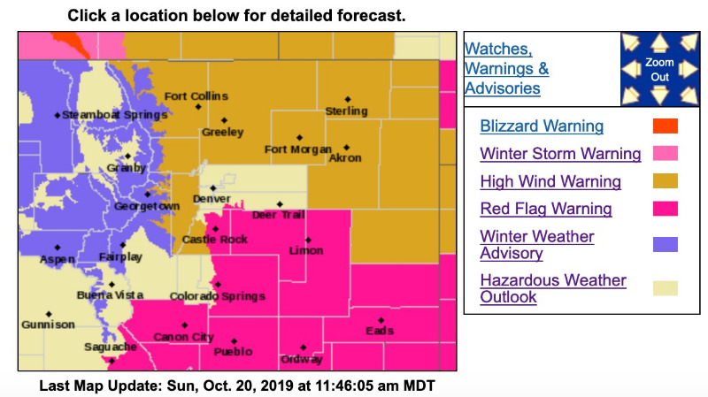
High Wind Warning
URGENT - WEATHER MESSAGE
National Weather Service Denver CO
249 AM MDT Sun Oct 20 2019
COZ035-036-038-039-201800-
/O.NEW.KBOU.HW.W.0008.191020T1200Z-191021T0100Z/
Larimer and Boulder Counties Between 6000 and 9000 Feet-
Jefferson and West Douglas Counties Above 6000 Feet/Gilpin/Clear Creek/Northeast Park Counties Below 9000 Feet-
Larimer County Below 6000 Feet/Northwest Weld County-
Boulder And Jefferson Counties Below 6000 Feet/West Broomfield County-
Including the cities of Estes Park, Glendevey, Nederland, Red Feather Lakes,
Bailey, Central City, Evergreen, Georgetown, Idaho Springs, Westcreek, Fort Collins, Hereford, Loveland, Nunn,
Arvada, Boulder, Golden, Lakewood, and Longmont
249 AM MDT Sun Oct 20 2019
...
HIGH WIND WARNING IN EFFECT FROM 6 AM THIS MORNING TO 7 PM MDT THIS EVENING...
* WHAT...West winds 35 to 45 mph with gusts up to 75 mph expected.
* WHERE...Larimer and Boulder Counties Between 6000 and 9000 Feet, Jefferson and West Douglas Counties Above 6000 Feet/Gilpin/Clear Creek/Northeast Park Counties Below 9000 Feet, Larimer County Below 6000 Feet/Northwest Weld County and Boulder and Jefferson Counties Below 6000 Feet/West Broomfield County.
* WHEN...From 6 AM this morning to 7 PM MDT this evening.
* IMPACTS...Strong winds will blow around unsecured objects. Tree limbs could be blown down and a few power outages may result. Travel will be difficult for high profile vehicles.
PRECAUTIONARY/PREPAREDNESS ACTIONS...
Strong winds may lead to property damage. Hazardous driving conditions due to powerful cross winds will pose a serious risk for drivers, especially for light weight and high profile vehicles. Loose outdoor items should be brought inside or secured properly.
Winter Weather Advisory
URGENT - WINTER WEATHER MESSAGE
National Weather Service Denver CO
444 AM MDT Sun Oct 20 2019
...SNOW, GUSTY WINDS, AND BLOWING SNOW CONTINUING...
.Snow, winds, and blowing snow will continue across the northern mountains of Colorado today. Snow will be heaviest through early this morning, then generally lighter snow through the rest of the day. People planning travel across the Colorado high country should be prepared for hazardous winter travel conditions, including snow covered and icy roads and reduced visibility.
COZ033-034-201800-
/O.CON.KBOU.WW.Y.0030.000000T0000Z-191020T1800Z/
Rocky Mountain National Park and the Medicine Bow Range-
The Mountains of Summit County, the Mosquito Range, and the Indian Peaks-
Including the cities of Cameron Pass, Laramie and Medicine Bow Mountains, Rabbit Ears Range, Rocky Mountain National Park, Willow Creek Pass,
Berthoud Pass, Breckenridge, East Slopes Mosquito Range, East Slopes Southern Gore Range, Eisenhower Tunnel, Indian Peaks, Kenosha Mountains, Mount Evans, Williams Fork Mountains, and Winter Park
444 AM MDT Sun Oct 20 2019
...
WINTER WEATHER ADVISORY REMAINS IN EFFECT UNTIL NOON MDT TODAY...
* WHAT...Snow expected. Total snow accumulations of 3 to 8 inches. Winds gusting as high as 60 mph.
* WHERE...Rocky Mountain National Park and the Medicine Bow Range and The Mountains of Summit County, the Mosquito Range, and the Indian Peaks.
* WHEN...Through noon today.
* IMPACTS...Plan on slippery roads and hazardous travel conditions. Areas of blowing snow could significantly reduce visibility.
PRECAUTIONARY/PREPAREDNESS ACTIONS...
Slow down and use caution while traveling.
The latest road conditions for the state you are calling from can be obtained by calling 5 1 1.