Winter Storm Watch
URGENT - WINTER WEATHER MESSAGE
National Weather Service Denver CO
439 AM MDT Sat Oct 26 2019
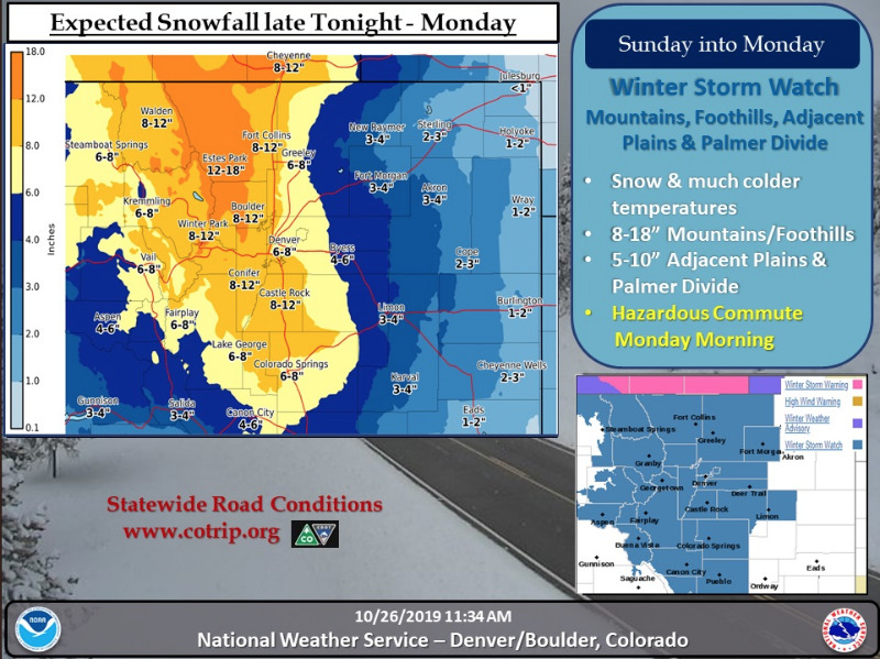
...WINTER RETURNING TO NORTHERN COLORADO LATE TONIGHT THROUGH MONDAY...
.A storm system will move into Colorado late tonight, and will bring colder and wintery weather, to north central and northeast Colorado through Monday. Snow is expected to develop over the northern mountains late tonight, which will continue through Sunday into Monday. The plains and urban corridor may see precipitation begin as freezing drizzle late tonight as the storm develops over the region. This may make roads icy and hazardous Sunday morning. Precipitation will switch to snow by mid-morning Sunday with generally light snow through the day. Snow may become heavy at times in the mountains by Sunday afternoon, and spread across the region Sunday night into Monday morning, before tapering off by Monday afternoon. Hazardous road conditions are expected to develop with the worst conditions Sunday night into Monday morning.
COZ036-037-261845-
/O.EXT.KBOU.WS.A.0013.191027T1800Z-191029T0000Z/
The Southern Front Range Foothills-South Park-
Including the cities of Bailey, Central City, Evergreen, Georgetown, Idaho Springs, Westcreek, Fairplay, Hartsel, Lake George, and South Park
439 AM MDT Sat Oct 26 2019
...
WINTER STORM WATCH NOW IN EFFECT FROM SUNDAY AFTERNOON THROUGH MONDAY AFTERNOON...
* WHAT...Heavy snow possible. Total snow accumulations of 8 to 14 inches possible.
* WHERE...South Park and the Southern Front Range Foothills.
* WHEN...From Sunday afternoon through Monday afternoon.
* IMPACTS...Travel could become very difficult. The hazardous conditions could impact the morning and evening commute times.
PRECAUTIONARY/PREPAREDNESS ACTIONS...
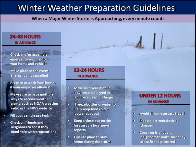
Monitor the latest forecasts for updates on this situation.
* * * * * * * * * * * * * * * * * * * * * * * * * * * * * * * * * * * * * * * * * * * * * * * * *
URGENT - WINTER WEATHER MESSAGE
National Weather Service Denver CO
439 AM MDT Sat Oct 26 2019
COZ032-034-261845-
/O.CON.KBOU.WS.A.0013.191027T1200Z-191029T0000Z/
Grand and
Summit Counties Below 9000 Feet-
The Mountains of Summit County, the Mosquito Range, and the Indian Peaks-
Including the cities of Dillon, Fraser, Granby, Grand Lake, Hot Sulphur Springs, Kremmling, Berthoud Pass, Breckenridge, East Slopes Mosquito Range, East Slopes Southern Gore Range, Eisenhower Tunnel, Indian Peaks, Kenosha Mountains, Mount Evans, Williams Fork Mountains, and Winter Park
439 AM MDT Sat Oct 26 2019
...
WINTER STORM WATCH REMAINS IN EFFECT FROM SUNDAY MORNING THROUGH MONDAY AFTERNOON...
* WHAT...Heavy snow possible.
Total snow accumulations of 8 to 14 inches possible.
* WHERE...The Mountains of Summit County, the Mosquito Range, and the Indian Peaks and Grand and Summit Counties Below 9000 Feet.
* WHEN...From Sunday morning through Monday afternoon.
* IMPACTS...Travel could become very difficult. The hazardous conditions could impact the morning and evening commute times.