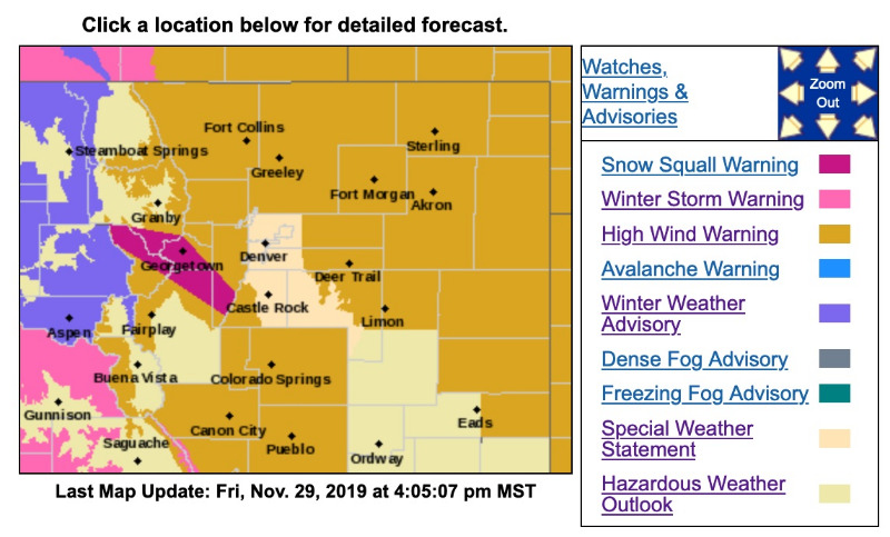
Snow Squall Warning
SNOW SQUALL WARNING
NWS DENVER CO
356 PM MST FRI NOV 29 2019
COC019-049-059-093-117-292311-
/O.CON.KBOU.SQ.W.0002.000000T0000Z-191129T2330Z/
356 PM MST FRI NOV 29 2019
Clear Creek County-Grand County-Jefferson County-Park County-Summit County-
...
A SNOW SQUALL WARNING REMAINS IN EFFECT UNTIL 430 PM MST FOR NORTHEASTERN PARK...NORTHERN SUMMIT...SOUTHERN GRAND...CLEAR CREEK AND SOUTHWESTERN JEFFERSON COUNTIES...
At 356 PM MST, a dangerous snow squall was located along a line extending from 10 miles east of Green Mountain Reservoir to near Wellington Lake, or along a line extending from 66 miles east of Glenwood Springs to 34 miles southwest of Denver, moving northeast at 20 mph.
HAZARD...
Extremely poor visibility snow and blowing snow. Wind gusts up to 30 mph.
SOURCE...Radar and webcams.
IMPACT...Expect hazardous road conditions.
This includes Interstate 70 between mile markers 206 and 233. Conditions have improved farther south around Hoosier Pass, but poor travel conditions remain.
Locations impacted include...
Silverthorne, Georgetown, Dillon, Empire, Silver Plume, Grant, Highland Park, Berthoud Pass, Loveland Pass,
Shawnee, Berthoud Falls, Pine Junction, Bakerville, Green Mountain Reservoir, Keystone, Echo Lake, Guanella Pass, Buffalo Creek, Wellington Lake and Mt Evans.
PRECAUTIONARY/PREPAREDNESS ACTIONS...
Consider avoiding or delaying travel until the snow squall passes your location. If you must travel, use extra caution and allow extra time. Rapid changes in visibility and slick road conditions may lead to accidents.
Wet roadways will quickly freeze. Black ice will cause roads, bridges and overpasses to become slick and dangerous. Slow down and be prepared for sudden loss of traction.
LAT...LON 3993 10643 3983 10570 3939 10516 3921 10526 3967 10615 3977 10638 3993 10643
- - - - - - - - - - - - - - - - - - - - - - - - - - - - - - - - - - -
High Wind Warning
URGENT - WEATHER MESSAGE
National Weather Service Denver CO
1212 PM MST Fri Nov 29 2019
COZ033>036-038-039-300600-
/O.CON.KBOU.HW.W.0009.191130T0300Z-191201T0100Z/
South and East Jackson/Larimer/North and Northeast Grand/
Northwest Boulder Counties Above 9000 Feet-
South and Southeast Grand/West Central and Southwest Boulder/Gilpin/[size=crimson]
Clear Creek/Summit/North and West Park Counties Above 9000 Feet[/size]-
Larimer and Boulder Counties Between 6000 and 9000 Feet-
Jefferson and West Douglas Counties Above 6000 Feet/Gilpin/Clear Creek/Northeast Park Counties Below 9000 Feet-
Larimer County Below 6000 Feet/Northwest Weld County-
Boulder And Jefferson Counties Below 6000 Feet/West Broomfield County-
Including the cities of Cameron Pass, Laramie and Medicine Bow Mountains, Rabbit Ears Range, Rocky Mountain National Park, Willow Creek Pass,
Berthoud Pass, Breckenridge, East Slopes Mosquito Range, East Slopes Southern Gore Range, Eisenhower Tunnel, Indian Peaks, Kenosha Mountains, Mount Evans, Williams Fork Mountains, Winter Park, Estes Park, Glendevey, Nederland, Red Feather Lakes,
Bailey, Central City, Evergreen, Georgetown, Idaho Springs, Westcreek, Fort Collins, Hereford, Loveland, Nunn,
Arvada, Boulder, Golden, Lakewood, and Longmont
1212 PM MST Fri Nov 29 2019
...
HIGH WIND WARNING REMAINS IN EFFECT FROM 8 PM THIS EVENING TO 6 PM MST SATURDAY...
* WHAT...
West winds 35 to 45 mph with gusts up to 90 mph expected.
* WHERE...Northern and Central mountains and foothills, especially on the Peak to Peak Highway and along highway 93 between Golden and Boulder.
* WHEN...From 8 PM this evening to 6 PM MST Saturday. The strongest winds can be expected during the daytime on Saturday.
*
IMPACTS...Damaging winds will blow down trees and power lines. Widespread power outages are expected. Travel will be difficult, especially for high profile vehicles. With the strong winds and snow on the ground, there will be areas of blowing snow and poor visibilities over exposed areas.
PRECAUTIONARY/PREPAREDNESS ACTIONS...
Strong winds may lead to property damage. Hazardous driving conditions due to powerful cross winds will pose a serious risk for drivers, especially for light weight and high profile vehicles. Loose outdoor items should be brought inside or secured properly.