Check for updates on Chief Meteorologist Steve Hamilton's weather page as the storm moves this way:
mymountaintown.com/expert-local-weather
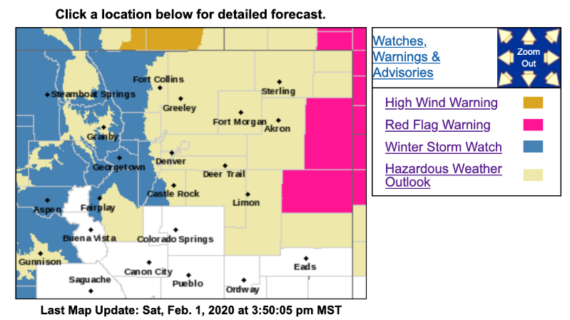
Winter Storm Watch
URGENT - WINTER WEATHER MESSAGE
National Weather Service Denver CO
325 PM MST Sat Feb 1 2020
...SNOW AND WIND TO IMPACT TRAVEL MONDAY AFTERNOON THROUGH TUESDAY AFTERNOON...
.A band of moderate to heavy snow will push into the northern Colorado mountains Monday afternoon resulting in very difficult travel conditions. Snow showers will continue Monday night through Tuesday afternoon.
Snow will also spread onto the plains Monday and Monday night, and then continue into Tuesday as the storm system moves across the state. Snow accumulations on the plains are expected to be lighter. However, a few inches of snow, and possible freezing drizzle early in the event, will still result in travel impacts with snow covered and slick road conditions. Plan ahead for the sharp change in temperatures and wintry travel conditions.
COZ031-033>036-020630-
/O.NEW.KBOU.WS.A.0001.200203T1900Z-200205T0100Z/
Rabbit Ears Pass-
Rocky Mountain National Park and the Medicine Bow Range-
The Mountains of Summit County, the Mosquito Range, and the Indian Peaks-
The Northern Front Range Foothills-
The Southern Front Range Foothills-
Including the cities of East Slopes Park and Northern Gore Ranges, Gore Pass, Rabbit Ears Pass, Cameron Pass, Laramie and Medicine Bow Mountains, Rabbit Ears Range, Rocky Mountain National Park, Willow Creek Pass, Berthoud Pass, Breckenridge, East Slopes Mosquito Range, East Slopes Southern Gore Range,
Eisenhower Tunnel, Indian Peaks, Kenosha Mountains, Mount Evans, Williams Fork Mountains, Winter Park, Estes Park, Glendevey, Nederland, Red Feather Lakes, Bailey, Central City, Evergreen, Georgetown, Idaho Springs, and Westcreek
325 PM MST Sat Feb 1 2020
...
WINTER STORM WATCH IN EFFECT FROM MONDAY AFTERNOON THROUGH TUESDAY AFTERNOON...
* WHAT...
Heavy snow possible. Total snow accumulations of 6 to 14 inches possible. Winds could gust as high as 45 mph.
* WHERE...Rabbit Ears Pass, Rocky Mountain National Park and the Medicine Bow Range, The Mountains of Summit County, the Mosquito Range, and the Indian Peaks, The Northern Front Range Foothills and The Southern Front Range Foothills.
* WHEN...From Monday afternoon through Tuesday afternoon.
* IMPACTS...
Travel could be very difficult. The hazardous conditions could impact the morning or evening commutes. The cold wind chills as low as 30 below zero could cause frostbite on exposed skin in as little as 30 minutes.
PRECAUTIONARY/PREPAREDNESS ACTIONS...
Monitor the latest forecasts for updates on this situation.