Red Flag Warning
URGENT - FIRE WEATHER MESSAGE
National Weather Service Denver/Boulder CO
327 AM MDT Tue Apr 28 2020
...HIGH FIRE DANGER TODAY...
.
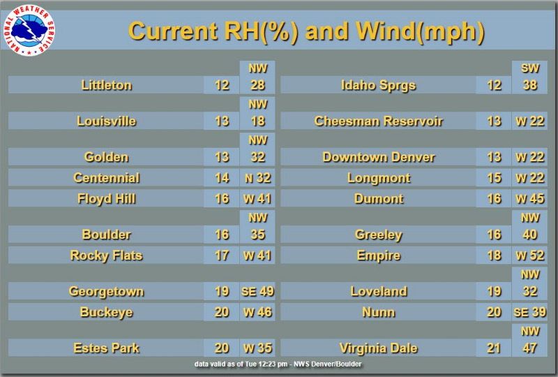
Gusty winds and low humidity will bring high grassland fire danger to the plains, I-25 Corridor, and South Park today. The highest fire danger will occur in areas that have not seen sufficient green-up this spring. Any fire that starts or escapes, would be capable of rapid growth. Residents should be aware of the elevated fire danger today and avoid activities that could produce open flames.
COZ214-238>251-281800-
/O.NEW.KBOU.FW.W.0005.200428T1700Z-200429T0200Z/
Central and Southeast Park County-
Larimer County Below 6000 Feet/Northwest Weld County-
Boulder And Jefferson Counties Below 6000 Feet/West Broomfield County-
North Douglas County Below 6000 Feet/Denver/West Adams and
Arapahoe Counties/East Broomfield County-
Elbert/Central and East Douglas Counties Above 6000 Feet-
Northeast Weld County-Central and South Weld County-Morgan County-
Central and East Adams and Arapahoe Counties-
North and Northeast Elbert County Below 6000 Feet/North Lincoln County-
Southeast Elbert County Below 6000 Feet/South Lincoln County-
Logan County-Washington County-Sedgwick County-Phillips County-
327 AM MDT Tue Apr 28 2020
...
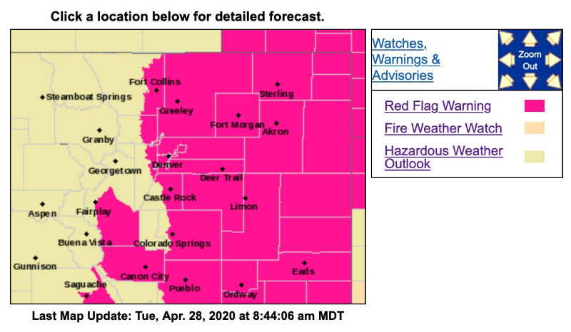
RED FLAG WARNING IN EFFECT FROM 11 AM THIS MORNING TO 8 PM MDT THIS EVENING FOR WIND AND LOW RELATIVE HUMIDITY FOR ALL OF THE PLAINS AND I-25 CORRIDOR...AND SOUTH PARK...
The National Weather Service in Denver has issued a Red Flag Warning FOR WIND AND LOW RELATIVE HUMIDITY, which is in effect from 11 AM this morning to 8 PM MDT this evening.
* Affected Area...Fire Weather Zones 214...238...239...240.. 241...242...243...244...245...246...247...248...249...250 and 251.
* Winds...North to northwest winds 20 to 30 mph with gusts up to 40 mph. Strongest winds east of I-25.
* Timing...Winds will increase late this morning, and then remain strong and gusty into the early evening hours. Winds and fire danger will decrease by mid evening.
* Relative Humidity...14 to 20 percent, lowest along the I-25 Corridor.
* Impacts...Do not burn today. If a fire escapes or starts, rapid spread will be possible.
PRECAUTIONARY/PREPAREDNESS ACTIONS...
A Red Flag Warning means that critical fire weather conditions are either occurring now....or will shortly. A combination of strong winds...low relative humidity...and warm temperatures can contribute to extreme fire behavior.