From Chief Meteorologist Steve Hamilton:
My Mountain Town Weather: Urgent: Red Flag Warning Wednesday...
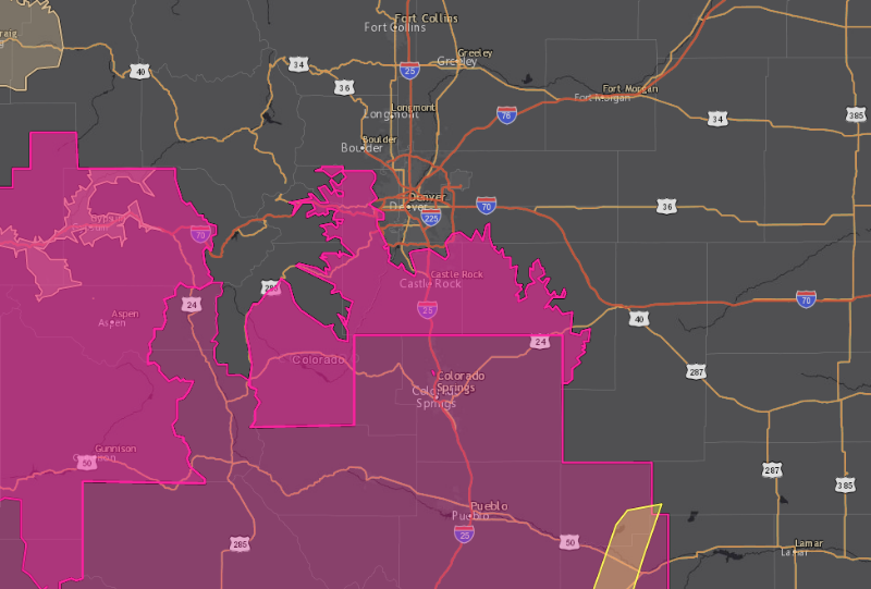
We'll have another round of gusty wind, warm temperatures and low relative humidity on Wednesday. The National Weather Service in Boulder has issued a Red Flag Warning, in effect from Noon until 9PM Wednesday for high wildfire danger. An incoming cold front will help to increase wind speeds, and the air mass is very dry. Conditions should ease on Thursday with the passage of a cold front.
mymountaintown.com/expert-local-weather
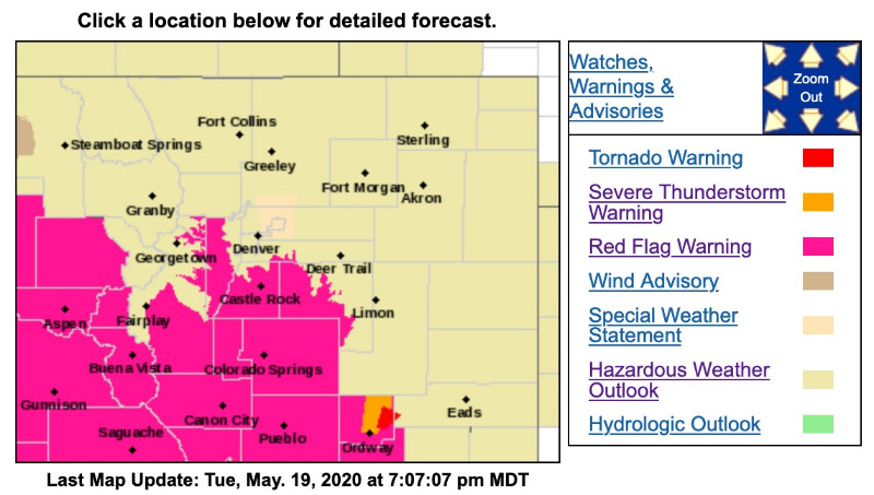
Red Flag Warning
URGENT - FIRE WEATHER MESSAGE
National Weather Service Denver/Boulder CO
107 PM MDT Tue May 19 2020
...FIRE DANGER INCREASING ACROSS SOUTH PARK, SOUTHERN FOOTHILLS, AND PALMER DIVIDE TODAY...AND AGAIN WEDNESDAY...
.Low humidity and breezy winds will lead to critical fire weather conditions today across South Park, the southern Front Range Foothills, and the Palmer Divide. A slight chance of dry thunderstorms is possible over these same areas which could lead to fire starts. On Wednesday, critical fire weather conditions are once again expected across these areas, with even stronger winds.
COZ214-216-241-200315-
/O.CON.KBOU.FW.W.0008.000000T0000Z-200520T0200Z/
/O.CON.KBOU.FW.W.0009.200520T1700Z-200521T0300Z/
Central and Southeast Park County-
Jefferson and West Douglas Counties Above 6000 Feet/Gilpin/Clear Creek/Northeast Park Counties Below 9000 Feet-
Elbert/Central and East Douglas Counties Above 6000 Feet-
107 PM MDT Tue May 19 2020
...RED FLAG WARNING REMAINS IN EFFECT UNTIL 8 PM MDT THIS EVENING FOR WIND AND LOW RELATIVE HUMIDITY FOR THE SOUTHERN FRONT RANGE FOOTHILLS, SOUTH PARK, AND PALMER DIVIDE...
...
RED FLAG WARNING REMAINS IN EFFECT FROM 11 AM TO 9 PM MDT WEDNESDAY FOR WIND AND LOW RELATIVE HUMIDITY FOR THE SOUTHERN FRONT RANGE FOOTHILLS, SOUTH PARK, AND PALMER DIVIDE...
* Affected Area...Fire Weather Zones 214...216 and 241.
* Winds...South 20 to 30 mph with gusts up to 45 mph.
* Timing...Noon through 8 pm MDT Tuesday.
* Relative Humidity...As low as 10 percent.
* Impacts...Any fire will be capable of rapid spread.
PRECAUTIONARY/PREPAREDNESS ACTIONS...
A Red Flag Warning means that critical fire weather conditions are either occurring now....or will shortly. A combination of strong winds...low relative humidity...and warm temperatures can contribute to extreme fire behavior.