URGENT: My Mountain Town Weather...
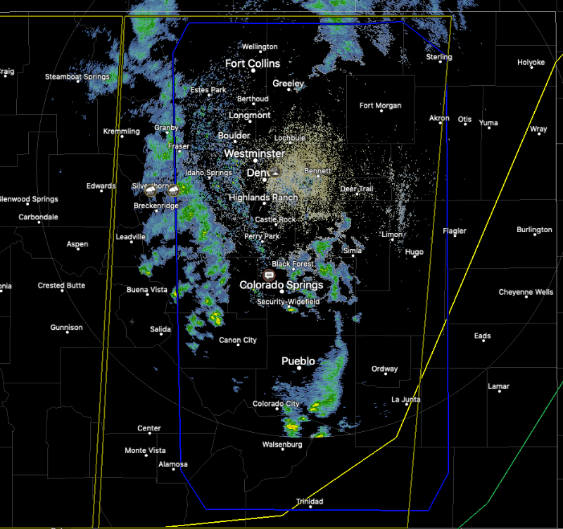
Severe Thunderstorm Watch in effect until 8:00 p.m. for all of the Front Range Foothills.
Strong low pressure to our east, and plenty of moist air will make conditions favorable for the development of severe weather across our area this afternoon, in to early evening.
Thunderstorms with damaging wind in excess of 70 mph, and large hail will be possible, along with frequent lightning. Isolated tornadoes are not out of the question.
mymountaintown.com/expert-local-weather
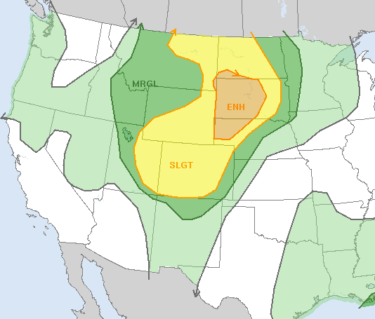
The foothills could get a "severe weather smackdown" this afternoon, thanks to an incoming cold front, moist air arriving from the south, and a low to the east. The SPC, (Storm Prediction Center), has most of our state under a "slight risk" of severe thunderstorms. This is quite unusual. So, here's what to do... Track storms using our weather radar, which also shows warnings:
mymountaintown.com/expert-local-weather
Have a place you can get to quickly that will protect you from hail, lightning and very strong wind. Don't get caught outside with rough stuff coming your way. Things could blow up pretty fast over various parts of the foothills at different times. The big threats: Thunderstorms with damaging wind 70+mph, large hail, and even a few isolated tornadoes. #cowx