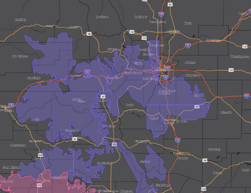
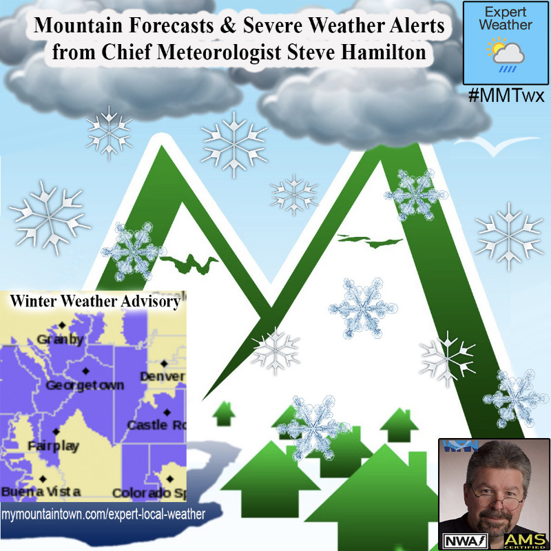
Winter Weather Advisory
URGENT - WINTER WEATHER MESSAGE
National Weather Service Denver CO
915 AM MST Mon Nov 23 2020
...SNOW DEVELOPS TONIGHT AND WILL IMPACT THE TUESDAY MORNING COMMUTE...
.A storm system will move into the area tonight and push across the area Tuesday morning. Snow will develop in the mountains this evening, and then become more widespread and heavier late tonight and early Tuesday morning. On the plains and Palmer Divide, rain and snow will develop overnight, turning to all snow late tonight or very early Tuesday morning. Travelers should be prepared for winter travel conditions and a slow, slippery commute Tuesday morning, especially in the western and southwestern metro areas where upslope flow will enhance snow amounts.
COZ034-036-240100-
/O.CON.KBOU.WW.Y.0028.201124T0700Z-201124T1900Z/
South and Southeast Grand/West Central and Southwest Boulder/Gilpin/
Clear Creek/Summit/North and West Park Counties Above 9000 Feet-
Jefferson and West Douglas Counties Above 6000 Feet/Gilpin/Clear Creek/Northeast Park Counties Below 9000 Feet-
Including Evergreen, Georgetown, Indian Peaks, Idaho Springs, Eisenhower Tunnel, East Slopes Southern Gore Range, Mount Evans, Central City, East Slopes Mosquito Range, Breckenridge, Winter Park, Williams Fork Mountains, Bailey, Kenosha Mountains, Westcreek, and Berthoud Pass
915 AM MST Mon Nov 23 2020
...
WINTER WEATHER ADVISORY REMAINS IN EFFECT FROM MIDNIGHT TONIGHT TO NOON MST TUESDAY...
* WHAT...Snow expected.
Total snow accumulations of 5 to 10 inches.
* WHERE...The Mountains of Summit County, the Mosquito Range, and the Indian Peaks, and The Southern Front Range Foothills.
* WHEN...From Midnight tonight to Noon MST Tuesday.
* IMPACTS...Travel could be difficult. The hazardous conditions could impact the Tuesday morning commute.
PRECAUTIONARY/PREPAREDNESS ACTIONS...
Slow down and use caution while traveling. The latest road conditions for the state you are calling from can be obtained by calling 5 1 1.
_ _ _ _ _ _ _
_ _ _ _ _ _ _
_ _ _ _ _ _ _
_ _ _ _ _ _ _
_ _ _ _ _ _ _
URGENT - WINTER WEATHER MESSAGE
National Weather Service Denver CO
915 AM MST Mon Nov 23 2020
...SNOW DEVELOPS TONIGHT AND WILL IMPACT THE TUESDAY MORNING COMMUTE...
COZ039-240100-
/O.EXA.KBOU.WW.Y.0028.201124T1000Z-201124T1900Z/
Boulder And Jefferson Counties Below 6000 Feet/West Broomfield County-
Including Boulder, Golden, Longmont, Arvada, and Lakewood
915 AM MST Mon Nov 23 2020
...
WINTER WEATHER ADVISORY IN EFFECT FROM 3 AM TO NOON MST TUESDAY...
* WHAT...Snow expected.
Total snow accumulations of 2 to 4 inches.
* WHERE...Boulder and the western suburbs of Denver.
* WHEN...From 3 AM to Noon MST Tuesday, however most of the accumulation will occur from 5 AM until 8 AM.
* IMPACTS...
Plan on slippery road conditions. The hazardous conditions could impact the Tuesday morning commute. Roads, and especially bridges and overpasses, will likely become slick and hazardous.
www.weather.gov/bou/