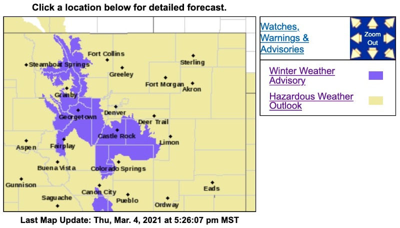
Winter Weather Advisory
URGENT - WINTER WEATHER MESSAGE
National Weather Service Denver CO
1012 AM MST Thu Mar 4 2021
COZ033-034-050115-
/O.CON.KBOU.WW.Y.0017.000000T0000Z-210305T0400Z/
South and East Jackson/Larimer/North and Northeast Grand/Northwest Boulder Counties Above 9000 Feet-
South and Southeast Grand/West Central and Southwest Boulder/Gilpin/
Clear Creek/Summit/North and West Park Counties Above 9000 Feet-
Including the cities of East Slopes Mosquito Range, Indian Peaks, Eisenhower Tunnel, Rocky Mountain National Park,
East Slopes Southern Gore Range, Mount Evans, Laramie and Medicine Bow Mountains, Cameron Pass,
Breckenridge, Kenosha Mountains, Winter Park, Williams Fork Mountains, Willow Creek Pass, Rabbit Ears Range, and Berthoud Pass
1012 AM MST Thu Mar 4 2021
...
WINTER WEATHER ADVISORY REMAINS IN EFFECT UNTIL 9 PM MST THIS EVENING...
* WHAT...
Snow ongoing, possibly heavy at times. Snow accumulations of 4 to 9 inches. Winds gusting as high as 40 mph.
* WHERE...Rocky Mountain National Park and the Medicine Bow Range, and The Mountains of Summit County, the Mosquito Range, and the Indian Peaks.
* WHEN...Until 9 PM MST this evening.
* IMPACTS...Travel could be very difficult. The hazardous conditions could impact the Thursday evening commute. Roads will likely become slick and hazardous.
PRECAUTIONARY/PREPAREDNESS ACTIONS...
Slow down and use caution while traveling. The latest road conditions for Colorado can be obtained by calling 5 1 1 or by going to
www.cotrip.org
_ _ _ _ _ _ _ _ _ _ _ _ _ _ _ _ _ _ _ _ _ _ _ _ _ _ _ _ _ _ _ _ _ _ _ _ _ _ _ _ _ _ _ _ _ _ _ _ _ _ _ _ _ _
URGENT - WINTER WEATHER MESSAGE
National Weather Service Denver CO
1012 AM MST Thu Mar 4 2021
COZ036-050115-
/O.EXB.KBOU.WW.Y.0017.000000T0000Z-210305T0700Z/
Jefferson and West Douglas Counties Above 6000 Feet/Gilpin/Clear Creek/Northeast Park Counties Below 9000 Feet-
Including the cities of Evergreen, Georgetown, Westcreek, Central City, Idaho Springs, and Bailey
1012 AM MST Thu Mar 4 2021
...
WINTER WEATHER ADVISORY IN EFFECT UNTIL MIDNIGHT MST TONIGHT...
* WHAT...
Rain and Snow ongoing, becoming all snow this afternoon. Snow accumulations between 3 to 7 inches.
* WHERE...The Southern Front Range Foothills.
* WHEN...Until Midnight MST tonight.
* IMPACTS...Travel could be very difficult. Roads will likely become slick and hazardous. Snow covered roads will make travel hazardous by later this afternoon and evening.
PRECAUTIONARY/PREPAREDNESS ACTIONS...
Slow down and use caution while traveling. The latest road conditions for Colorado can be obtained by calling 5 1 1 or by going to
www.cotrip.org