Flash Flood Watch
Flood Watch
National Weather Service Denver CO
846 AM MDT Thu Jul 1 2021
COZ035>041-020600-
/O.NEW.KBOU.FF.A.0001.210701T1700Z-210702T0600Z/
/00000.0.ER.000000T0000Z.000000T0000Z.000000T0000Z.OO/
Larimer and Boulder Counties Between 6000 and 9000 Feet-
Jefferson and West Douglas Counties Above 6000 Feet/Gilpin/Clear Creek/Northeast Park Counties Below 9000 Feet-
Central and Southeast Park County-Larimer County Below 6000 Feet/Northwest Weld County-
Boulder And Jefferson Counties Below 6000 Feet/West Broomfield County-
North Douglas County Below 6000 Feet/Denver/West Adams and Arapahoe Counties/East Broomfield County-
Elbert/Central and East Douglas Counties Above 6000 Feet-
Including the cities of Hartsel, Elbert, Westcreek,
Arvada, Central City, Red Feather Lakes, Larkspur, Bailey, Evergreen, Georgetown, Glendevey, Nederland, Aurora,
Fairplay, Littleton, South Park, Boulder, Highlands Ranch, City of Denver, Loveland, Kiowa, Estes Park, Longmont, Fondis, Denver International Airport,
Golden, Parker, Castle Rock,
Lakewood, Fort Collins, Nunn,
Idaho Springs, Lake George, Hereford, and Brighton
846 AM MDT Thu Jul 1 2021
...
FLASH FLOOD WATCH IN EFFECT THROUGH THIS EVENING...
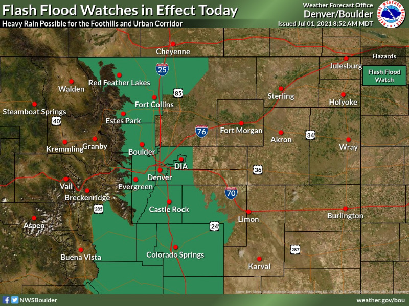
The National Weather Service in Denver has issued a *Flash Flood Watch for Portions of central, north central, and northeast Colorado, including the following areas, in central Colorado, Central and Southeast Park County and Jefferson and West Douglas Counties Above 6000 Feet/Gilpin/Clear Creek/Northeast Park Counties Below 9000 Feet. In north central Colorado, Larimer County Below 6000 Feet/Northwest Weld County and Larimer and Boulder Counties Between 6000 and 9000 Feet. In northeast Colorado, Boulder And Jefferson Counties Below 6000 Feet/West Broomfield County, Elbert/Central and East Douglas Counties Above 6000 Feet and North Douglas County Below 6000 Feet/Denver/West Adams and Arapahoe Counties/East Broomfield County.
* Through this evening.
* Increasing moisture and instability today will lead to widespread thunderstorm development by the early afternoon. Heavy rain and flash flooding will be possible in these slow moving storms, especially over burn areas.
* Rapid increases in water in creeks and small drainages could make roads become quickly impassable.
PRECAUTIONARY/PREPAREDNESS ACTIONS...
You should monitor later forecasts and be prepared to take action should Flash Flood Warnings be issued.