My Mountain Town Weather from Chief Meteorologist Steve Hamilton: URGENT Flash Flood Watch...
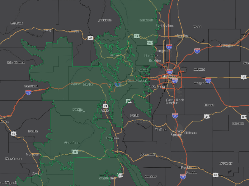
The National Weather Service in Boulder has issued a Flash Flood Watch for parts of the Front Range Foothills, (green area on map) until Saturday night.
-Thunderstorms are expected Friday and Saturday afternoon. A few storms may have heavy rainfall, which will increase the chance of localized flash flooding, especially in burn scar areas.
-Several people have already perished in flash floods this summer, so please take this seriously.
From NWS:
Flash Flood Watch
Flood Watch
National Weather Service Denver CO
100 AM MDT Fri Jul 23 2021
.Widespread slow moving thunderstorms are expected today with a
threat of flash flooding in the burn areas.
COZ033>035-240300-
/O.EXT.KBOU.FF.A.0004.210723T1700Z-210724T0300Z/
/00000.0.ER.000000T0000Z.000000T0000Z.000000T0000Z.OO/
South and East Jackson/Larimer/North and Northeast Grand/Northwest Boulder Counties Above 9000 Feet-South and Southeast Grand/West Central and Southwest Boulder/Gilpin/
Clear Creek/Summit/North and West Park Counties Above 9000 Feet-
Larimer and Boulder Counties Between 6000 and 9000 Feet-
Including the cities of Glendevey, East Slopes Mosquito Range, Estes Park, Indian Peaks, Nederland, Eisenhower Tunnel, Rocky Mountain National Park, East Slopes Southern Gore Range, Mount Evans, Laramie and Medicine Bow Mountains, Red Feather Lakes, Cameron Pass, Breckenridge, Kenosha Mountains, Winter Park, Williams Fork Mountains, Willow Creek Pass, Rabbit Ears Range, and Berthoud Pass
100 AM MDT Fri Jul 23 2021
...
FLASH FLOOD WATCH NOW IN EFFECT FROM 11 AM MDT THIS MORNING THROUGH THIS EVENING...
The Flash Flood Watch is now in effect for
* Portions of central and north central Colorado, including the following areas, in central Colorado, South and Southeast Grand/West Central and Southwest Boulder/Gilpin/Clear Creek/Summit/North and West Park Counties Above 9000 Feet. In north central Colorado, Larimer and Boulder Counties Between 6000 and 9000 Feet and South and East Jackson/Larimer/North and Northeast Grand/Northwest Boulder Counties Above 9000 Feet.
* From 11 AM MDT this morning through this evening.
* Slow moving thunderstorms capable of producing heavy rainfall, especially in the Cameron Peak, East Troublesome, CalWood and Williams Fork burn areas.
* Excessive runoff from heavy rain may cause flash flooding of creeks and streams, roads and roadside culverts. The heavy rains could also trigger rock slides or debris flows
PRECAUTIONARY/PREPAREDNESS ACTIONS...
It is important to know where you are relative to streams, rivers, or creeks which can become killers in heavy rains. Campers and hikers should pay close attention to rapidly changing weather conditions and avoid streams or creeks if thunderstorms develop.
You should monitor later forecasts and be prepared to take action should Flash Flood Warnings be issued.