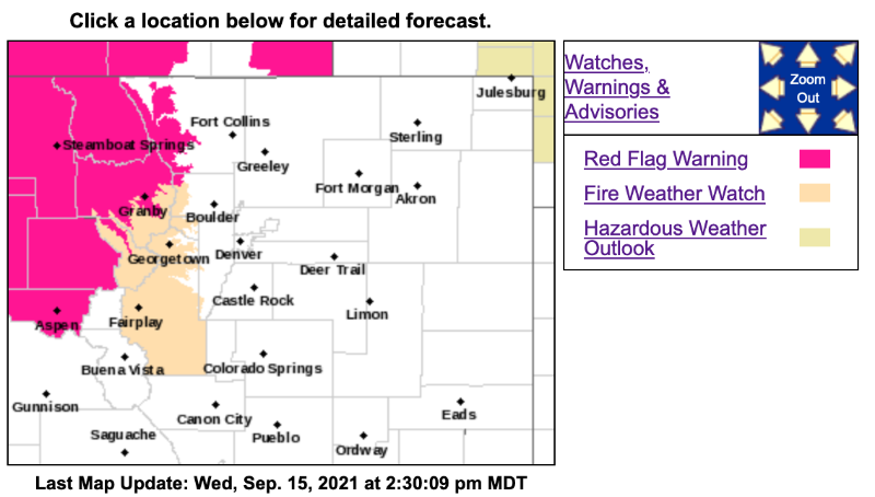
Fire Weather Watch
URGENT - FIRE WEATHER MESSAGE
National Weather Service Denver/Boulder CO
231 PM MDT Wed Sep 15 2021
...
Critical Fire Danger Thursday and Friday Afternoons...
.Warm temperatures, low daytime humidity, and gusty winds will result in critical fire weather conditions during the afternoon and early evening hours Thursday and Friday. Mixing heights will also increase above 10,000 ft, increasing the potential for deep vertical plume growth in the event of any new starts.
COZ212-214-161200-
/O.NEW.KBOU.FW.A.0012.210917T1800Z-210918T0100Z/
South and Southeast Grand/West Central and Southwest Boulder/Gilpin/
Clear Creek/Summit/North and West Park Counties Above 9000 Feet-Central and Southeast Park County-
231 PM MDT Wed Sep 15 2021
...
FIRE WEATHER WATCH IN EFFECT FROM FRIDAY AFTERNOON THROUGH FRIDAY EVENING FOR WIND AND LOW RELATIVE HUMIDITY FOR THE MOUNTAINS AND HIGH VALLEYS...
The National Weather Service in Denver has issued a Fire Weather Watch for wind and low relative humidity, which is in effect from Friday afternoon through Friday evening.
* Affected Area...Fire Weather Zones 212 and 214.
* Timing...Noon to 7 PM. Most critical conditions mid to late afternoon.
* Winds...West 10 to 20 mph, with gusts to 30 mph.
* Relative Humidity...Between 10 and 15%.
* Impacts...Conditions will be conducive to rapid spread of new and existing fires. Probability of ignition will increase. Avoid any burning or outdoor activities that may cause sparks, and abide by established fire restrictions.
PRECAUTIONARY/PREPAREDNESS ACTIONS...
A Fire Weather Watch means that critical fire weather conditions are forecast to occur. Listen for later forecasts and possible Red Flag Warnings.