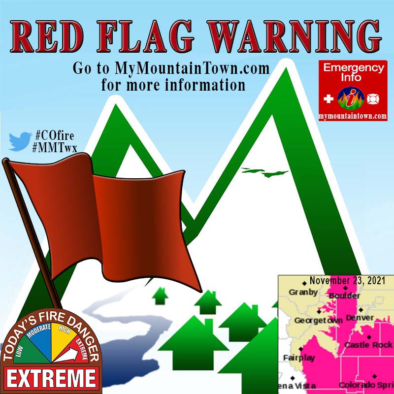
Red Flag Warning
URGENT - FIRE WEATHER MESSAGE
National Weather Service Denver/Boulder CO
240 PM MST Mon Nov 22 2021
...
DANGEROUS FIRE WEATHER CONDITIONS EXPECTED TUESDAY OVER THE FRONT RANGE FOOTHILLS, PALMER DIVIDE, SOUTH PARK, AND PORTIONS OF THE URBAN CORRIDOR...FIRE ZONES 214, 215, 216, 238, 239, 242, 246, AND 247...
COZ214>216-238-239-241-242-230545-
/O.UPG.KBOU.FW.A.0018.211123T1800Z-211124T0000Z/
/O.NEW.KBOU.FW.W.0023.211123T1600Z-211124T0000Z/
Central and Southeast Park County-
Larimer and Boulder Counties Between 6000 and 9000 Feet-
Jefferson and West Douglas Counties Above 6000 Feet/Gilpin/Clear Creek/Northeast Park Counties Below 9000 Feet-
Larimer County Below 6000 Feet/Northwest Weld County-
Boulder And
Jefferson Counties Below 6000 Feet/West Broomfield County-
Elbert/Central and East Douglas Counties Above 6000 Feet-
Northeast Weld County-
240 PM MST Mon Nov 22 2021
...
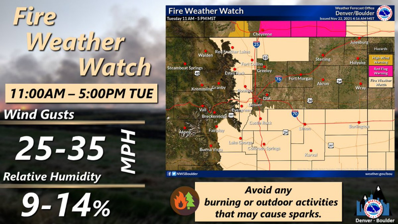
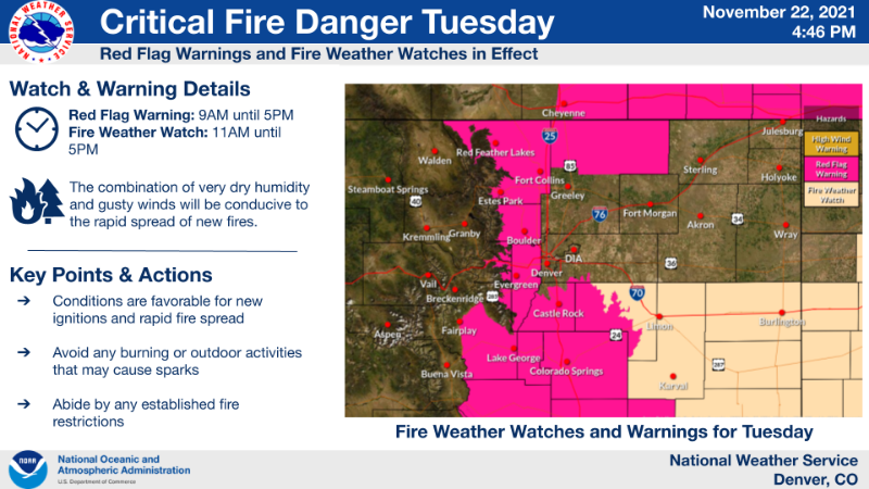
RED FLAG WARNING IN EFFECT FROM 9 AM TO 5 PM MST TUESDAY FOR WIND AND LOW RELATIVE HUMIDITY FOR THE FRONT RANGE FOOTHILLS, SOUTH PARK, PALMER DIVIDE, AND PORTIONS OF THE I-25 URBAN CORRIDOR...FIRE WEATHER ZONES 214...215...216...238...239...24...AND 242...
The National Weather Service in Denver has issued a Red Flag Warning for wind and low relative humidity, which is in effect from 9 AM to 5 PM MST Tuesday.
The Fire Weather Watch is no longer in effect.
* Affected Area...Fire Weather Zones 214, 215, 216, 238, 239, 241 and 242.
* Timing...9 AM to 5 PM MST Tuesday evening.
* Winds...West 20 to 30 mph with gusts up to 45 mph. Strongest winds in the foothills.
* Relative Humidity...As low as 10 percent.
* Impacts...Conditions will be conducive to the rapid spread of new fires. Probability of ignition will increase. Avoid any burning or outdoor activities that may cause sparks, and abide by established fire restrictions.
PRECAUTIONARY/PREPAREDNESS ACTIONS...
A Red Flag Warning means that critical fire weather conditions are either occurring now....or will shortly. A combination of strong winds...low relative humidity...and warm temperatures can contribute to extreme fire behavior.