From Chief Meteorologist Steve Hamilton:
Finally, "Some" Snow for "Some" of the Foothills...
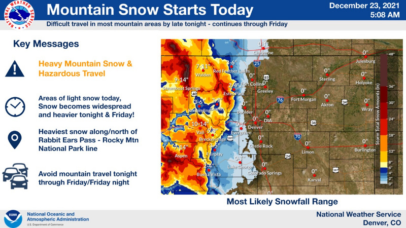
A strong Pacific storm system will move into Colorado late Thursday and hang around through the Christmas weekend.
mymountaintown.com/expert-local-weather
Some of the foothills may see a few inches of snow accumulation. Fairplay, Alma, Jefferson and Como stand the best chance of accumulating snow, and a Winter Weather Advisory is posted for those areas. For the rest of the foothills, accumulation will be minor, with some of the precipitation falling as rain. Accompanying the storm will be very gusty wind. In areas where heavier snow is expected, blowing snow will make travel difficult. Great news for the mountains, where a Winter Storm Warning is up. We could see 1 to 2 feet of much needed snowfall in the higher elevations, so if you'll be traveling over Vail Pass or the Divide, driving will be hazardous, especially Christmas Day. A little more snow is possible Sunday.
WINTER WEATHER ADVISORY...
The National Weather Service in Boulder has issued a Winter Weather Advisory, in effect from 2:00 p.m. Thursday until 5:00 a.m. Saturday.
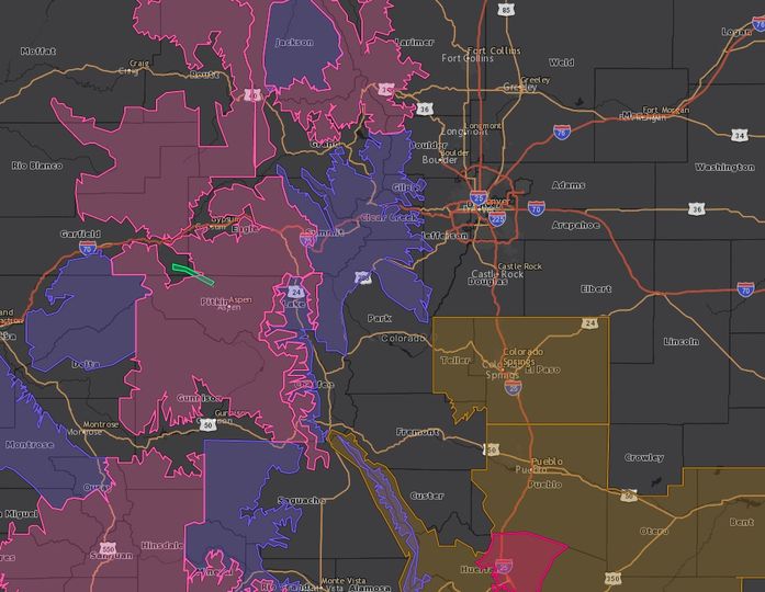
Snow is expected, with accumulations between 7 and 13 inches in the blue highlighted area on the above map. This includes Fairplay, Jefferson, Alma and Como.
Gusty wind will accompany the snow, so visibility will be reduced, and roads will be slick.
Winter Weather Advisory
URGENT - WINTER WEATHER MESSAGE
National Weather Service Denver CO
409 AM MST Thu Dec 23 2021
COZ034-232300-
/O.CON.KBOU.WW.Y.0035.211223T2100Z-211225T1200Z/
South and Southeast Grand/West Central and Southwest Boulder/Gilpin/
Clear Creek/Summit/North and West Park Counties Above 9000 Feet-
Including the cities of Indian Peaks, Eisenhower Tunnel, East Slopes Southern Gore Range, Mount Evans, East Slopes Mosquito Range, Breckenridge, Winter Park, Williams Fork Mountains, Kenosha Mountains, and Berthoud Pass
409 AM MST Thu Dec 23 2021
...
WINTER WEATHER ADVISORY REMAINS IN EFFECT FROM 2 PM THIS AFTERNOON TO 5 AM MST SATURDAY...
* WHAT...Snow expected, with the heaviest snow late tonight through Friday.
Total snow accumulations between 6 and 14 inches. Winds gusting as high as 50 mph.
* WHERE...The Mountains of Summit County, the Mosquito Range, and the Indian Peaks.
* WHEN...From 2 PM this afternoon to 5 AM MST Saturday.
* IMPACTS...Roads will become slick and hazardous by tonight, and remain in place through Friday and Friday night.
PRECAUTIONARY/PREPAREDNESS ACTIONS...
Slow down and use caution while traveling. The latest road conditions for Colorado can be obtained by calling 5 1 1 or by going to
www.cotrip.org
For more information from the National Weather Service, visit
weather.gov/bou