From Chief Meteorologist Steve Hamilton:
URGENT My Mountain Town Weather: WINTER STORM WATCH...
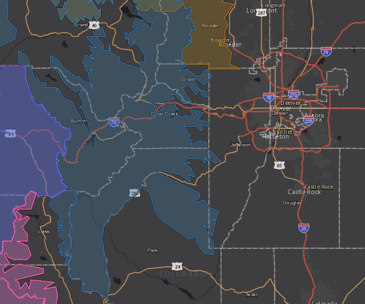
The National Weather Service in Boulder has issued a Winter Storm Watch in effect Wednesday evening through Friday afternoon. (Blue area on map.)
This includes the Park Range, Indian Peaks and Rocky Mountain National Park, Medicine Bow Range and the Summit County mountains. Fairplay, Alma, Jefferson and Como are included.
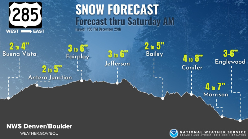
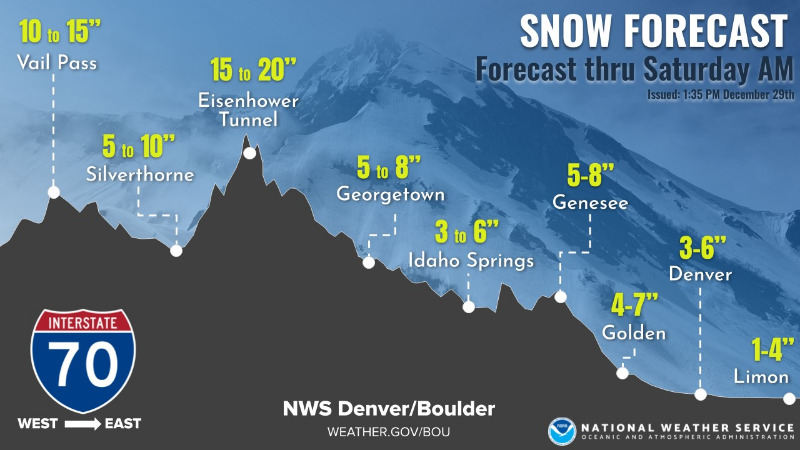
Snow totals of 8 to 18 inches are possible, along with west wind gusting over 60 mph.
My Mountain Town Weather: Some Foothills Snow Possible...
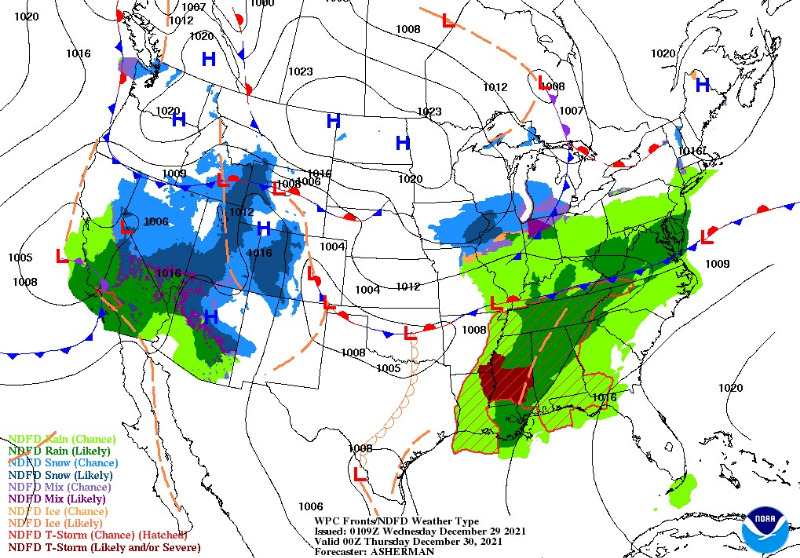
The weather pattern looks mostly fair for the foothills through most of Thursday, except for increasingly gusty wind ahead of an incoming Pacific storm system. Details:
mymountaintown.com/expert-local-weather
Winter Storm Watch
URGENT - WINTER WEATHER MESSAGE
National Weather Service Denver CO
1053 AM MST Wed Dec 29 2021
COZ031-033-034-300800-
/O.CON.KBOU.WS.A.0010.211230T0600Z-220101T1200Z/
West Jackson and West Grand Counties Above 9000 Feet-
South and East Jackson/Larimer/North and Northeast Grand/Northwest Boulder Counties Above 9000 Feet-
South and Southeast Grand/West Central and Southwest Boulder/Gilpin/
Clear Creek/Summit/North and West Park Counties Above 9000 Feet-
Including the cities of East Slopes Mosquito Range, Indian Peaks, Eisenhower Tunnel, Rocky Mountain National Park, East Slopes Southern Gore Range, Mt Zirkel, Mount Evans, Laramie and Medicine Bow Mountains, Cameron Pass,
Breckenridge, Kenosha Mountains, Winter Park, Williams Fork Mountains, Willow Creek Pass, Rabbit Ears Range, and
Berthoud Pass
1053 AM MST Wed Dec 29 2021
...
WINTER STORM WATCH REMAINS IN EFFECT FROM THIS EVENING THROUGH LATE FRIDAY NIGHT...
* WHAT...
Heavy snow likely. Total snow accumulations between 10 to 20 inches expected, 8 to 16 inches for mountains of Summit County. Heaviest snow expected for the Park Range, Indian Peaks and Rocky Mountain National Park, where locally higher totals will be possible. Strong west winds with gusts 60 to 70 mph also possible on Thursday.
* WHERE...Rabbit Ears Pass, Rocky Mountain National Park and the Medicine Bow Range, and The Mountains of Summit County, the Mosquito Range, and the Indian Peaks.
* WHEN...From this evening through late Friday night.
* IMPACTS...
Visibility may be near zero at times resulting in white out conditions. Travel may be treacherous and potentially life-threatening. Travel could be very difficult to impossible. The hazardous conditions could impact the Thursday morning and evening commutes. Gusty winds could bring down tree branches.
PRECAUTIONARY/PREPAREDNESS ACTIONS...
Monitor the latest forecasts for updates on this situation.
For more information from the National Weather Service, visit
weather.gov/bou