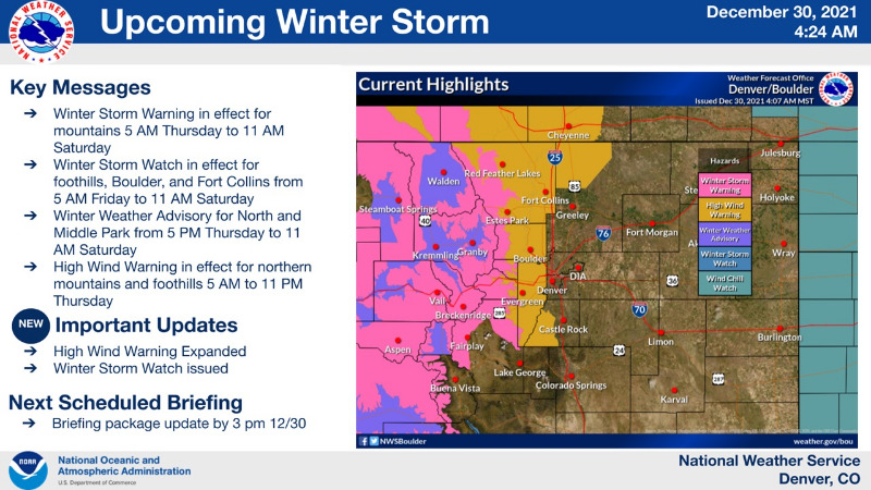
Chief Meteorologist Steve Hamilton My Mountain Town Weather: UPDATE
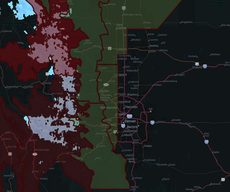
High Wind Warning is in effect until 5:00 p.m. today (ugly green area on map).
Wind gusting at 25 to 40 mph, with occasional gusts to 80 mph in the wind-prone areas.
This includes Jefferson and West Douglas Counties Above 6000 Feet, Gilpin, Clear Creek, and Northeast Park Counties Below 9000 Feet, Larimer County Below 6000 feet, Northwest Weld County and Boulder, and Jefferson Counties Below 6000 Feet as well as western Broomfield County.
Damage to power lines, leading to power outages possible.
Difficult travel especially for high-profile vehicles.
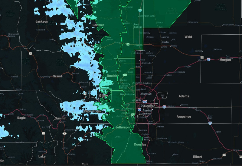
Winter Storm Watch...
The National Weather Service in Boulder has issued a Winter Storm Watch (green highlight on map), in effect from late Thursday night through Saturday morning.
Snow is possible, with some areas of heavy snowfall. Accumulation of 5 to 12 inches possible.
This includes the Northern Front Range Foothills, The Southern Front Range Foothills, Fort Collins, and Boulder and the western suburbs of Denver.
Local forecast:
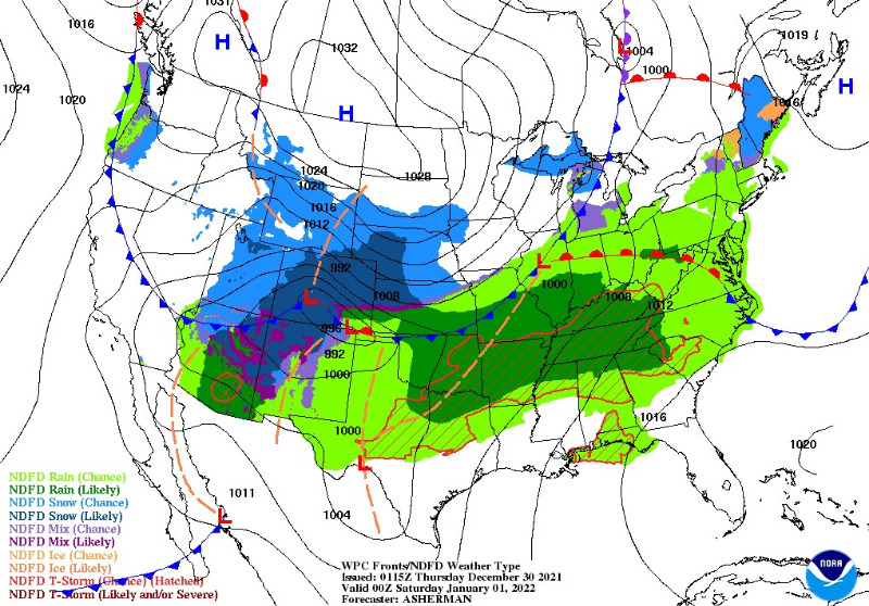
Cold Arctic air will race down the eastern side of the Rockies and arrive here Friday night, and New Year's Day. And, a Pacific storm system will move in by Thursday night, bringing us a decent chance of accumulating snow for the Front Range. The best window for accumulating snow will be Friday and Friday night, generally between 5 to 12". Higher amounts for Fairplay, Alma, Jefferson and Como, where a Winter Storm Warning is in effect until 5:00 a.m. Saturday. More good news for the mountains, where we could see up to 20" of fresh snow. Road conditions are likely to be icy and snow packed New Years Eve and early New Year's Day. Also, gusty wind will cause blowing snow and poor visibility, and the temperatures will get very cold. If you're going to be out and about Friday night, be prepared for hazardous winter driving conditions.
mymountaintown.com/expert-local-weather
Winter Storm Warning
URGENT - WINTER WEATHER MESSAGE
National Weather Service Denver CO
300 AM MST Thu Dec 30 2021
COZ031-033-034-302200-
/O.EXT.KBOU.WS.W.0013.211230T1200Z-220101T1800Z/
West Jackson and West Grand Counties Above 9000 Feet-
South and East Jackson/Larimer/North and Northeast Grand/Northwest Boulder Counties Above 9000 Feet-
South and Southeast Grand/West Central and Southwest Boulder/Gilpin/
Clear Creek/Summit/North and West Park Counties Above 9000 Feet-
Including the cities of East Slopes Mosquito Range, Indian Peaks, Eisenhower Tunnel, Rocky Mountain National Park, East Slopes Southern Gore Range, Mt Zirkel, Mount Evans, Laramie and Medicine Bow Mountains, Cameron Pass, Breckenridge, Kenosha Mountains, Winter Park, Williams Fork Mountains, Willow Creek Pass, Rabbit Ears Range, and Berthoud Pass
300 AM MST Thu Dec 30 2021
...
WINTER STORM WARNING NOW IN EFFECT UNTIL 11 AM MST SATURDAY...
* WHAT...
Heavy snow likely, especially Thursday night and Friday. Total snow accumulations between 12 to 24 inches expected, 8 to 16 inches for mountains of Summit County. Heaviest snow expected in the Park Range, Indian Peaks and Rocky Mountain National Park, where locally higher totals will be possible. Strong west winds with gusts 60 to 75 mph can also be expected on Thursday with blowing snow and poor visibilities on the mountain passes.
* WHERE...Rabbit Ears Pass, Rocky Mountain National Park and the Medicine Bow Range, and The Mountains of Summit County, the Mosquito Range, and the Indian Peaks.
* WHEN...Until 11 AM MST Saturday.
* IMPACTS...Travel may become very difficult to impossible due to heavy snowfall on roadways. The hazardous conditions could impact the Thursday evening, Friday morning, and Friday evening commutes. Gusty winds could bring down tree branches.
PRECAUTIONARY/PREPAREDNESS ACTIONS...
If you must travel, keep an extra flashlight, food, and water in your vehicle in case of an emergency. The latest road conditions for Colorado can be obtained by calling 5 1 1 or by going to
www.cotrip.org