Fire Weather Watch
URGENT - FIRE WEATHER MESSAGE
National Weather Service Denver/Boulder CO
255 PM MDT Mon Apr 4 2022
COZ238>251-051200-
/O.NEW.KBOU.FW.A.0003.220405T1800Z-220406T0300Z/
Larimer County Below 6000 Feet/Northwest Weld County-
Boulder And Jefferson Counties Below 6000 Feet/West Broomfield County-
North Douglas County Below 6000 Feet/Denver/West Adams and Arapahoe Counties/East Broomfield County-
Elbert/Central and East Douglas Counties Above 6000 Feet-
Northeast Weld County-Central and South Weld County-Morgan County-
Central and East Adams and Arapahoe Counties-
255 PM MDT Mon Apr 4 2022
...
FIRE WEATHER WATCH IN EFFECT FROM TUESDAY AFTERNOON THROUGH TUESDAY EVENING FOR WIND AND LOW RELATIVE HUMIDITY FOR THE NORTHEASTERN COLORADO PLAINS AND
PALMER DIVIDE...
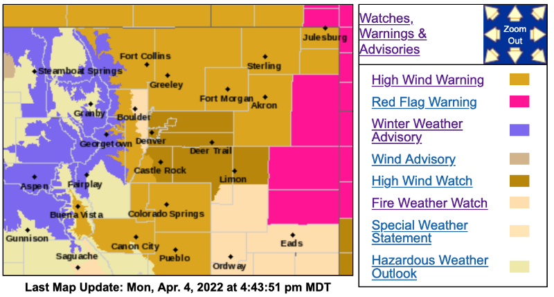
The National Weather Service in Denver has issued a Fire Weather Watch for wind and low relative humidity, which is in effect from Tuesday afternoon through Tuesday evening.
* Affected Area...Fire Weather Zones 238, 239, 240, 241, 242, 243, 244, 245, 246, 247, 248, 249, 250 and 251.
* Timing...
From Noon until 9PM Tuesday afternoon and evening.
* Winds...Northwest 30 to 40 mph with gusts up to 60 mph.
* Relative Humidity...As low as 15 to 25 percent.
* Impacts...
Any fire that develops will likely spread rapidly. Outdoor burning should be avoided, as well as any activity that may produce a spark.
PRECAUTIONARY/PREPAREDNESS ACTIONS...
A Fire Weather Watch means that critical fire weather conditions are forecast to occur. Listen for later forecasts and possible Red Flag Warnings.