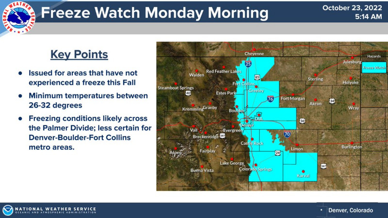
Winter Weather Advisory
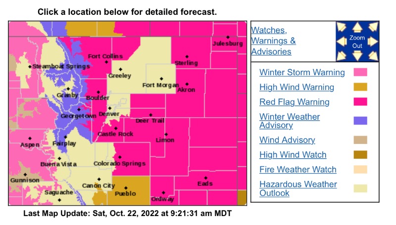
URGENT - WINTER WEATHER MESSAGE
National Weather Service Denver CO
924 AM MDT Sat Oct 22 2022
COZ033-034-230330-
/O.CON.KBOU.WW.Y.0028.221023T0600Z-221024T1200Z/
South and East Jackson/Larimer/North and Northeast Grand/Northwest Boulder Counties Above 9000 Feet-
South and Southeast Grand/West Central and Southwest Boulder/Gilpin/
Clear Creek/Summit/North and West Park Counties Above 9000 Feet-
Including the cities ofEisenhower Tunnel, Laramie and Medicine Bow Mountains, Willow Creek Pass, East Slopes Mosquito Range, Cameron Pass, Winter Park, Rabbit Ears Range, Kenosha Mountains, Indian Peaks, Mount Evans, Williams Fork Mountains, East Slopes Southern Gore Range, Breckenridge, Berthoud Pass, and Rocky Mountain National Park
924 AM MDT Sat Oct 22 2022
...
WINTER WEATHER ADVISORY REMAINS IN EFFECT FROM MIDNIGHT TONIGHT TO 6 AM MDT MONDAY...
* WHAT...
Snow expected. Total snow accumulations between 2 to 8 inches. Winds gusting as high as 50 mph.
* WHERE...Rocky Mountain National Park and the Medicine Bow Range, and The Mountains of Summit County, the Mosquito Range, and the Indian Peaks.
* WHEN...From Midnight tonight to 6 AM MDT Monday.
* IMPACTS...
Plan on slippery road conditions.
PRECAUTIONARY/PREPAREDNESS ACTIONS...
Slow down and use caution while traveling. The latest road conditions for Colorado can be obtained by calling 5 1 1 or by going to
www.cotrip.org
.
For more information from the National Weather Service, visit
weather.gov/bou