Red Flag Warning
URGENT - FIRE WEATHER MESSAGE
National Weather Service Denver/Boulder CO
1101 AM MST Sun Mar 5 2023
...DRY AND WINDY TODAY...
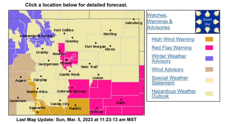
.Strong west to southwest winds and low humidity will create enhanced fire weather conditions today. Over much of northeastern Colorado, current or recent snow cover will limit fire spread. However, areas south of Limon and the Denver-Boulder area have drier grasses and will also have the stronger winds and lower humidities so a Red Flag Warning is in effect for those areas.
COZ239-240-247-060100-
/O.CON.KBOU.FW.W.0002.000000T0000Z-230306T0100Z/
Boulder And Jefferson Counties Below 6000 Feet/West Broomfield County-North Douglas County Below 6000 Feet/Denver/West Adams and Arapahoe Counties/East Broomfield County-Southeast Elbert County Below 6000 Feet/South Lincoln County-
1101 AM MST Sun Mar 5 2023
...
RED FLAG WARNING REMAINS IN EFFECT UNTIL 6 PM MST THIS EVENING FOR WIND AND LOW RELATIVE HUMIDITY FOR THE DENVER METRO AREA AND SOUTHERN LINCOLN COUNTY..
* Affected Area...Fire Weather Zones 239, 240 and 247.
* Timing...11 AM to 6 PM today.
* Winds...West 20 to 30 mph with gusts up to 50 mph.
* Relative Humidity...As low as 9 percent.
* Impacts...Conditions will be favorable for rapid fire spread. Avoid outdoor burning and any activities that may produce sparks.
PRECAUTIONARY/PREPAREDNESS ACTIONS...
A Red Flag Warning means that critical fire weather conditions are either occurring now....or will shortly. A combination of strong winds...low relative humidity...and warm temperatures can contribute to extreme fire behavior.