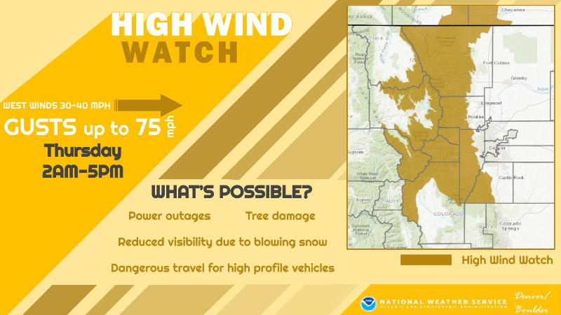
UPDATE from Chief Meteorologist Steve Hamilton: High Wind Watch
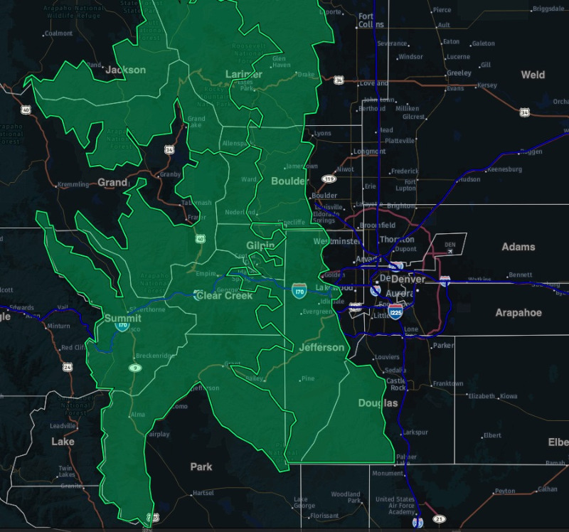
The National Weather Service in Boulder has issued a High Wind Watch (green highlight) in effect late Wednesday night through Thursday afternoon. West wind 30 to 45 mph possible, with gusts of 75 mph possible in the wind-prone areas. Power outages and tree damage will be possible.
High Wind Watch
URGENT - WEATHER MESSAGE
National Weather Service Denver CO
222 PM MST Tue Dec 5 2023
COZ033>036-061230-
/O.NEW.KBOU.HW.A.0005.231207T0900Z-231208T0000Z/
South and East Jackson/Larimer/North and Northeast Grand/Northwest Boulder Counties Above 9000 Feet-South and Southeast Grand/West Central and Southwest Boulder/Gilpin/
Clear Creek/Summit/North and West Park Counties Above 9000 Feet-Larimer and Boulder Counties Between 6000 and 9000 Feet-
Jefferson and West Douglas Counties Above 6000 Feet/Gilpin/Clear Creek/Northeast Park Counties Below 9000 Feet-
Including the cities of Estes Park, Williams Fork Mountains, Westcreek,
Breckenridge, Mount Blue Sky, East Slopes Mosquito Range, Winter Park, Rabbit Ears Range, Laramie and Medicine Bow Mountains, Red Feather Lakes, Central City, Cameron Pass, Willow Creek Pass, Rocky Mountain National Park, Indian Peaks,
Bailey, Glendevey, Berthoud Pass,
Evergreen, Kenosha Mountains, Georgetown, Nederland, East Slopes Southern Gore Range,
Eisenhower Tunnel, and Idaho Springs
222 PM MST Tue Dec 5 2023
...
HIGH WIND WATCH IN EFFECT FROM LATE WEDNESDAY NIGHT THROUGH THURSDAY AFTERNOON...
* WHAT...
West winds 30 to 40 mph with gusts up to 75 mph possible. Highest winds expected over higher mountain passes and exposed east slopes.
* WHERE...Rocky Mountain National Park and the Medicine Bow Range, The Mountains of Summit County, the Mosquito Range, and the Indian Peaks, The Northern Front Range Foothills, and The Southern Front Range Foothills.
* WHEN...From late Wednesday night through Thursday afternoon.
* IMPACTS...Damaging winds could blow down trees and power lines. Widespread power outages are possible. Travel could be difficult, especially for high profile vehicles.
PRECAUTIONARY/PREPAREDNESS ACTIONS...
Monitor the latest forecasts and warnings for updates.
For more information from the National Weather Service, visit
weather.gov/bou