Red Flag Warning
URGENT - FIRE WEATHER MESSAGE
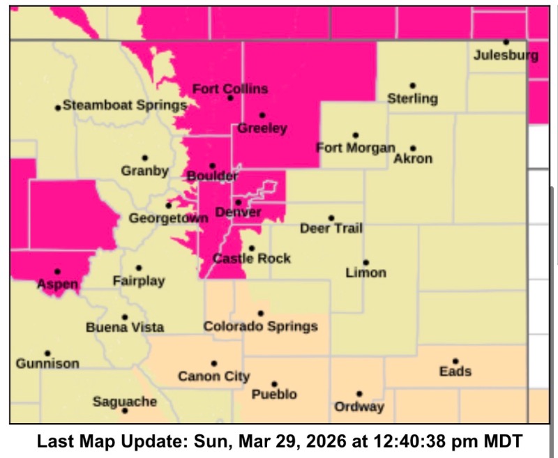
National Weather Service Denver/Boulder CO
1219 PM MDT Sun Mar 29 2026
COZ215-216-238>240-242-243-300615-
/O.UPG.KBOU.FW.A.0022.260330T1700Z-260331T0200Z/
/O.NEW.KBOU.FW.W.0029.260330T1700Z-260331T0200Z/
Larimer and Boulder Counties Between 6000 and 9000 Feet-
Jefferson and West Douglas Counties Above 6000 Feet/Gilpin/Clear Creek/Northeast Park Counties Below 9000 Feet-Larimer County Below 6000 Feet/Northwest Weld County-Boulder And
Jefferson Counties Below 6000 Feet-West Broomfield County-North Douglas County Below 6000 Feet/Denver/West Adams and Arapahoe Counties/East Broomfield County-Northeast Weld County-Central and South Weld County-
1219 PM MDT Sun Mar 29 2026
...
RED FLAG WARNING IN EFFECT FROM 11 AM TO 8 PM MDT MONDAY FOR WIND AND LOW RELATIVE HUMIDITY FOR THE FOOTHILLS AND NEARBY PLAINS…
The National Weather Service in Denver has issued a Red Flag Warning for wind and low relative humidity, which is in effect from 11 AM to 8 PM MDT Monday. The Fire Weather Watch is no longer in effect.
* AFFECTED AREA...Fire Weather Zones 215, 216, 238, 239, 240, 242 and 243.
* TIMING...From 11 AM to 8 PM MDT Monday.
* WINDS...West 10 to 20 mph with gusts up to 30 mph in the plains and 40 mph in the foothills.
* RELATIVE HUMIDITY...As low as 9 percent.
* IMPACTS...Conditions will be favorable for rapid fire spread. Avoid outdoor burning and any activity that may produce a spark and start a wildfire.
PRECAUTIONARY/PREPAREDNESS ACTIONS...
A Red Flag Warning means that critical fire weather conditions are either occurring now....or will shortly. A combination of strong winds...low relative humidity...and warm temperatures can contribute to extreme fire behavior.