Red Flag Warning
URGENT - FIRE WEATHER MESSAGE
National Weather Service Denver/Boulder CO
1154 AM MDT Mon Apr 13 2026
...
TODAY`S RED FLAG WARNING REMAINS IN EFFECT UNTIL 8 PM THIS EVENING...
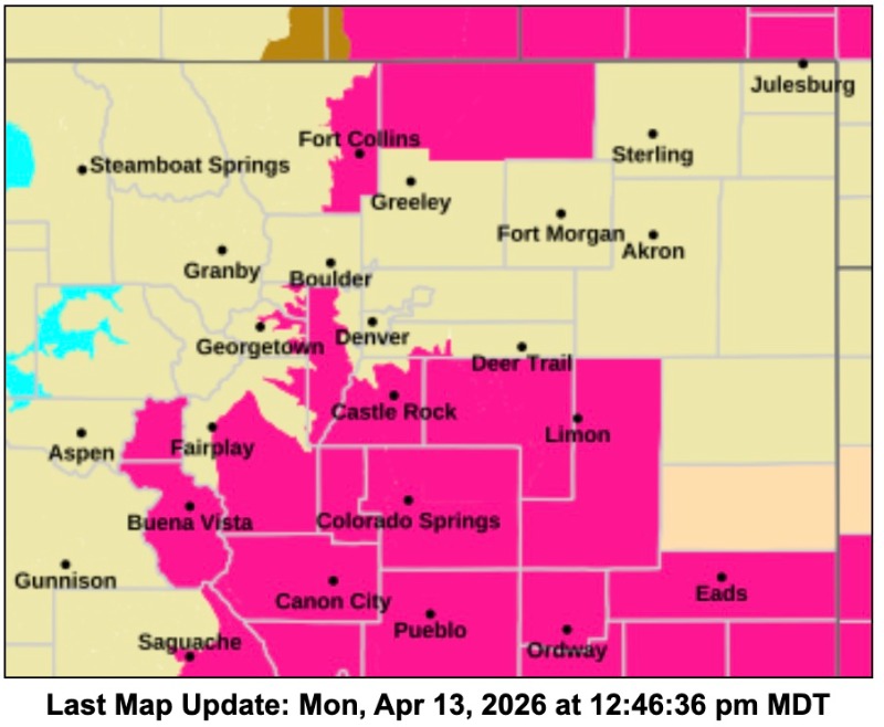
COZ214-216-238-241-242-246-140200-
/O.CON.KBOU.FW.W.0033.000000T0000Z-260414T0200Z/
Central and Southeast Park County-Jefferson and West Douglas Counties Above 6000 Feet/Gilpin/Clear Creek/Northeast Park Counties Below 9000 Feet-Larimer County Below 6000 Feet/Northwest Weld County-Elbert/Central and East Douglas Counties Above 6000 Feet-Northeast Weld County-North and Northeast Elbert County Below 6000 Feet/North Lincoln County-
1154 AM MDT Mon Apr 13 2026
...
RED FLAG WARNING REMAINS IN EFFECT UNTIL 8 PM MDT THIS EVENING FOR WIND AND LOW RELATIVE HUMIDITY FOR SOUTH PARK, THE SOUTHERN FRONT RANGE FOOTHILLS, PALMER DIVIDE INTO EAST CENTRAL COLORADO, AND EASTERN LARIMER AND NORTHWEST WELD COUNTIES...
* AFFECTED AREA...Fire Weather Zones 214, 216, 238, 241, 242 and 246.
* TIMING...Until 8 PM MDT this evening.
* WINDS...Southwest 10 to 20 mph with gusts around 30 mph.
* RELATIVE HUMIDITY...As low as 10 percent.
* IMPACTS...Conditions will be favorable for rapid fire spread. Avoid outdoor burning and any activity that may produce a spark and start a wildfire.
PRECAUTIONARY/PREPAREDNESS ACTIONS...
A Red Flag Warning means that critical fire weather conditions are either occurring now....or will shortly. A combination of strong winds...low relative humidity...and warm temperatures can contribute to extreme fire behavior.