- Forum
- Life Up the Hill
- Community News, Events, and Calendar
- South Platte Ranger District plans prescribed burn in Jefferson County
South Platte Ranger District plans prescribed burn in Jefferson County
- ElkCreekFireDepartment
-
 Topic Author
- Mountain Legend
-

Public Affairs Specialist: Lana Longwell
(719) 318-7749
This email address is being protected from spambots. You need JavaScript enabled to view it.
www.fs.usda.gov/psicc
South Platte Ranger District plans prescribed burn in Jefferson County
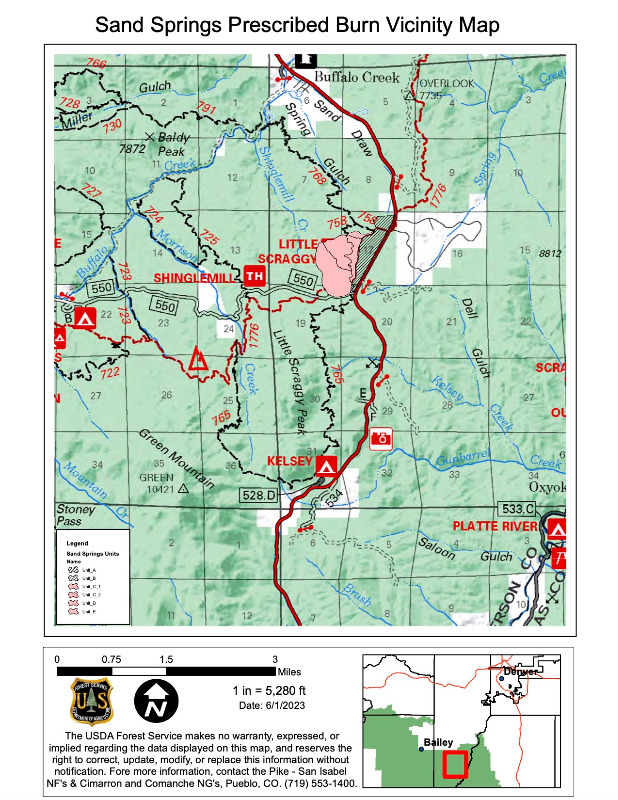
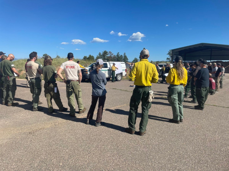
Conifer, Colo., June 09, 2023 – The Pike-San Isabel National Forests & Cimarron and Comanche National Grasslands South Platte Ranger District plans to burn up to 300 acres in the Sand Draw/Little Scraggy area of Jefferson County in the coming weeks. Implementation of the Sand Springs prescribed fire is expected to begin as soon as weather and forest vegetation conditions meet project objectives. The public will receive notification prior to implementation via email if signed up for notifications.
The project is a continuation of the hazardous fuels management projects the South Platte Ranger District has implemented to improve forest health, minimize the risk to firefighters, and improve public safety. Prescribed fire is an effective land management tool used to reduce the accumulation of hazardous fuels and to lessen the impacts of future wildfires.
Burning may occur in June or July of 2023. Ignitions will take place when weather and fuel conditions are such that the fire behavior will be within the burn plan limitations and substantial smoke impacts are unlikely to affect the surrounding communities. If burning does take place, it may continue for several days to several weeks. Smoke may linger in the air after ignition is completed and be visible from many locations surrounding the area.
Prescribed fire smoke may affect your health. For more information see: www.colorado.gov/pacific/cdphe/wood-smoke-and-health .
For additional information, follow us on Twitter @PSICC_NF, #SouthPlatteRD #SandSpringsRX. You may also call the District Ranger at 303-275-5610 or email This email address is being protected from spambots. You need JavaScript enabled to view it.. Sign up to be notified prior to implementation of prescribed fires on the South Platte Ranger District via email: forms.office.com/g/PbbEQ7DSh0 .
###
In case of emergency, please dial 911.
elkcreekfpd.colorado.gov/
Facebook Page
303-816-9385 (Office Hours M-F 8:00-4:30)
This email address is being protected from spambots. You need JavaScript enabled to view it.
Please Log in or Create an account to join the conversation.
- ElkCreekFireDepartment
-
 Topic Author
- Mountain Legend
-

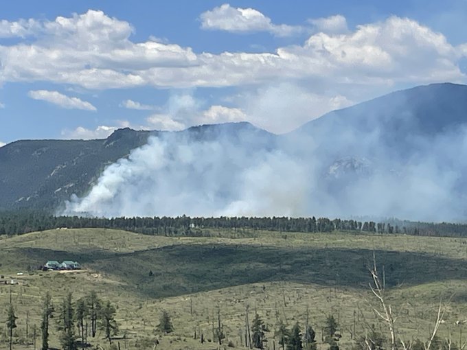
10:31am - #SandSpringsRX has a successful test fire and will proceed with ignitions. Smoke may be visible from hwy 126, Conifer, Pine & Bailey. #SouthPlatte and cooperator resources plan to burn 235 acres.
11:50am - Ignitions on the #SandSpringsRX are going well. One resource objective for the RX is to create a sustainable forest by increasing diversity of forest vegetation and wildlife, while enhancing resistance to widespread insects and disease, and mitigating fuel loading. #SouthPlatteRD
In case of emergency, please dial 911.
elkcreekfpd.colorado.gov/
Facebook Page
303-816-9385 (Office Hours M-F 8:00-4:30)
This email address is being protected from spambots. You need JavaScript enabled to view it.
Please Log in or Create an account to join the conversation.
- ElkCreekFireDepartment
-
 Topic Author
- Mountain Legend
-

In case of emergency, please dial 911.
elkcreekfpd.colorado.gov/
Facebook Page
303-816-9385 (Office Hours M-F 8:00-4:30)
This email address is being protected from spambots. You need JavaScript enabled to view it.
Please Log in or Create an account to join the conversation.
- MountainTownAlerts
-

- Mountain Legend
-

- Posts: 9616
- Thank you received: 219
Date: 7/12/2023
Location: Little Scraggy Trailhead, FS Road 550 and County Road 126
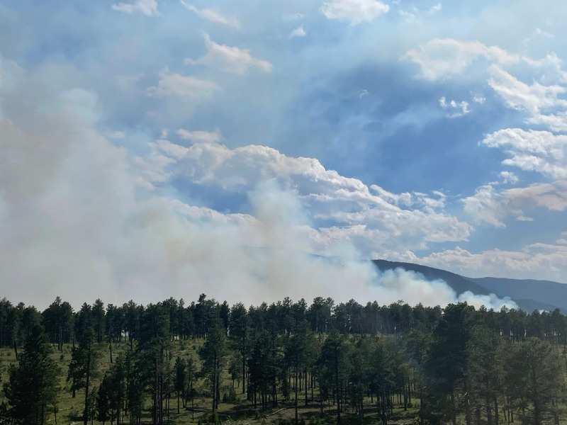
Status: Fire crews successfully burned approximately 235 acres within the Sand Springs project today. All fire stayed within pre-established control lines. Crews will remain on scene throughout the evening to patrol the edges.
Plan for tomorrow’s shift: All resources will return tomorrow and begin extinguishing heat along the control lines. Interior pockets of heat will continue to burn producing visible smoke at times. Forest and trail users should continue to avoid the area while firefighters are engaged.
Public and firefighter safety is always the number-one priority during prescribed burning operations. Seeing flames and smoke, even after dark, is part of normal operations. Residual burning is allowed to happen only under the safest conditions. If you see alarming smoke or flames, please contact Pueblo Interagency Dispatch Center at (719) 553-1600.
Please Log in or Create an account to join the conversation.
- Forum
- Life Up the Hill
- Community News, Events, and Calendar
- South Platte Ranger District plans prescribed burn in Jefferson County

