- Forum
- Life Up the Hill
- Community News, Events, and Calendar
- Pile Burn Operations Planned for November 6-7, conditions permitting
Pile Burn Operations Planned for November 6-7, conditions permitting
- ElkCreekFireDepartment
-
 Topic Author
- Mountain Legend
-

Less
More
05 Nov 2024 21:30 #1
by ElkCreekFireDepartment
In case of emergency, please dial 911.
elkcreekfpd.colorado.gov/
Facebook Page
Twitter
Instagram
303-816-9385 (Office Hours M-F 8:00-4:30)
This email address is being protected from spambots. You need JavaScript enabled to view it.
Pile Burn Operations Planned for November 6-7, conditions permitting was created by ElkCreekFireDepartment
COMMUNITY ALERT - SMOKE POSSIBLE:
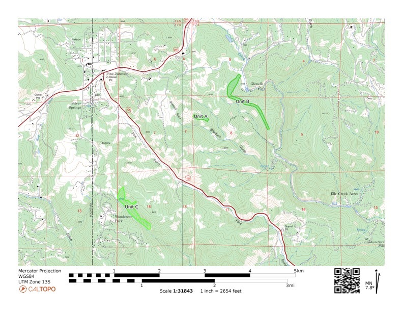
If conditions permit, the Module may be conducting pile burn operations Wednesday, November 6th - Thursday, November 7th in the area of Hwy 126 and Hwy 285 at the Preserve at Pine Meadows. Some information about the projects and maps follow:
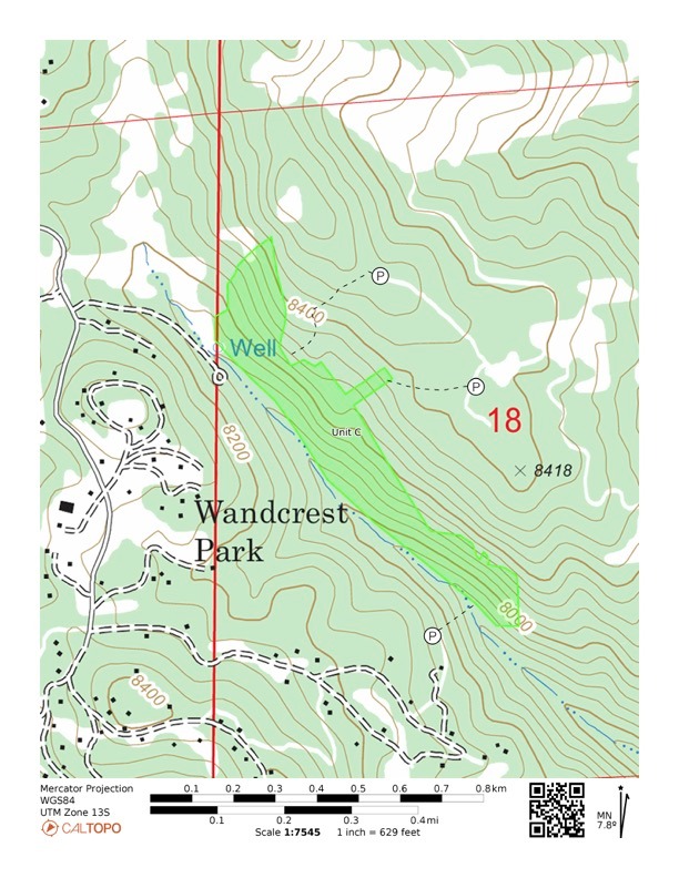
- May be completing the burning piles in the Preserve at Pine Meadows (Unit C on attached map)
- Coordinates: 39.43981, -105.38837
- Project is part of an approximately 50 acre thinning project the Module completed in 2020.
- Some smoke may be seen in the Preserve at Pine Meadows, Wandcrest, and Hwy 126 areas.
- Smoke may affect your health, please follow the link below for more information on the health effects of smoke.
- For information on prescribed fire visit ecfd.maps.arcgis.com/apps/Cascade/index....aa8833a3c43ae269481&
- Please see map below for pile project areas.
In case of emergency, please dial 911.
elkcreekfpd.colorado.gov/
Facebook Page
303-816-9385 (Office Hours M-F 8:00-4:30)
This email address is being protected from spambots. You need JavaScript enabled to view it.
Please Log in or Create an account to join the conversation.
- Forum
- Life Up the Hill
- Community News, Events, and Calendar
- Pile Burn Operations Planned for November 6-7, conditions permitting
Time to create page: 0.144 seconds


