- Forum
- Life Up the Hill
- Community News, Events, and Calendar
- December 10: Slash Pile Burns at Preserve at Pine Meadows
December 10: Slash Pile Burns at Preserve at Pine Meadows
- ElkCreekFireDepartment
-
 Topic Author
- Mountain Legend
-

Less
More
09 Dec 2024 20:49 #1
by ElkCreekFireDepartment
In case of emergency, please dial 911.
elkcreekfpd.colorado.gov/
Facebook Page
Twitter
Instagram
303-816-9385 (Office Hours M-F 8:00-4:30)
This email address is being protected from spambots. You need JavaScript enabled to view it.
POSSIBLE SMOKE TOMORROW:
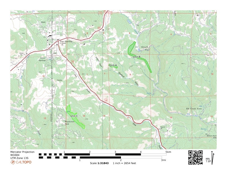
If conditions permit, the Module may be conducting pile burn operations tomorrow, December 10th in the area of Hwy 126 and Hwy 285 at the Preserve at Pine Meadows. We will send additional notifications before the burn day. Some information about the projects and maps follow:
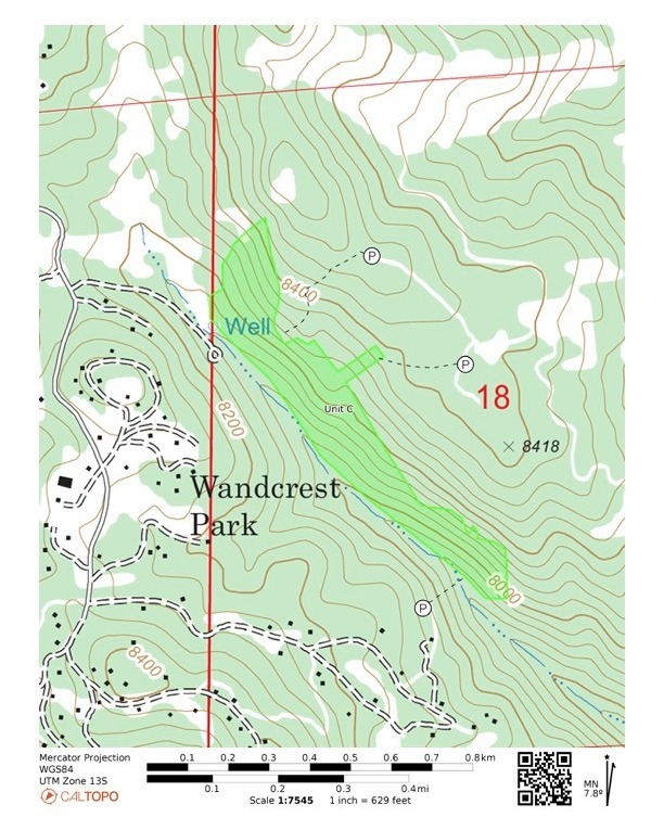
- Will be continuing the burning of piles in the Preserve at Pine Meadows (Unit C on attached map)
- Coordinates: 39.43981, -105.38837
- Project is part of an approximately 50 acre thinning project the Module completed in 2020.
- Some smoke may be seen in the Preserve at Pine Meadows, Wandcrest, and Hwy 126 areas.
- Smoke may affect your health, please follow the link below for more information on the health effects of smoke.
- For information on prescribed fire visit ecfd.maps.arcgis.com/apps/Cascade/index.html ...
- Please see map below for pile project areas.
In case of emergency, please dial 911.
elkcreekfpd.colorado.gov/
Facebook Page
303-816-9385 (Office Hours M-F 8:00-4:30)
This email address is being protected from spambots. You need JavaScript enabled to view it.
Please Log in or Create an account to join the conversation.
- Forum
- Life Up the Hill
- Community News, Events, and Calendar
- December 10: Slash Pile Burns at Preserve at Pine Meadows
Time to create page: 0.140 seconds


