Fire Danger Information
- jf1acai
-
 Topic Author
- Mountain Legend
-

Less
More
30 Mar 2011 08:38 #1
by jf1acai
Experience enables you to recognize a mistake when you make it again - Jeanne Pincha-Tulley
Comprehensive is Latin for there is lots of bad stuff in it - Trey Gowdy
Fire Danger Information was created by jf1acai
List to all Colorado Fires.
http://inciweb.org/state/6/
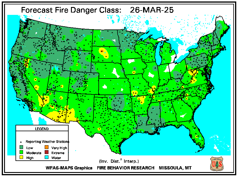
As linked in the Board Index under Scanner and Emergency Information, the Forecast Fire Danger map, below, is part of the National Fire Danger Rating System.
Also a part of this system is the Observed Fire Danger map:
Explanation of the National Fire Danger Rating System
Additional helpful information regarding fire danger is shown on the Haines Index map:
Explanation of Haines Index
These maps are updated daily during the fire season by Wildland Fire Assessment System (WFAS-MAPS), located at the USDA Forest Service Rocky Mountain Research Station in Missoula, Montana.
Experience enables you to recognize a mistake when you make it again - Jeanne Pincha-Tulley
Comprehensive is Latin for there is lots of bad stuff in it - Trey Gowdy
Please Log in or Create an account to join the conversation.
Time to create page: 0.126 seconds


