The
previous Winter Storm Watch
has been upgraded to a Winter Storm Warning.
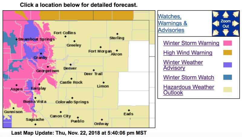
Winter Storm Warning - Higher Foothills Friday Night To Sunday Morning...
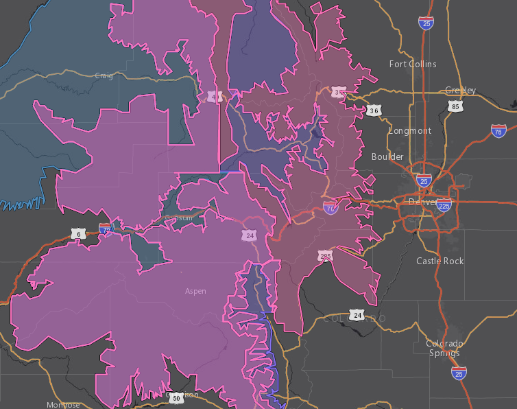
A Winter Storm Warning is posted for Friday night through early Sunday morning for the higher foothills. This includes the communities of Fairplay, Jefferson, Alma and Como. A powerful Pacific storm system will move into Colorado on Friday. 6 to 12 inches of snow, and wind gusts up to 60 mph are possible for our higher foothills and into the mountains. Snow and blowing snow will make travel hazardous. For the rest of the foothills, only a few snow showers are expected, but wind will be gusty from Friday night through Saturday. The system moves out late Saturday with snow and wind tapering off. Fair but chilly weather is expected Sunday.
mymountaintown.com/expert-local-weather
Winter Storm Warning
URGENT - WINTER WEATHER MESSAGE
National Weather Service Denver CO
349 PM MST Thu Nov 22 2018
...SNOW, STRONG WINDS AND BLOWING SNOW WILL CREATE HAZARDOUS
HOLIDAY TRAVEL CONDITIONS IN THE HIGH COUNTRY...
.A strong weather disturbance being carried along by strong and moist northwest flow aloft will produce snow in the mountains of north central Colorado through Saturday night. Snow is expected to spread from Rabbit Ears Pass tonight, to Rocky Mountain National Park and the I-70 Corridor through Summit County by Saturday. The heaviest snow is expected to develop Saturday afternoon and evening as the core of the weather disturbance is moving over the state. In addition, wind gusts of 50 to 60 MPH will produce considerable blowing snow on the higher passes. These harsh winter conditions may lead to travel delays and road closures from later tonight through Saturday night. Check road conditions with the Colorado Department of Transportation before heading up into the high country, and keep up-to-date on the latest forecasts. Weather conditions are expected to quickly improve on Sunday.
COZ031-033-034-230700-
/O.UPG.KBOU.WS.A.0008.181124T0100Z-181125T1200Z/
/O.NEW.KBOU.WS.W.0007.181124T0100Z-181125T1200Z/
Rabbit Ears Pass-
Rocky Mountain National Park and the Medicine Bow Range-
The Mountains of Summit County, the Mosquito Range, and the Indian Peaks-
Including the cities of East Slopes Park and Northern Gore Ranges, Gore Pass, Rabbit Ears Pass, Cameron Pass, Laramie and Medicine Bow Mountains, Rabbit Ears Range, Rocky Mountain National Park, Willow Creek Pass, Berthoud Pass,
Breckenridge, East Slopes Mosquito Range, East Slopes Southern Gore Range, Eisenhower Tunnel, Indian Peaks, Kenosha Mountains, Mount Evans, Williams Fork Mountains, and Winter Park
349 PM MST Thu Nov 22 2018
...
WINTER STORM WARNING IN EFFECT FROM 6 PM FRIDAY TO 5 AM MST SUNDAY...
* WHAT...Heavy snow expected.
Total snow accumulations of 10 to 18 inches expected. Winds gusting as high as 60 mph.
* WHERE...Rabbit Ears Pass, Rocky Mountain National Park and the Medicine Bow Range and The Mountains of Summit County, the Mosquito Range, and the Indian Peaks.
* WHEN...From 6 PM Friday to 5 AM MST Sunday.
* ADDITIONAL DETAILS...Travel could become very difficult to impossible. Areas of blowing snow could significantly reduce visibility. Strong winds could cause tree damage. Cold wind chills as low as 20 below zero could cause frostbite on exposed skin in as little as 30 minutes.
PRECAUTIONARY/PREPAREDNESS ACTIONS...
A Winter Storm Warning for snow means severe winter weather conditions will make travel very hazardous or impossible. If you must travel, keep an extra flashlight, food and water in your vehicle in case of an emergency.
The latest road conditions for the state you are calling from can be obtained by calling 5 1 1.